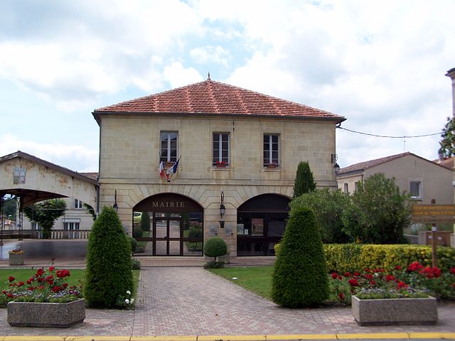
La Sauve (La Sauve)

- commune in Gironde, France
- Country:

- Postal Code: 33670
- Coordinates: 44° 46' 10" N, 0° 18' 43" E


- GPS tracks (wikiloc): [Link]
- AboveSeaLevel: 81 м m
- Area: 18.64 sq km
- Population: 1437
- Web site: http://www.mairiedelasauve.fr
- Wikipedia en: wiki(en)
- Wikipedia: wiki(fr)
- Wikidata storage: Wikidata: Q457696
- Wikipedia Commons Category: [Link]
- Freebase ID: [/m/03ns2dp]
- GeoNames ID: Alt: [6616575]
- SIREN number: [213305055]
- BnF ID: [15256551z]
- VIAF ID: Alt: [245388004]
- archINFORM location ID: [599]
- INSEE municipality code: 33505
Shares border with regions:


Créon
- commune in Gironde, France
- Country:
- Postal Code: 33670
- Coordinates: 44° 46' 28" N, 0° 20' 53" E
- GPS tracks (wikiloc): [Link]
- Area: 8.02 sq km
- Population: 4579
- Web site: [Link]


Saint-Léon
- commune in Gironde, France
- Country:
- Postal Code: 33670
- Coordinates: 44° 46' 7" N, 0° 16' 21" E
- GPS tracks (wikiloc): [Link]
- Area: 4.49 sq km
- Population: 342
- Web site: [Link]


Camiac-et-Saint-Denis
- commune in Gironde, France
- Country:
- Postal Code: 33420
- Coordinates: 44° 47' 42" N, 0° 16' 29" E
- GPS tracks (wikiloc): [Link]
- Area: 6.6 sq km
- Population: 359


Capian
- commune in Gironde, France
- Country:
- Postal Code: 33550
- Coordinates: 44° 42' 39" N, 0° 19' 52" E
- GPS tracks (wikiloc): [Link]
- Area: 18.23 sq km
- Population: 703


Cursan
- commune in Gironde, France
- Country:
- Postal Code: 33670
- Coordinates: 44° 48' 13" N, 0° 20' 14" E
- GPS tracks (wikiloc): [Link]
- Area: 6.07 sq km
- Population: 641
- Web site: [Link]

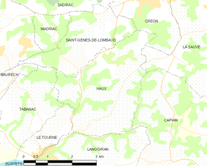
Haux
- commune in Gironde, France
- Country:
- Postal Code: 33550
- Coordinates: 44° 44' 0" N, 0° 21' 37" E
- GPS tracks (wikiloc): [Link]
- Area: 10.21 sq km
- Population: 810
- Web site: [Link]

Targon
- commune in Gironde, France
- Country:
- Postal Code: 33760
- Coordinates: 44° 44' 5" N, 0° 15' 49" E
- GPS tracks (wikiloc): [Link]
- Area: 25.88 sq km
- Population: 2047
- Web site: [Link]


Espiet
- commune in Gironde, France
- Country:
- Postal Code: 33420
- Coordinates: 44° 47' 59" N, 0° 15' 44" E
- GPS tracks (wikiloc): [Link]
- Area: 6.79 sq km
- Population: 766
- Web site: [Link]