canton of La Pacaudière (canton de La Pacaudière)
- canton of France (until March 2015)
- Country:

- Capital: La Pacaudière
- Coordinates: 46° 10' 52" N, 3° 52' 29" E


- GPS tracks (wikiloc): [Link]
- Wikipedia en: wiki(en)
- Wikipedia: wiki(fr)
- Wikidata storage: Wikidata: Q1237687
- INSEE canton code: [4212]
Includes regions:


Vivans
- commune in Loire, France
- Country:
- Postal Code: 42310
- Coordinates: 46° 11' 22" N, 3° 56' 33" E
- GPS tracks (wikiloc): [Link]
- Area: 25.16 sq km
- Population: 232


Saint-Martin-d'Estréaux
- commune in Loire, France
- Country:
- Postal Code: 42620
- Coordinates: 46° 12' 22" N, 3° 47' 55" E
- GPS tracks (wikiloc): [Link]
- Area: 29.6 sq km
- Population: 858
- Web site: [Link]


Urbise
- commune in Loire, France
- Country:
- Postal Code: 42310
- Coordinates: 46° 15' 15" N, 3° 53' 32" E
- GPS tracks (wikiloc): [Link]
- Area: 15.5 sq km
- Population: 132
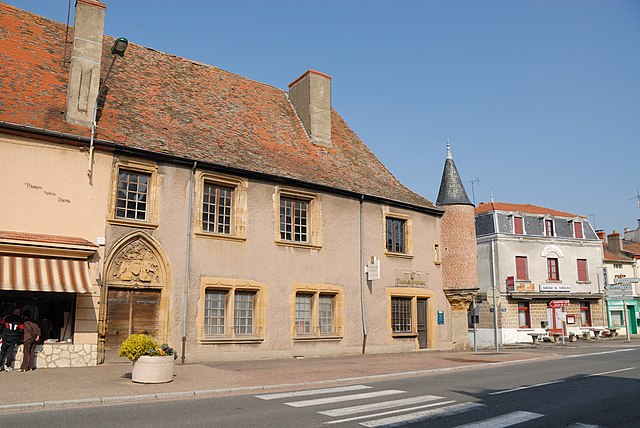

La Pacaudière
- commune in Loire, France
- Country:
- Postal Code: 42310
- Coordinates: 46° 10' 32" N, 3° 52' 3" E
- GPS tracks (wikiloc): [Link]
- Area: 20.61 sq km
- Population: 1044
- Web site: [Link]

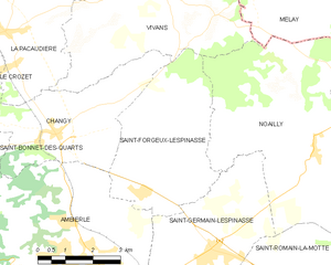
Saint-Forgeux-Lespinasse
- commune in Loire, France
- Country:
- Postal Code: 42640
- Coordinates: 46° 7' 24" N, 3° 55' 52" E
- GPS tracks (wikiloc): [Link]
- Area: 16.19 sq km
- Population: 632

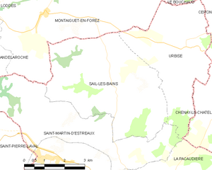
Sail-les-Bains
- commune in Loire, France
- Country:
- Postal Code: 42310
- Coordinates: 46° 14' 18" N, 3° 50' 44" E
- GPS tracks (wikiloc): [Link]
- Area: 21.11 sq km
- Population: 203
- Web site: [Link]