canton of Langeais (canton de Langeais)

- canton of France
- Country:

- Coordinates: 47° 20' 40" N, 0° 21' 16" E


- GPS tracks (wikiloc): [Link]
- Area: 785.92 sq km
- Population: 35537
- Wikipedia en: wiki(en)
- Wikipedia: wiki(fr)
- Wikidata storage: Wikidata: Q1096774
- INSEE canton code: [3708]
Includes regions:

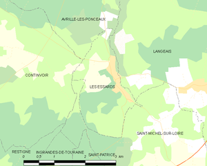
Les Essards
- former commune in Indre-et-Loire, France
- Country:
- Postal Code: 37130
- Coordinates: 47° 20' 43" N, 0° 18' 7" E
- GPS tracks (wikiloc): [Link]
- Area: 4.17 sq km
- Population: 160


Cléré-les-Pins
- commune in Indre-et-Loire, France
- Country:
- Postal Code: 37340
- Coordinates: 47° 25' 31" N, 0° 23' 27" E
- GPS tracks (wikiloc): [Link]
- Area: 35.62 sq km
- Population: 1423
- Web site: [Link]


Langeais
- former commune in Indre-et-Loire, France
- Country:
- Postal Code: 37130
- Coordinates: 47° 19' 32" N, 0° 24' 22" E
- GPS tracks (wikiloc): [Link]
- Area: 60.38 sq km
- Population: 4248
- Web site: [Link]


Avrillé-les-Ponceaux
- commune in Indre-et-Loire, France
- Country:
- Postal Code: 37340
- Coordinates: 47° 23' 40" N, 0° 17' 11" E
- GPS tracks (wikiloc): [Link]
- Area: 32.8 sq km
- Population: 488

Cinq-Mars-la-Pile
- commune in Indre-et-Loire, France
- Country:
- Postal Code: 37130
- Coordinates: 47° 20' 51" N, 0° 27' 42" E
- GPS tracks (wikiloc): [Link]
- Area: 20.11 sq km
- Population: 3461
- Web site: [Link]


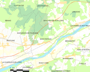
Saint-Michel-sur-Loire
- former commune in Indre-et-Loire, France
- Country:
- Postal Code: 37130
- Coordinates: 47° 18' 27" N, 0° 20' 57" E
- GPS tracks (wikiloc): [Link]
- Area: 17.51 sq km
- Population: 688


Mazières-de-Touraine
- commune in Indre-et-Loire, France
- Country:
- Postal Code: 37130
- Coordinates: 47° 22' 59" N, 0° 25' 33" E
- GPS tracks (wikiloc): [Link]
- Area: 34.18 sq km
- Population: 1291
- Web site: [Link]

Saint-Patrice
- former commune in Indre-et-Loire, France
- Country:
- Postal Code: 37130
- Coordinates: 47° 17' 11" N, 0° 18' 24" E
- GPS tracks (wikiloc): [Link]
- Area: 17.18 sq km
- Population: 672


Ingrandes-de-Touraine
- former commune in Indre-et-Loire, France
- Country:
- Postal Code: 37140
- Coordinates: 47° 16' 58" N, 0° 15' 59" E
- GPS tracks (wikiloc): [Link]
- Area: 9.46 sq km
- Population: 552