canton of Le Blanc (canton du Blanc)

- canton of France
- Country:

- Capital: Le Blanc
- Coordinates: 46° 38' 4" N, 1° 3' 49" E


- GPS tracks (wikiloc): [Link]
- Area: 886.46 sq km
- Population: 18939
- Wikipedia en: wiki(en)
- Wikipedia: wiki(fr)
- Wikidata storage: Wikidata: Q1725768
- Wikipedia Commons Category: [Link]
- Library of Congress authority ID: Alt: [n00037254]
- INSEE canton code: [3603]
Includes regions:


Concremiers
- commune in Indre, France
- Country:
- Postal Code: 36300
- Coordinates: 46° 35' 49" N, 1° 1' 0" E
- GPS tracks (wikiloc): [Link]
- Area: 28.11 sq km
- Population: 651


Saint-Aigny
- commune in Indre, France
- Country:
- Postal Code: 36300
- Coordinates: 46° 38' 45" N, 1° 1' 31" E
- GPS tracks (wikiloc): [Link]
- Area: 14.86 sq km
- Population: 290

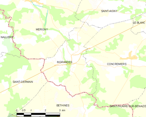
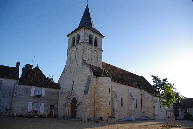
Ingrandes
- commune in Indre, France
- Country:
- Postal Code: 36300
- Coordinates: 46° 35' 51" N, 0° 57' 48" E
- GPS tracks (wikiloc): [Link]
- Area: 11.12 sq km
- Population: 322


Le Blanc
- commune in Indre, France
- Country:
- Postal Code: 36300
- Coordinates: 46° 38' 1" N, 1° 3' 46" E
- GPS tracks (wikiloc): [Link]
- Area: 57.61 sq km
- Population: 6572
- Web site: [Link]

Douadic
- commune in Indre, France
- Country:
- Postal Code: 36300
- Coordinates: 46° 42' 18" N, 1° 6' 41" E
- GPS tracks (wikiloc): [Link]
- Area: 43.14 sq km
- Population: 454


Pouligny-Saint-Pierre
- commune in Indre, France
- Country:
- Postal Code: 36300
- Coordinates: 46° 40' 51" N, 1° 2' 21" E
- GPS tracks (wikiloc): [Link]
- Area: 47.45 sq km
- Population: 1090


Ruffec
- commune in Indre, France
- Country:
- Postal Code: 36300
- Coordinates: 46° 37' 45" N, 1° 10' 17" E
- GPS tracks (wikiloc): [Link]
- Area: 40.93 sq km
- Population: 599

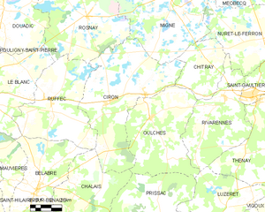
Ciron
- commune in Indre, France
- Country:
- Postal Code: 36300
- Coordinates: 46° 37' 38" N, 1° 14' 42" E
- GPS tracks (wikiloc): [Link]
- Area: 57.94 sq km
- Population: 562


Rosnay
- commune in Indre, France
- Country:
- Postal Code: 36300
- Coordinates: 46° 42' 4" N, 1° 12' 52" E
- GPS tracks (wikiloc): [Link]
- Area: 59.03 sq km
- Population: 506