canton of Meung-sur-Loire (canton de Meung-sur-Loire)
- canton of France
- Country:

- Capital: Meung-sur-Loire
- Coordinates: 47° 53' 41" N, 1° 40' 37" E


- GPS tracks (wikiloc): [Link]
- Population: 35315
- Wikipedia en: wiki(en)
- Wikipedia: wiki(fr)
- Wikidata storage: Wikidata: Q1482750
- INSEE canton code: [4510]
Includes regions:


Le Bardon
- commune in Loiret, France
- Country:

- Postal Code: 45130
- Coordinates: 47° 50' 39" N, 1° 39' 5" E


- GPS tracks (wikiloc): [Link]
- Area: 12.23 sq km
- Population: 1060


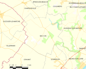
Baccon
- commune in Loiret, France
- Country:

- Postal Code: 45130
- Coordinates: 47° 53' 28" N, 1° 37' 43" E


- GPS tracks (wikiloc): [Link]
- Area: 33.02 sq km
- Population: 706


Chaingy
- commune in Loiret, France
- Country:

- Postal Code: 45380
- Coordinates: 47° 53' 1" N, 1° 46' 23" E


- GPS tracks (wikiloc): [Link]
- Area: 21.69 sq km
- Population: 3617
- Web site: [Link]


Coulmiers
- commune in Loiret, France
- Country:

- Postal Code: 45130
- Coordinates: 47° 55' 53" N, 1° 39' 49" E


- GPS tracks (wikiloc): [Link]
- Area: 14.28 sq km
- Population: 552
- Web site: [Link]


Saint-Ay
- commune in Loiret, France
- Country:

- Postal Code: 45130
- Coordinates: 47° 51' 29" N, 1° 45' 14" E


- GPS tracks (wikiloc): [Link]
- Area: 10.07 sq km
- Population: 3317
- Web site: [Link]


Rozières-en-Beauce
- commune in Loiret, France
- Country:

- Postal Code: 45130
- Coordinates: 47° 56' 31" N, 1° 42' 6" E


- GPS tracks (wikiloc): [Link]
- Area: 9.17 sq km
- Population: 205


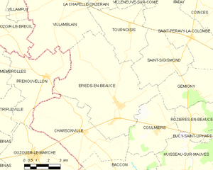
Épieds-en-Beauce
- commune in Loiret, France
- Country:

- Postal Code: 45130
- Coordinates: 47° 57' 0" N, 1° 37' 3" E


- GPS tracks (wikiloc): [Link]
- Area: 40.22 sq km
- Population: 1475


Charsonville
- commune in Loiret, France
- Country:

- Postal Code: 45130
- Coordinates: 47° 55' 44" N, 1° 34' 48" E


- GPS tracks (wikiloc): [Link]
- Area: 24.55 sq km
- Population: 614
- Web site: [Link]


Meung-sur-Loire
- commune in Loiret, France
- Country:

- Postal Code: 45130
- Coordinates: 47° 49' 43" N, 1° 41' 54" E


- GPS tracks (wikiloc): [Link]
- Area: 20.35 sq km
- Population: 6267
- Web site: [Link]


Huisseau-sur-Mauves
- commune in Loiret, France
- Country:

- Postal Code: 45130
- Coordinates: 47° 53' 35" N, 1° 42' 11" E


- GPS tracks (wikiloc): [Link]
- Area: 37.16 sq km
- Population: 1672
- Web site: [Link]
