canton of Perreux (canton de Perreux)
- canton of France (until March 2015)
- Country:

- Capital: Perreux
- Coordinates: 46° 1' 17" N, 4° 8' 49" E


- GPS tracks (wikiloc): [Link]
- Wikipedia en: wiki(en)
- Wikipedia: wiki(fr)
- Wikidata storage: Wikidata: Q548397
- INSEE canton code: [4214]
Includes regions:


Saint-Vincent-de-Boisset
- commune in Loire, France
- Country:

- Postal Code: 42120
- Coordinates: 46° 0' 26" N, 4° 7' 20" E


- GPS tracks (wikiloc): [Link]
- Area: 4.11 sq km
- Population: 926


Parigny
- commune in Loire, France
- Country:

- Postal Code: 42120
- Coordinates: 45° 59' 26" N, 4° 5' 51" E


- GPS tracks (wikiloc): [Link]
- Area: 9.15 sq km
- Population: 597
- Web site: [Link]
Notre-Dame-de-Boisset
- commune in Loire, France
- Country:

- Postal Code: 42120
- Coordinates: 45° 59' 39" N, 4° 7' 45" E


- GPS tracks (wikiloc): [Link]
- Area: 9.1 sq km
- Population: 566
- Web site: [Link]


Le Coteau
- commune in Loire, France
- Country:

- Postal Code: 42120
- Coordinates: 46° 1' 38" N, 4° 5' 12" E


- GPS tracks (wikiloc): [Link]
- Area: 4.89 sq km
- Population: 6821
- Web site: [Link]


Montagny
- commune in Loire, France
- Country:

- Postal Code: 42840
- Coordinates: 46° 1' 58" N, 4° 14' 9" E


- GPS tracks (wikiloc): [Link]
- AboveSeaLevel: 490 м m
- Area: 25.57 sq km
- Population: 1071
- Web site: [Link]


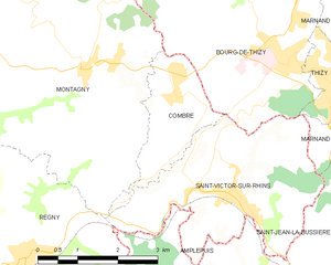
Combre
- commune in Loire, France
- Country:

- Postal Code: 42840
- Coordinates: 46° 1' 32" N, 4° 15' 49" E


- GPS tracks (wikiloc): [Link]
- Area: 4.01 sq km
- Population: 436
- Web site: [Link]


Commelle-Vernay
- commune in Loire, France
- Country:

- Postal Code: 42120
- Coordinates: 45° 59' 39" N, 4° 3' 58" E


- GPS tracks (wikiloc): [Link]
- Area: 12.41 sq km
- Population: 2883
- Web site: [Link]


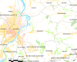
Perreux
- commune in Loire, France
- Country:

- Postal Code: 42120
- Coordinates: 46° 2' 17" N, 4° 7' 20" E


- GPS tracks (wikiloc): [Link]
- Area: 41.35 sq km
- Population: 2141
- Web site: [Link]