Perreux (Perreux)

- commune in Loire, France
- Country:

- Postal Code: 42120
- Coordinates: 46° 2' 17" N, 4° 7' 20" E


- GPS tracks (wikiloc): [Link]
- Area: 41.35 sq km
- Population: 2141
- Web site: http://www.perreux.fr/
- Wikipedia en: wiki(en)
- Wikipedia: wiki(fr)
- Wikidata storage: Wikidata: Q735473
- Wikipedia Commons Category: [Link]
- Freebase ID: [/m/03qd3h6]
- Freebase ID: [/m/03qd3h6]
- GeoNames ID: Alt: [6434223]
- GeoNames ID: Alt: [6434223]
- SIREN number: [214201709]
- SIREN number: [214201709]
- BnF ID: [152597381]
- BnF ID: [152597381]
- PACTOLS thesaurus ID: [pcrtEsx7YHs0kl]
- PACTOLS thesaurus ID: [pcrtEsx7YHs0kl]
- INSEE municipality code: 42170
- INSEE municipality code: 42170
Shares border with regions:


Saint-Vincent-de-Boisset
- commune in Loire, France
- Country:
- Postal Code: 42120
- Coordinates: 46° 0' 26" N, 4° 7' 20" E
- GPS tracks (wikiloc): [Link]
- Area: 4.11 sq km
- Population: 926
Notre-Dame-de-Boisset
- commune in Loire, France
- Country:
- Postal Code: 42120
- Coordinates: 45° 59' 39" N, 4° 7' 45" E
- GPS tracks (wikiloc): [Link]
- Area: 9.1 sq km
- Population: 566
- Web site: [Link]


Le Coteau
- commune in Loire, France
- Country:
- Postal Code: 42120
- Coordinates: 46° 1' 38" N, 4° 5' 12" E
- GPS tracks (wikiloc): [Link]
- Area: 4.89 sq km
- Population: 6821
- Web site: [Link]


Montagny
- commune in Loire, France
- Country:
- Postal Code: 42840
- Coordinates: 46° 1' 58" N, 4° 14' 9" E
- GPS tracks (wikiloc): [Link]
- AboveSeaLevel: 490 м m
- Area: 25.57 sq km
- Population: 1071
- Web site: [Link]

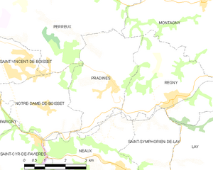
Pradines
- commune in Loire, France
- Country:
- Postal Code: 42630
- Coordinates: 45° 59' 54" N, 4° 10' 35" E
- GPS tracks (wikiloc): [Link]
- Area: 11.6 sq km
- Population: 785

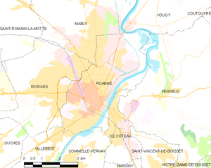
Roanne
- commune in Loire, France
- Country:
- Postal Code: 42300
- Coordinates: 46° 2' 10" N, 4° 4' 5" E
- GPS tracks (wikiloc): [Link]
- Area: 16.12 sq km
- Population: 34831
- Web site: [Link]


Coutouvre
- commune in Loire, France
- Country:
- Postal Code: 42460
- Coordinates: 46° 4' 22" N, 4° 12' 42" E
- GPS tracks (wikiloc): [Link]
- Area: 21.87 sq km
- Population: 1113


Vougy
- commune in Loire, France
- Country:
- Postal Code: 42720
- Coordinates: 46° 6' 12" N, 4° 7' 8" E
- GPS tracks (wikiloc): [Link]
- AboveSeaLevel: 280 м m
- Area: 20.9 sq km
- Population: 1445
- Web site: [Link]