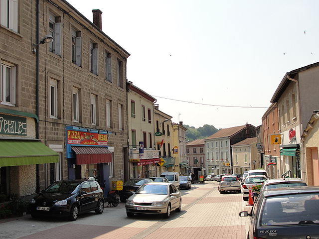
Saint-Just-Saint-Rambert (Saint-Just-Saint-Rambert)

- commune in Loire, France
- Country:

- Postal Code: 42170
- Coordinates: 45° 29' 59" N, 4° 14' 29" E


- GPS tracks (wikiloc): [Link]
- AboveSeaLevel: 417 м m
- Area: 40.63 sq km
- Population: 14935
- Web site: http://www.stjust-strambert.com
- Wikipedia en: wiki(en)
- Wikipedia: wiki(fr)
- Wikidata storage: Wikidata: Q1106343
- Wikipedia Commons Category: [Link]
- Freebase ID: [/m/02w__0j]
- Freebase ID: [/m/02w__0j]
- GeoNames ID: Alt: [2978997]
- GeoNames ID: Alt: [2978997]
- SIREN number: [214202798]
- SIREN number: [214202798]
- BnF ID: [15259845k]
- BnF ID: [15259845k]
- VIAF ID: Alt: [158544138]
- VIAF ID: Alt: [158544138]
- Library of Congress authority ID: Alt: [n95028322]
- Library of Congress authority ID: Alt: [n95028322]
- PACTOLS thesaurus ID: [pcrtMF3l8U9aF1]
- PACTOLS thesaurus ID: [pcrtMF3l8U9aF1]
- MusicBrainz area ID: [4acf943e-0f04-4ec8-8820-2755fd47edc2]
- MusicBrainz area ID: [4acf943e-0f04-4ec8-8820-2755fd47edc2]
- SUDOC authorities ID: [118621971]
- SUDOC authorities ID: [118621971]
- INSEE municipality code: 42279
- INSEE municipality code: 42279
Shares border with regions:

La Fouillouse
- commune in Loire, France
- Country:
- Postal Code: 42480
- Coordinates: 45° 30' 14" N, 4° 18' 49" E
- GPS tracks (wikiloc): [Link]
- Area: 20.57 sq km
- Population: 4383
- Web site: [Link]

Andrézieux-Bouthéon
- commune in Loire, France
- Country:
- Postal Code: 42160
- Coordinates: 45° 31' 34" N, 4° 15' 37" E
- GPS tracks (wikiloc): [Link]
- Area: 16.28 sq km
- Population: 9947
- Web site: [Link]


Bonson
- commune in Loire, France
- Country:
- Postal Code: 42160
- Coordinates: 45° 31' 24" N, 4° 12' 57" E
- GPS tracks (wikiloc): [Link]
- Area: 5.15 sq km
- Population: 3747
- Web site: [Link]


Saint-Marcellin-en-Forez
- commune in Loire, France
- Country:
- Postal Code: 42680
- Coordinates: 45° 29' 50" N, 4° 10' 2" E
- GPS tracks (wikiloc): [Link]
- Area: 31.09 sq km
- Population: 4671
- Web site: [Link]

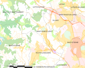
Saint-Genest-Lerpt
- commune in Loire, France
- Country:
- Postal Code: 42530
- Coordinates: 45° 26' 46" N, 4° 20' 12" E
- GPS tracks (wikiloc): [Link]
- Area: 12.68 sq km
- Population: 6112
- Web site: [Link]


Saint-Étienne
- commune in Loire, France
- Country:
- Postal Code: 42230; 42000; 42100
- Coordinates: 45° 26' 2" N, 4° 23' 23" E
- GPS tracks (wikiloc): [Link]
- AboveSeaLevel: 516 м m
- Area: 79.97 sq km
- Population: 171057
- Web site: [Link]


Chambles
- commune in Loire, France
- Country:
- Postal Code: 42170
- Coordinates: 45° 26' 31" N, 4° 14' 18" E
- GPS tracks (wikiloc): [Link]
- Area: 18.9 sq km
- Population: 981