canton of Valençay (canton de Valençay)

- canton of France
- Country:

- Capital: Valençay
- Coordinates: 47° 9' 41" N, 1° 34' 1" E


- GPS tracks (wikiloc): [Link]
- Population: 17826
- Wikipedia en: wiki(en)
- Wikipedia: wiki(fr)
- Wikidata storage: Wikidata: Q1727746
- Wikipedia Commons Category: [Link]
- INSEE canton code: [3613]
Includes regions:
Fontguenand
- commune in Indre, France
- Country:
- Postal Code: 36600
- Coordinates: 47° 13' 5" N, 1° 32' 16" E
- GPS tracks (wikiloc): [Link]
- Area: 18.24 sq km
- Population: 230
- Web site: [Link]

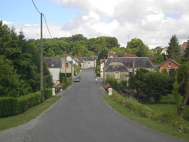
La Vernelle
- commune in Indre, France
- Country:
- Postal Code: 36600
- Coordinates: 47° 14' 53" N, 1° 32' 35" E
- GPS tracks (wikiloc): [Link]
- Area: 17.08 sq km
- Population: 760

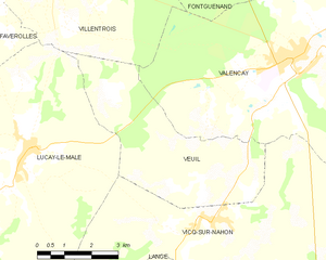
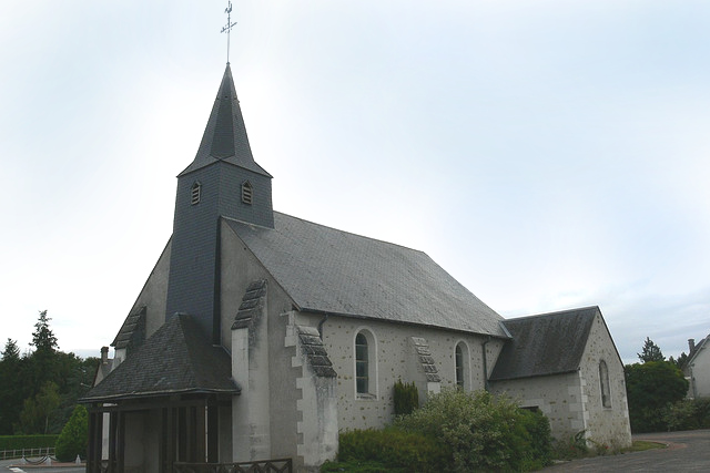
Veuil
- commune in Indre, France
- Country:
- Postal Code: 36600
- Coordinates: 47° 7' 16" N, 1° 31' 31" E
- GPS tracks (wikiloc): [Link]
- Area: 18.84 sq km
- Population: 378


Lye
- commune in Indre, France
- Country:
- Postal Code: 36600
- Coordinates: 47° 13' 40" N, 1° 28' 24" E
- GPS tracks (wikiloc): [Link]
- Area: 24.77 sq km
- Population: 771


Luçay-le-Mâle
- commune in Indre, France
- Country:
- Postal Code: 36360
- Coordinates: 47° 7' 48" N, 1° 26' 29" E
- GPS tracks (wikiloc): [Link]
- Area: 68.08 sq km
- Population: 1385
- Web site: [Link]
Langé
- commune in Indre, France
- Country:
- Postal Code: 36600
- Coordinates: 47° 4' 26" N, 1° 30' 49" E
- GPS tracks (wikiloc): [Link]
- Area: 20.63 sq km
- Population: 295
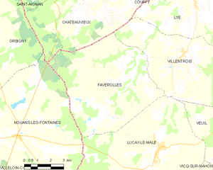
Faverolles-en-Berry
- commune in Indre, France
- Country:
- Postal Code: 36360
- Coordinates: 47° 10' 19" N, 1° 24' 30" E
- GPS tracks (wikiloc): [Link]
- Area: 41.41 sq km
- Population: 327
- Web site: [Link]


Valençay
- commune in Indre, France
- Country:
- Postal Code: 36600
- Coordinates: 47° 9' 38" N, 1° 33' 58" E
- GPS tracks (wikiloc): [Link]
- Area: 41.59 sq km
- Population: 2453
- Web site: [Link]


Vicq-sur-Nahon
- commune in Indre, France
- Country:
- Postal Code: 36600
- Coordinates: 47° 6' 24" N, 1° 31' 52" E
- GPS tracks (wikiloc): [Link]
- Area: 49.08 sq km
- Population: 749


Villentrois
- commune in Indre, France
- Country:
- Postal Code: 36600
- Coordinates: 47° 11' 40" N, 1° 27' 45" E
- GPS tracks (wikiloc): [Link]
- Area: 32.38 sq km
- Population: 613