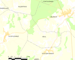
Villentrois (Villentrois)

- commune in Indre, France
- Country:

- Postal Code: 36600
- Coordinates: 47° 11' 40" N, 1° 27' 45" E


- GPS tracks (wikiloc): [Link]
- Area: 32.38 sq km
- Population: 613
- Wikipedia en: wiki(en)
- Wikipedia: wiki(fr)
- Wikidata storage: Wikidata: Q956536
- Wikipedia Commons Category: [Link]
- Freebase ID: [/m/03nvbh_]
- GeoNames ID: Alt: [6433013]
- SIREN number: [213602444]
- BnF ID: [152575489]
- WOEID: [631920]
- INSEE municipality code: 36244
Shares border with regions:
Fontguenand
- commune in Indre, France
- Country:
- Postal Code: 36600
- Coordinates: 47° 13' 5" N, 1° 32' 16" E
- GPS tracks (wikiloc): [Link]
- Area: 18.24 sq km
- Population: 230
- Web site: [Link]

Veuil
- commune in Indre, France
- Country:
- Postal Code: 36600
- Coordinates: 47° 7' 16" N, 1° 31' 31" E
- GPS tracks (wikiloc): [Link]
- Area: 18.84 sq km
- Population: 378


Lye
- commune in Indre, France
- Country:
- Postal Code: 36600
- Coordinates: 47° 13' 40" N, 1° 28' 24" E
- GPS tracks (wikiloc): [Link]
- Area: 24.77 sq km
- Population: 771


Luçay-le-Mâle
- commune in Indre, France
- Country:
- Postal Code: 36360
- Coordinates: 47° 7' 48" N, 1° 26' 29" E
- GPS tracks (wikiloc): [Link]
- Area: 68.08 sq km
- Population: 1385
- Web site: [Link]
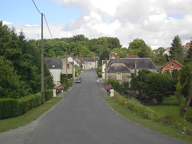
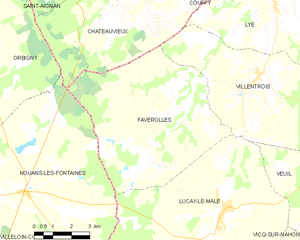
Faverolles-en-Berry
- commune in Indre, France
- Country:
- Postal Code: 36360
- Coordinates: 47° 10' 19" N, 1° 24' 30" E
- GPS tracks (wikiloc): [Link]
- Area: 41.41 sq km
- Population: 327
- Web site: [Link]


Châteauvieux
- commune in Loir-et-Cher, France
- Country:
- Postal Code: 41110
- Coordinates: 47° 13' 47" N, 1° 22' 59" E
- GPS tracks (wikiloc): [Link]
- Area: 33.48 sq km
- Population: 546


Valençay
- commune in Indre, France
- Country:
- Postal Code: 36600
- Coordinates: 47° 9' 38" N, 1° 33' 58" E
- GPS tracks (wikiloc): [Link]
- Area: 41.59 sq km
- Population: 2453
- Web site: [Link]