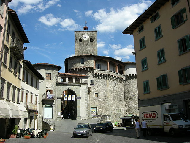
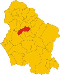
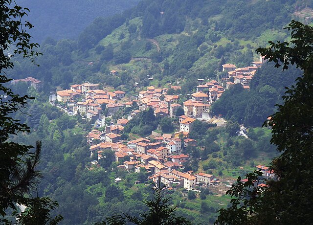
Careggine (Careggine)
.svg)
- Italian comune
 Hiking in Careggine
Careggine, located in the Apuan Alps in Tuscany, Italy, is a beautiful destination for hiking enthusiasts. The region is characterized by stunning mountain landscapes, lush forests, and a variety of trails suitable for different skill levels.
Hiking Trails
-
Sentiero della Libertà: This is a well-marked trail that not only offers scenic views but is also steeped in history. It follows the path that was used by partisans during World War II.
-
Monte Matanna: A more challenging hike that rewards adventurers with panoramic views at the summit. The trail takes you through dense woods and rocky terrain.
-
Sella di Ponte di Tavole: An easier hike suitable for families, with beautiful views along the way. This trail offers a great opportunity to enjoy the surrounding natural beauty without too much strain.
Best Time to Hike
The best months for hiking in Careggine are late spring through early autumn, from May to October. During these months, the weather is generally mild and the landscapes are lush and vibrant.
Tips for Hiking in Careggine
- Stay Hydrated: Bring plenty of water, as some trails can be long and strenuous.
- Wear Proper Footwear: Sturdy hiking boots are recommended for the rocky and uneven paths.
- Check Weather Conditions: The weather can change quickly in the mountains, so it's important to check forecasts and be prepared for sudden changes.
- Maps and Navigation: It's useful to have a physical map or a GPS app, as not all trails may be well-marked.
Local Flora and Fauna
While hiking, keep an eye out for local wildlife, including deer, foxes, and various bird species. The Apuan Alps are also home to unique plant species, making it a great area for nature lovers.
Conclusion
Hiking in Careggine offers a blend of natural beauty, historical significance, and diverse trail options. Whether you’re a seasoned hiker or a beginner, there's something for everyone in this picturesque part of Italy. Remember to respect the environment and follow local guidelines to ensure that these beautiful trails remain pristine for future hikers!
- Country:

- Postal Code: 55030
- Local Dialing Code: 0583
- Licence Plate Code: LU
- Coordinates: 44° 7' 15" N, 10° 19' 35" E


- GPS tracks (wikiloc): [Link]
- AboveSeaLevel: 882 м m
- Area: 24.08 sq km
- Population: 539
- Web site: http://www.careggine.org
- Wikipedia en: wiki(en)
- Wikipedia: wiki(it)
- Wikidata storage: Wikidata: Q216886
- Wikipedia Commons Category: [Link]
- Freebase ID: [/m/0f6jq1]
- GeoNames ID: Alt: [6543594]
- VIAF ID: Alt: [245878511]
- OSM relation ID: [42835]
- GND ID: Alt: [7644168-4]
- ISTAT ID: 046008
- Italian cadastre code: B760
Shares border with regions:


Camporgiano
- Italian comune
Hiking in Camporgiano
Camporgiano is a charming village located in the Garfagnana region of Tuscany, Italy. This area is known for its stunning landscapes, including valleys, mountains, and rich natural flora and fauna, making it an excellent destination for hiking enthusiasts....
- Country:
- Postal Code: 55031
- Local Dialing Code: 0583
- Licence Plate Code: LU
- Coordinates: 44° 9' 39" N, 10° 20' 4" E
- GPS tracks (wikiloc): [Link]
- AboveSeaLevel: 475 м m
- Area: 27.09 sq km
- Population: 2137
- Web site: [Link]

Castelnuovo di Garfagnana
- Italian comune
Hiking in Castelnuovo di Garfagnana
Castelnuovo di Garfagnana, located in the beautiful Garfagnana area of Tuscany, Italy, is an excellent destination for hiking enthusiasts. Surrounded by the stunning Apuan Alps and the Apennines, the region offers a variety of trails that cater to different skill levels, from easy walks to challenging hikes....
- Country:
- Postal Code: 55032
- Local Dialing Code: 0583
- Licence Plate Code: LU
- Coordinates: 44° 7' 19" N, 10° 24' 20" E
- GPS tracks (wikiloc): [Link]
- AboveSeaLevel: 270 м m
- Area: 28.48 sq km
- Population: 5936
- Web site: [Link]

Molazzana
- Italian comune
Hiking in Molazzana
Molazzana is a small village located in the Garfagnana region of Tuscany, Italy. Surrounded by the beautiful Apuan Alps and rich in natural beauty, it offers various hiking trails that cater to different experience levels. Here are some highlights about hiking in Molazzana:...
- Country:
- Postal Code: 55020
- Local Dialing Code: 0583
- Licence Plate Code: LU
- Coordinates: 44° 4' 0" N, 10° 25' 0" E
- GPS tracks (wikiloc): [Link]
- AboveSeaLevel: 474 м m
- Area: 31.33 sq km
- Population: 1046
- Web site: [Link]

Stazzema
- Italian comune
Hiking in Stazzema
Stazzema, located in the Apuan Alps of Tuscany, Italy, is a wonderful destination for hiking enthusiasts. This area is known for its stunning landscapes, rich history, and diverse wildlife. Here are some key points to consider when hiking in and around Stazzema:...
- Country:
- Postal Code: 55040; 55060
- Local Dialing Code: 0584
- Licence Plate Code: LU
- Coordinates: 43° 59' 35" N, 10° 18' 38" E
- GPS tracks (wikiloc): [Link]
- AboveSeaLevel: 453 м m
- Area: 82.08 sq km
- Population: 3083
- Web site: [Link]


Vagli Sotto
- Italian comune
Hiking in Vagli Sotto
Vagli Sotto is a picturesque village located in Tuscany, Italy, nestled in the Apuan Alps. The area around Vagli Sotto offers stunning hiking opportunities, characterized by its diverse landscapes, rich flora and fauna, and breathtaking views. Here are some highlights to consider if you're planning a hike in this region:...
- Country:
- Postal Code: 55030
- Local Dialing Code: 0583
- Licence Plate Code: LU
- Coordinates: 44° 7' 0" N, 10° 17' 0" E
- GPS tracks (wikiloc): [Link]
- AboveSeaLevel: 600 м m
- Area: 41.22 sq km
- Population: 930
- Web site: [Link]