
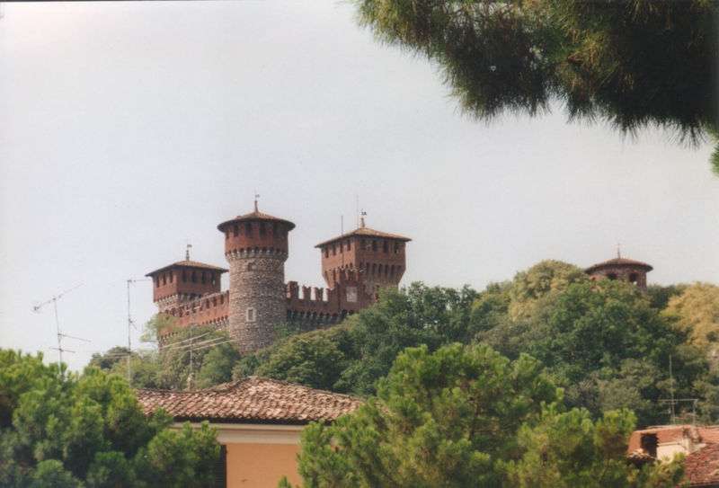
Carpenedolo (Carpenedolo)
.svg)
- Italian comune
 Hiking in Carpenedolo
Carpenedolo, located in the Lombardy region of Italy, is a charming town that offers access to scenic hiking opportunities, primarily within the surrounding countryside and nearby natural areas. While Carpenedolo itself may not be widely recognized for extensive hiking trails, it serves as a great starting point for exploring the natural beauty of Lombardy.
Hiking Highlights in and Around Carpenedolo:
-
Nature Reserves: Check for nearby nature reserves or parks, such as the Parco Regionale del Mincio, which is not too far from Carpenedolo. This park offers picturesque trails alongside the Mincio River, with opportunities for birdwatching and enjoying diverse flora and fauna.
-
Countryside Trails: The flat landscape around Carpenedolo lends itself to leisurely hikes or longer walks through farmlands and fields. Look for local trails that can lead you through charming villages and provide a glimpse of rural Italian life.
-
Lake Garda: Although it’s a bit of a drive, Lake Garda is close enough for a day trip and offers a variety of hiking trails along its shores and in the nearby mountains. The area boasts stunning views and beautiful landscapes.
-
Valcamonica: If you’re up for a bit of travel, the Valcamonica valley offers a wealth of hiking opportunities, including routes that allow you to explore ancient rock carvings and breathtaking mountain vistas.
Tips for Hiking in Carpenedolo:
- Weather Considerations: Be mindful of the weather, especially in the spring and fall, when rain and temperatures can vary. Always check the local forecast before heading out.
- Trail Maps and Resources: Use local maps and hiking apps to identify trails. Local tourist information centers may have additional resources, maps, and guides.
- Gear Up: Bring appropriate hiking gear, including comfortable shoes, water, snacks, and a first-aid kit. It's also advisable to carry a map and a compass or a GPS device.
- Leave No Trace: Respect the environment by sticking to marked trails and carrying out any trash you bring along.
Overall, while Carpenedolo might not be a top hiking destination, it offers access to beautiful landscapes and tranquil walks, making it a peaceful retreat for nature lovers. Enjoy your hiking adventure!
- Country:

- Postal Code: 25013
- Local Dialing Code: 030
- Licence Plate Code: BS
- Coordinates: 45° 21' 55" N, 10° 25' 56" E


- GPS tracks (wikiloc): [Link]
- AboveSeaLevel: 78 м m
- Area: 29.84 sq km
- Population: 12957
- Web site: http://www.comune.carpenedolo.bs.it/
- Wikipedia en: wiki(en)
- Wikipedia: wiki(it)
- Wikidata storage: Wikidata: Q103810
- Wikipedia Commons Category: [Link]
- Freebase ID: [/m/041pvx]
- GeoNames ID: Alt: [6537166]
- VIAF ID: Alt: [243218620]
- OSM relation ID: [44719]
- WOEID: [712318]
- UN/LOCODE: [ITCRP]
- ISTAT ID: 017039
- Italian cadastre code: B817
Shares border with regions:

Acquafredda
- Italian comune
Hiking in Acquafredda
Acquafredda is a charming coastal area located in southern Italy, specifically in the region of Basilicata. It offers various opportunities for hiking enthusiasts to explore its beautiful landscapes, featuring a mix of coastal views, rugged cliffs, and lush greenery. Here are some highlights about hiking in Acquafredda:...
- Country:
- Postal Code: 25010
- Local Dialing Code: 030
- Licence Plate Code: BS
- Coordinates: 45° 18' 25" N, 10° 24' 48" E
- GPS tracks (wikiloc): [Link]
- AboveSeaLevel: 56 м m
- Area: 9 sq km
- Population: 1565
- Web site: [Link]

Calvisano
- Italian comune
Hiking in Calvisano
Calvisano is a charming town located in the Lombardy region of northern Italy, known for its picturesque landscapes and proximity to various natural reserves. Hiking opportunities around Calvisano are typically characterized by beautiful scenery, lush countryside, and serene rural settings....
- Country:
- Postal Code: 25012
- Local Dialing Code: 030
- Licence Plate Code: BS
- Coordinates: 45° 20' 56" N, 10° 20' 45" E
- GPS tracks (wikiloc): [Link]
- AboveSeaLevel: 67 м m
- Area: 44.83 sq km
- Population: 8543
- Web site: [Link]
Montichiari
- Italian comune
Hiking in Montichiari
Montichiari, located in the province of Brescia in Northern Italy, is not typically known as a major hiking destination compared to other regions in the Italian Alps or the Dolomites. However, it is surrounded by scenic countryside, rolling hills, and offers some opportunities for outdoor activities including hiking....
- Country:
- Postal Code: 25018
- Local Dialing Code: 030
- Licence Plate Code: BS
- Coordinates: 45° 24' 58" N, 10° 23' 30" E
- GPS tracks (wikiloc): [Link]
- AboveSeaLevel: 108 м m
- Area: 81.192 sq km
- Population: 25714
- Web site: [Link]


Castiglione delle Stiviere
- Italian comune
Hiking in Castiglione delle Stiviere
Castiglione delle Stiviere is a charming town located in the Lombardy region of northern Italy, known for its rich history, beautiful landscapes, and proximity to various natural attractions. While it may not be as famous for hiking as other areas in Italy, there are several opportunities for outdoor activities and exploration in the surrounding region....
- Country:
- Postal Code: 46043
- Local Dialing Code: 0376
- Licence Plate Code: MN
- Coordinates: 45° 24' 0" N, 10° 30' 0" E
- GPS tracks (wikiloc): [Link]
- AboveSeaLevel: 111 м m
- Area: 42.02 sq km
- Population: 23570
- Web site: [Link]


Castel Goffredo
- Italian comune
Hiking in Castel Goffredo
Castel Goffredo, located in the Lombardy region of Italy, is not as widely recognized for hiking as some other mountainous areas, but it offers a charming landscape and opportunities for outdoor activities. The region is primarily agricultural, characterized by rolling hills, vineyards, and small bodies of water, providing a serene backdrop for hiking enthusiasts....
- Country:
- Postal Code: 46042
- Local Dialing Code: 0376
- Licence Plate Code: MN
- Coordinates: 45° 17' 52" N, 10° 28' 30" E
- GPS tracks (wikiloc): [Link]
- AboveSeaLevel: 50 м m
- Area: 42.4 sq km
- Population: 12633
- Web site: [Link]