Castiglione delle Stiviere (Castiglione delle Stiviere)
- Italian comune
 Hiking in Castiglione delle Stiviere
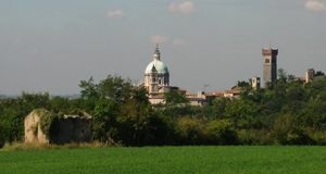
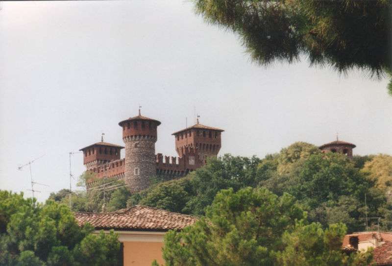
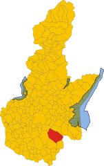
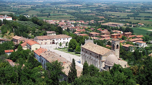
Castiglione delle Stiviere is a charming town located in the Lombardy region of northern Italy, known for its rich history, beautiful landscapes, and proximity to various natural attractions. While it may not be as famous for hiking as other areas in Italy, there are several opportunities for outdoor activities and exploration in the surrounding region.
Hiking Areas Near Castiglione delle Stiviere:
-
Mincio River Park:
- About a 30-minute drive from Castiglione delle Stiviere, the Mincio River Park features a network of trails alongside the river, through wetlands, and alongside agricultural fields. The trails are generally flat and suitable for hikers of all levels. The park is home to diverse wildlife, making it a great spot for birdwatching.
-
Garda Lake:
- Approximately 30 kilometers away, Lake Garda offers stunning hiking routes with views of the lake and the surrounding mountains. The Sentiero del Ponale is a popular trail that provides breathtaking views and connects various towns around the lake. The area features a range of trails, from easy walks to more challenging hikes.
-
Bergamo Alps:
- If you're willing to travel a bit further (around an hour), the Bergamo Alps offer more challenging hiking opportunities, with well-marked trails leading to high-altitude panoramas, alpine meadows, and picturesque villages.
Tips for Hiking in the Area:
- Weather: Always check the weather forecast before heading out, as conditions can change quickly, especially in mountainous or lake areas.
- Gear: Wear comfortable hiking shoes, and consider bringing trekking poles for added stability on more challenging trails.
- Hydration & Snacks: Carry enough water and snacks, especially on longer hikes, as facilities may be scarce on the trails.
- Trail Maps: Utilize local maps or hiking apps to stay on track, as some trails might not be well-signposted.
Local Attractions:
In addition to hiking, Castiglione delle Stiviere has historical sites worth visiting, such as San Luigi Gonzaga's Sanctuary, which reflects the town's religious significance and historical importance.
Overall, while Castiglione delle Stiviere may not be a major hiking destination, its proximity to beautiful natural areas makes it a lovely starting point for outdoor adventures in the Lombardy region.
- Country:

- Postal Code: 46043
- Local Dialing Code: 0376
- Licence Plate Code: MN
- Coordinates: 45° 24' 0" N, 10° 30' 0" E


- GPS tracks (wikiloc): [Link]
- AboveSeaLevel: 111 м m
- Area: 42.02 sq km
- Population: 23570
- Web site: http://www.comune.castiglione.mn.it/
- Wikipedia en: wiki(en)
- Wikipedia: wiki(it)
- Wikidata storage: Wikidata: Q42890
- Wikipedia Commons Category: [Link]
- Freebase ID: [/m/044vkn]
- GeoNames ID: Alt: [6537232]
- VIAF ID: Alt: [153111459]
- OSM relation ID: [44740]
- TGN ID: [7007540]
- UN/LOCODE: [ITCDT]
- ISTAT ID: 020017
- Italian cadastre code: C312
Shares border with regions:


Calcinato
- Italian comune
Calcinato is a charming town located in the Lombardy region of northern Italy, not far from the city of Brescia. While it may not be as well-known for hiking as some other areas in Italy, it offers opportunities for outdoor activities and exploration in the surrounding region....
- Country:

- Postal Code: 25011
- Local Dialing Code: 030
- Licence Plate Code: BS
- Coordinates: 45° 27' 29" N, 10° 24' 53" E


- GPS tracks (wikiloc): [Link]
- AboveSeaLevel: 171 м m
- Area: 33.3 sq km
- Population: 12894
- Web site: [Link]


Carpenedolo
- Italian comune
Carpenedolo, located in the Lombardy region of Italy, is a charming town that offers access to scenic hiking opportunities, primarily within the surrounding countryside and nearby natural areas. While Carpenedolo itself may not be widely recognized for extensive hiking trails, it serves as a great starting point for exploring the natural beauty of Lombardy....
- Country:

- Postal Code: 25013
- Local Dialing Code: 030
- Licence Plate Code: BS
- Coordinates: 45° 21' 55" N, 10° 25' 56" E


- GPS tracks (wikiloc): [Link]
- AboveSeaLevel: 78 м m
- Area: 29.84 sq km
- Population: 12957
- Web site: [Link]


Lonato del Garda
- Italian comune
Lonato del Garda, located in the Lombardy region of northern Italy, is a beautiful area that offers various hiking opportunities, particularly due to its proximity to Lake Garda and the surrounding hills. Here are some key points to consider if you're planning a hiking trip in this region:...
- Country:

- Postal Code: 25017
- Local Dialing Code: 030
- Licence Plate Code: BS
- Coordinates: 45° 27' 39" N, 10° 28' 38" E


- GPS tracks (wikiloc): [Link]
- AboveSeaLevel: 170 м m
- Area: 68.2 sq km
- Population: 16506
- Web site: [Link]


Montichiari
- Italian comune
Montichiari, located in the province of Brescia in Northern Italy, is not typically known as a major hiking destination compared to other regions in the Italian Alps or the Dolomites. However, it is surrounded by scenic countryside, rolling hills, and offers some opportunities for outdoor activities including hiking....
- Country:

- Postal Code: 25018
- Local Dialing Code: 030
- Licence Plate Code: BS
- Coordinates: 45° 24' 58" N, 10° 23' 30" E


- GPS tracks (wikiloc): [Link]
- AboveSeaLevel: 108 м m
- Area: 81.192 sq km
- Population: 25714
- Web site: [Link]


Medole
- Italian comune
Medole is located in the Lombardy region of Italy, known for its picturesque landscapes and proximity to various outdoor activities, including hiking. While Medole itself may not be a major hiking destination, its surrounding area offers a variety of trails and natural settings that are great for hikers....
- Country:

- Postal Code: 46046
- Local Dialing Code: 0376
- Licence Plate Code: MN
- Coordinates: 45° 20' 0" N, 10° 31' 0" E


- GPS tracks (wikiloc): [Link]
- AboveSeaLevel: 62 м m
- Area: 25.73 sq km
- Population: 4055
- Web site: [Link]


Solferino
- Italian comune
Hiking in Solferino, located in the Lombardy region of Italy, is a delightful experience characterized by scenic landscapes, historical significance, and a variety of trails that cater to different skill levels. Here are some key points about hiking in this area:...
- Country:

- Postal Code: 46040
- Local Dialing Code: 0376
- Licence Plate Code: MN
- Coordinates: 45° 22' 20" N, 10° 33' 59" E


- GPS tracks (wikiloc): [Link]
- AboveSeaLevel: 124 м m
- Area: 13.08 sq km
- Population: 2631
- Web site: [Link]


Castel Goffredo
- Italian comune
Castel Goffredo, located in the Lombardy region of Italy, is not as widely recognized for hiking as some other mountainous areas, but it offers a charming landscape and opportunities for outdoor activities. The region is primarily agricultural, characterized by rolling hills, vineyards, and small bodies of water, providing a serene backdrop for hiking enthusiasts....
- Country:

- Postal Code: 46042
- Local Dialing Code: 0376
- Licence Plate Code: MN
- Coordinates: 45° 17' 52" N, 10° 28' 30" E


- GPS tracks (wikiloc): [Link]
- AboveSeaLevel: 50 м m
- Area: 42.4 sq km
- Population: 12633
- Web site: [Link]
