
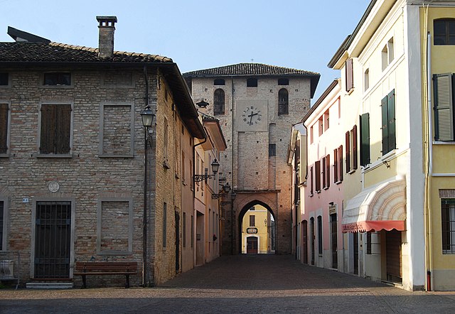
Castel Goffredo (Castel Goffredo)
.svg)
- Italian comune
 Hiking in Castel Goffredo
Castel Goffredo, located in the Lombardy region of Italy, is not as widely recognized for hiking as some other mountainous areas, but it offers a charming landscape and opportunities for outdoor activities. The region is primarily agricultural, characterized by rolling hills, vineyards, and small bodies of water, providing a serene backdrop for hiking enthusiasts.
Hiking Opportunities:
-
Scenic Trails: While specific hiking trails may not be extensively documented, you can find several walking paths and rural trails in the surrounding countryside. Exploring these can yield beautiful views of the local flora and fauna.
-
Nearby Natural Parks: The nearby Mincio River Park and Parco del Ticino are excellent destinations for hiking and outdoor activities. These parks feature numerous trails, where you can enjoy natural scenery, birdwatching, and picnicking.
-
Local Culture: Hiking in this area allows you to immerse yourself in the local culture, encountering charming villages, vineyards, and historical landmarks along the way.
Tips for Hiking in Castel Goffredo:
- Prepare for Variable Conditions: The weather can change, so be prepared with appropriate clothing and gear.
- Stay Hydrated: Bring plenty of water, especially during warmer months, and snacks for energy.
- Explore Vineyards: If you're interested, consider tours or routes that take you through the vineyards, where you can enjoy tastings and learn about local wine production.
- Respect the Environment: Stay on marked paths and be mindful of local wildlife and ecosystems.
Suggested Routes:
- Rural Countryside Walks: Take leisurely walks through the countryside, where you can enjoy the tranquility of the landscape.
- Nearby Nature Parks: Traveling a bit outside of Castel Goffredo to reach surrounding parks will significantly broaden your hiking options.
Conclusion:
While Castel Goffredo may not offer extensive hiking opportunities like other Italian regions, it provides a lovely setting for casual walks, cultural exploration, and nature appreciation in a less-touristed area. Combining hikes with visits to vineyards and local attractions can make for a delightful experience.
- Country:

- Postal Code: 46042
- Local Dialing Code: 0376
- Licence Plate Code: MN
- Coordinates: 45° 17' 52" N, 10° 28' 30" E


- GPS tracks (wikiloc): [Link]
- AboveSeaLevel: 50 м m
- Area: 42.4 sq km
- Population: 12633
- Web site: http://www.comune.castelgoffredo.mn.it/
- Wikipedia en: wiki(en)
- Wikipedia: wiki(it)
- Wikidata storage: Wikidata: Q43034
- Wikipedia Commons Gallery: [Link]
- Wikipedia Commons Category: [Link]
- Freebase ID: [/m/041pz9]
- GeoNames ID: Alt: [6537231]
- VIAF ID: Alt: [151263374]
- OSM relation ID: [44609]
- Quora topic ID: [Castel-Goffredo]
- TGN ID: [7045614]
- UN/LOCODE: [ITCGF]
- DMOZ ID: Alt: [Regional/Europe/Italy/Lombardy/Localities/Castel_Goffredo/]
- ISTAT ID: 020015
- Italian cadastre code: C118
Shares border with regions:

Acquafredda
- Italian comune
Hiking in Acquafredda
Acquafredda is a charming coastal area located in southern Italy, specifically in the region of Basilicata. It offers various opportunities for hiking enthusiasts to explore its beautiful landscapes, featuring a mix of coastal views, rugged cliffs, and lush greenery. Here are some highlights about hiking in Acquafredda:...
- Country:
- Postal Code: 25010
- Local Dialing Code: 030
- Licence Plate Code: BS
- Coordinates: 45° 18' 25" N, 10° 24' 48" E
- GPS tracks (wikiloc): [Link]
- AboveSeaLevel: 56 м m
- Area: 9 sq km
- Population: 1565
- Web site: [Link]

Carpenedolo
- Italian comune
Hiking in Carpenedolo
Carpenedolo, located in the Lombardy region of Italy, is a charming town that offers access to scenic hiking opportunities, primarily within the surrounding countryside and nearby natural areas. While Carpenedolo itself may not be widely recognized for extensive hiking trails, it serves as a great starting point for exploring the natural beauty of Lombardy....
- Country:
- Postal Code: 25013
- Local Dialing Code: 030
- Licence Plate Code: BS
- Coordinates: 45° 21' 55" N, 10° 25' 56" E
- GPS tracks (wikiloc): [Link]
- AboveSeaLevel: 78 м m
- Area: 29.84 sq km
- Population: 12957
- Web site: [Link]


Casaloldo
- Italian comune
Hiking in Casaloldo
Casaloldo, a small town in the Lombardy region of Italy, may not be widely recognized for its hiking trails, but it offers a picturesque landscape typical of the northern Italian countryside. While specific hiking trails in Casaloldo itself might be limited, there are opportunities for outdoor activities in the surrounding areas, especially in the provinces of Mantua and Brescia....
- Country:
- Postal Code: 46040
- Local Dialing Code: 0376
- Licence Plate Code: MN
- Coordinates: 45° 15' 0" N, 10° 29' 0" E
- GPS tracks (wikiloc): [Link]
- AboveSeaLevel: 45 м m
- Area: 16.85 sq km
- Population: 2699
- Web site: [Link]


Casalmoro
- Italian comune
Hiking in Casalmoro
Casalmoro is a picturesque village located in northern Italy, known for its stunning natural landscapes and hiking opportunities. While specific trails can vary, the area generally offers various routes suitable for different skill levels, ranging from easy walks to more challenging hikes....
- Country:
- Postal Code: 46040
- Local Dialing Code: 0376
- Licence Plate Code: MN
- Coordinates: 45° 16' 0" N, 10° 24' 0" E
- GPS tracks (wikiloc): [Link]
- AboveSeaLevel: 47 м m
- Area: 13.7 sq km
- Population: 2240
- Web site: [Link]


Asola
- Italian comune
Hiking in Asola
Asola, located in the Lombardy region of Italy, offers various hiking opportunities that beautifully showcase the area's natural landscapes and cultural heritage. While it may not be as renowned as some of the bigger hiking destinations in Italy, it provides a more tranquil and less crowded experience for those who wish to explore the countryside....
- Country:
- Postal Code: 46041
- Local Dialing Code: 0376
- Licence Plate Code: MN
- Coordinates: 45° 13' 0" N, 10° 25' 0" E
- GPS tracks (wikiloc): [Link]
- AboveSeaLevel: 42 м m
- Area: 73.48 sq km
- Population: 10069
- Web site: [Link]

Ceresara
- Italian comune
Hiking in Ceresara
Ceresara is a charming village located in the Lombardy region of Italy, near the banks of the Po River. While it may not be as well-known as some of Italy’s more famous hiking destinations, the surrounding areas offer a variety of trails and natural landscapes for outdoor enthusiasts to explore....
- Country:
- Postal Code: 46040
- Local Dialing Code: 0376
- Licence Plate Code: MN
- Coordinates: 45° 15' 44" N, 10° 34' 10" E
- GPS tracks (wikiloc): [Link]
- AboveSeaLevel: 44 м m
- Area: 37.31 sq km
- Population: 2609
- Web site: [Link]


Medole
- Italian comune
Hiking in Medole
Medole is located in the Lombardy region of Italy, known for its picturesque landscapes and proximity to various outdoor activities, including hiking. While Medole itself may not be a major hiking destination, its surrounding area offers a variety of trails and natural settings that are great for hikers....
- Country:
- Postal Code: 46046
- Local Dialing Code: 0376
- Licence Plate Code: MN
- Coordinates: 45° 20' 0" N, 10° 31' 0" E
- GPS tracks (wikiloc): [Link]
- AboveSeaLevel: 62 м m
- Area: 25.73 sq km
- Population: 4055
- Web site: [Link]


Castiglione delle Stiviere
- Italian comune
Hiking in Castiglione delle Stiviere
Castiglione delle Stiviere is a charming town located in the Lombardy region of northern Italy, known for its rich history, beautiful landscapes, and proximity to various natural attractions. While it may not be as famous for hiking as other areas in Italy, there are several opportunities for outdoor activities and exploration in the surrounding region....
- Country:
- Postal Code: 46043
- Local Dialing Code: 0376
- Licence Plate Code: MN
- Coordinates: 45° 24' 0" N, 10° 30' 0" E
- GPS tracks (wikiloc): [Link]
- AboveSeaLevel: 111 м m
- Area: 42.02 sq km
- Population: 23570
- Web site: [Link]