Casalnuovo Monterotaro (Casalnuovo Monterotaro)
.svg)
- Italian comune
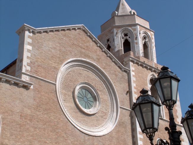
 Hiking in Casalnuovo Monterotaro
Casalnuovo Monterotaro is a charming village located in the province of Foggia, in the Apulia region of Italy. While it may not be as widely known as some of the more famous hiking destinations, it offers a great opportunity for outdoor enthusiasts to explore beautiful natural landscapes and enjoy the serene atmosphere of the Italian countryside.
Hiking Trails in the Area
-
Sentiero della Rimembranza: This trail offers a picturesque walk through the surrounding countryside, featuring native flora and fauna. It's relatively easy and suitable for all skill levels.
-
Monte Cornacchia: Located not too far from Casalnuovo Monterotaro, this is the highest peak in the Apennine Mountains in the region. The trek up Monte Cornacchia offers stunning panoramic views and a chance to explore diverse plant life along the way.
-
Foresta Umbra: While a bit of a drive from Casalnuovo, this forest within the Gargano National Park is famous for its lush greenery and unique biodiversity. There are numerous trails varying in difficulty, which are perfect for day hikes.
Tips for Hiking in Casalnuovo Monterotaro
- Trail Conditions: Ensure to check trail conditions before heading out, as some lesser-known paths may be less maintained.
- Timing: The best times to hike in this region are during the spring (April to June) and fall (September to October) when the weather is typically mild.
- Local Flora and Fauna: Keep your eyes peeled for local wildlife. The area is home to various birds, mammals, and unique plant species.
- Hydration and Snacks: Carry plenty of water and light snacks to keep your energy up during hikes.
- Respect Nature: As always, practice Leave No Trace principles to preserve the natural beauty of the area.
Additional Activities
In addition to hiking, you may find opportunities for birdwatching, photography, and exploring the rich history and culture of the region. Consider visiting local markets or trying out traditional Apulian cuisine after a day of hiking.
Whether you're a seasoned hiker or a beginner, Casalnuovo Monterotaro and its surrounding areas offer a peaceful and scenic backdrop for outdoor exploration.
- Country:

- Postal Code: 71033
- Local Dialing Code: 0881
- Licence Plate Code: FG
- Coordinates: 41° 37' 0" N, 15° 6' 0" E


- GPS tracks (wikiloc): [Link]
- AboveSeaLevel: 432 м m
- Area: 48.36 sq km
- Population: 1507
- Web site: http://www.comune.casalnuovomonterotaro.fg.it
- Wikipedia en: wiki(en)
- Wikipedia: wiki(it)
- Wikidata storage: Wikidata: Q51902
- Wikipedia Commons Category: [Link]
- Freebase ID: [/m/0fz5vr]
- GeoNames ID: Alt: [6537536]
- VIAF ID: Alt: [150318733]
- OSM relation ID: [41401]
- Library of Congress authority ID: Alt: [n2007065436]
- UN/LOCODE: [ITOVM]
- ISTAT ID: 071013
- Italian cadastre code: B904
Shares border with regions:
Pietramontecorvino
- Italian comune
Hiking in Pietramontecorvino
Pietramontecorvino is a charming hilltop village located in the province of Foggia, in the Apulia region of southern Italy. Surrounded by beautiful landscapes, it offers excellent hiking opportunities for nature enthusiasts....
- Country:
- Postal Code: 71038
- Local Dialing Code: 0881
- Licence Plate Code: FG
- Coordinates: 41° 33' 0" N, 15° 8' 0" E
- GPS tracks (wikiloc): [Link]
- AboveSeaLevel: 456 м m
- Area: 71.65 sq km
- Population: 2671
- Web site: [Link]


Colletorto
- Italian comune
Hiking in Colletorto
Colletorto is a charming village located in the Molise region of Italy, known for its stunning landscapes and natural beauty, making it a great destination for hiking enthusiasts. The area features rolling hills, lush forests, and breathtaking views of the surrounding countryside, providing a serene backdrop for outdoor activities....
- Country:
- Postal Code: 86044
- Local Dialing Code: 0874
- Licence Plate Code: CB
- Coordinates: 41° 39' 50" N, 14° 58' 27" E
- GPS tracks (wikiloc): [Link]
- AboveSeaLevel: 508 м m
- Area: 35.91 sq km
- Population: 1866
- Web site: [Link]


San Giuliano di Puglia
- Italian comune
Hiking in San Giuliano di Puglia
San Giuliano di Puglia is a small town located in the Molise region of Italy, surrounded by picturesque landscapes that are ideal for hiking and outdoor activities. While San Giuliano itself is not a widely known hiking destination, its proximity to the Apennine Mountains and the surrounding countryside offers several opportunities for nature lovers and hikers....
- Country:
- Postal Code: 86040
- Local Dialing Code: 0874
- Licence Plate Code: CB
- Coordinates: 41° 41' 0" N, 14° 58' 0" E
- GPS tracks (wikiloc): [Link]
- AboveSeaLevel: 890 м m
- Area: 42.05 sq km
- Population: 1024
- Web site: [Link]


Carlantino
- Italian comune
Hiking in Carlantino
Carlantino is a charming town located in the province of Foggia, in the Apennine region of Italy. Though not as widely known as some other hiking destinations, it offers scenic landscapes and a taste of authentic Italian countryside, making it an appealing destination for those who enjoy outdoor activities....
- Country:
- Postal Code: 71030
- Local Dialing Code: 0881
- Licence Plate Code: FG
- Coordinates: 41° 35' 41" N, 14° 58' 31" E
- GPS tracks (wikiloc): [Link]
- AboveSeaLevel: 558 м m
- Area: 34.71 sq km
- Population: 957
- Web site: [Link]


Casalvecchio di Puglia
- Italian comune
Hiking in Casalvecchio di Puglia
Casalvecchio di Puglia is a charming village located in the Apulia region of southern Italy, nestled in the northern part of the province of Foggia. While it's not as widely recognized for hiking as some other areas in Italy, the surrounding landscape offers beautiful opportunities for outdoor activities....
- Country:
- Postal Code: 71030
- Local Dialing Code: 0881
- Licence Plate Code: FG
- Coordinates: 41° 36' 0" N, 15° 7' 0" E
- GPS tracks (wikiloc): [Link]
- AboveSeaLevel: 465 м m
- Area: 31.93 sq km
- Population: 1838
- Web site: [Link]
Castelnuovo della Daunia
- Italian comune
Hiking in Castelnuovo della Daunia
Castelnuovo della Daunia is a charming town located in the Apennine Mountains of Italy, specifically in the region of Apulia (Puglia). It offers a mix of historical sites and natural beauty, making it an attractive destination for hiking enthusiasts. Here’s what you can expect when hiking in and around Castelnuovo della Daunia:...
- Country:
- Postal Code: 71034
- Local Dialing Code: 0881
- Licence Plate Code: FG
- Coordinates: 41° 35' 0" N, 15° 7' 0" E
- GPS tracks (wikiloc): [Link]
- AboveSeaLevel: 600 м m
- Area: 61.49 sq km
- Population: 1390
- Web site: [Link]
Celenza Valfortore
- Italian comune
Hiking in Celenza Valfortore
Celenza Valfortore, a charming village located in the Province of Foggia in the Apulia region of Italy, is nestled in the picturesque landscape of the Apennine Mountains. The area offers diverse hiking opportunities, suitable for various skill levels, from beginners to experienced hikers....
- Country:
- Postal Code: 71035
- Local Dialing Code: 0881
- Licence Plate Code: FG
- Coordinates: 41° 34' 0" N, 14° 59' 0" E
- GPS tracks (wikiloc): [Link]
- AboveSeaLevel: 480 м m
- Area: 65.42 sq km
- Population: 1530
- Web site: [Link]

Lucera
- Italian comune
Hiking in Lucera
Lucera, located in the Apulia region of southern Italy, offers a variety of hiking opportunities that allow you to experience the beautiful landscapes, historical sites, and unique flora and fauna of the area. Here are some key points to consider for hiking in and around Lucera:...
- Country:
- Postal Code: 71036
- Local Dialing Code: 0881
- Licence Plate Code: FG
- Coordinates: 41° 30' 0" N, 15° 20' 0" E
- GPS tracks (wikiloc): [Link]
- AboveSeaLevel: 50 м m
- Area: 339.79 sq km
- Population: 33085
- Web site: [Link]