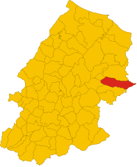
San Giuliano di Puglia (San Giuliano di Puglia)
.svg)
- Italian comune
 Hiking in San Giuliano di Puglia
San Giuliano di Puglia is a small town located in the Molise region of Italy, surrounded by picturesque landscapes that are ideal for hiking and outdoor activities. While San Giuliano itself is not a widely known hiking destination, its proximity to the Apennine Mountains and the surrounding countryside offers several opportunities for nature lovers and hikers.
Hiking Opportunities:
-
Monti del Matese:
- Located to the northwest of San Giuliano, the Matese Mountains offer a variety of hiking trails ranging from easy walks to more challenging ascents. The area is known for its stunning views, lush forests, and diverse wildlife.
-
Natural Parks:
- The nearby Parco Regionale del Matese features several trails that cater to different skill levels. Hikers can explore the unique flora and fauna of the region, as well as enjoy beautiful landscapes and panoramic viewpoints.
-
Countryside Trails:
- The rolling hills and rural roads around San Giuliano provide numerous options for leisurely hikes. These trails often pass through charming villages, vineyards, and olive groves, allowing hikers to experience the local culture and cuisine.
-
Historical Routes:
- There are also historical trails connecting San Giuliano di Puglia to nearby historic sites and towns, offering a unique blend of outdoor and cultural experiences.
Best Practices for Hiking in San Giuliano di Puglia:
-
Preparation: Always check the weather before heading out and dress appropriately for the conditions. Proper footwear is essential, especially on rocky or uneven terrain.
-
Guided Tours: If you're unfamiliar with the area, consider joining a guided hiking tour. Local guides can provide insights into the region’s history and natural environment.
-
Stay Hydrated: Carry enough water, especially in warmer months, and pack some snacks for energy.
-
Respect Nature: Follow local regulations, stay on marked trails, and respect the environment.
-
Safety: Always let someone know your hiking plans and expected return time, especially if venturing into more remote areas.
In summary, while San Giuliano di Puglia may not be a prominent hiking destination, its location offers access to beautiful hiking opportunities in the Molise region. Whether you're looking for challenging mountain trails or scenic country walks, you can find a suitable hike to enjoy the natural beauty of Italy.
- Country:

- Postal Code: 86040
- Local Dialing Code: 0874
- Licence Plate Code: CB
- Coordinates: 41° 41' 0" N, 14° 58' 0" E


- GPS tracks (wikiloc): [Link]
- AboveSeaLevel: 890 м m
- Area: 42.05 sq km
- Population: 1024
- Web site: http://www.comune.sangiulianodipuglia.cb.it/
- Wikipedia en: wiki(en)
- Wikipedia: wiki(it)
- Wikidata storage: Wikidata: Q278157
- Wikipedia Commons Category: [Link]
- Freebase ID: [/m/0121z2]
- GeoNames ID: Alt: [6537524]
- OSM relation ID: [41471]
- ISTAT ID: 070068
- Italian cadastre code: H929
Shares border with regions:
Sant’Elia a Pianisi
- Italian comune
Hiking in Sant’Elia a Pianisi
Sant'Elia a Pianisi is a charming town located in the Molise region of Italy. While it may not be the most famous hiking destination, it offers a beautiful natural landscape and some opportunities for outdoor activities. If you're interested in hiking in this area, here are some insights:...
- Country:
- Postal Code: 86048
- Local Dialing Code: 0874
- Licence Plate Code: CB
- Coordinates: 41° 37' 17" N, 14° 52' 34" E
- GPS tracks (wikiloc): [Link]
- AboveSeaLevel: 666 м m
- Area: 68.25 sq km
- Population: 1732
- Web site: [Link]


Bonefro
- Italian comune
Hiking in Bonefro
Bonefro, a small town located in the province of Campobasso in the Molise region of Italy, offers beautiful hiking opportunities amidst a rich natural landscape. Here are some highlights for hiking in and around Bonefro:...
- Country:
- Postal Code: 86041
- Local Dialing Code: 0874
- Licence Plate Code: CB
- Coordinates: 41° 42' 15" N, 14° 56' 9" E
- GPS tracks (wikiloc): [Link]
- AboveSeaLevel: 631 м m
- Area: 31.28 sq km
- Population: 1331
- Web site: [Link]


Colletorto
- Italian comune
Hiking in Colletorto
Colletorto is a charming village located in the Molise region of Italy, known for its stunning landscapes and natural beauty, making it a great destination for hiking enthusiasts. The area features rolling hills, lush forests, and breathtaking views of the surrounding countryside, providing a serene backdrop for outdoor activities....
- Country:
- Postal Code: 86044
- Local Dialing Code: 0874
- Licence Plate Code: CB
- Coordinates: 41° 39' 50" N, 14° 58' 27" E
- GPS tracks (wikiloc): [Link]
- AboveSeaLevel: 508 м m
- Area: 35.91 sq km
- Population: 1866
- Web site: [Link]

Santa Croce di Magliano
- Italian comune
Hiking in Santa Croce di Magliano
Santa Croce di Magliano is a charming town located in the Molise region of Italy, known for its scenic landscapes and rich history. Hiking in this area offers a unique opportunity to explore the natural beauty and cultural heritage of the region....
- Country:
- Postal Code: 86047
- Local Dialing Code: 0874
- Licence Plate Code: CB
- Coordinates: 41° 43' 0" N, 14° 59' 0" E
- GPS tracks (wikiloc): [Link]
- AboveSeaLevel: 608 м m
- Area: 53.37 sq km
- Population: 4345
- Web site: [Link]
Casalnuovo Monterotaro
- Italian comune
Hiking in Casalnuovo Monterotaro
Casalnuovo Monterotaro is a charming village located in the province of Foggia, in the Apulia region of Italy. While it may not be as widely known as some of the more famous hiking destinations, it offers a great opportunity for outdoor enthusiasts to explore beautiful natural landscapes and enjoy the serene atmosphere of the Italian countryside....
- Country:
- Postal Code: 71033
- Local Dialing Code: 0881
- Licence Plate Code: FG
- Coordinates: 41° 37' 0" N, 15° 6' 0" E
- GPS tracks (wikiloc): [Link]
- AboveSeaLevel: 432 м m
- Area: 48.36 sq km
- Population: 1507
- Web site: [Link]
Castelnuovo della Daunia
- Italian comune
Hiking in Castelnuovo della Daunia
Castelnuovo della Daunia is a charming town located in the Apennine Mountains of Italy, specifically in the region of Apulia (Puglia). It offers a mix of historical sites and natural beauty, making it an attractive destination for hiking enthusiasts. Here’s what you can expect when hiking in and around Castelnuovo della Daunia:...
- Country:
- Postal Code: 71034
- Local Dialing Code: 0881
- Licence Plate Code: FG
- Coordinates: 41° 35' 0" N, 15° 7' 0" E
- GPS tracks (wikiloc): [Link]
- AboveSeaLevel: 600 м m
- Area: 61.49 sq km
- Population: 1390
- Web site: [Link]