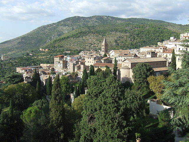
Castel Madama (Castel Madama)
.svg)
- Italian comune
 Hiking in Castel Madama
Castel Madama is a charming medieval town located in the province of Rome, Italy, surrounded by beautiful natural landscapes, making it an excellent destination for hiking enthusiasts. Here are some key points you might find interesting:
Trails and Routes
-
Nature Paths: There are several hiking trails in and around Castel Madama that take you through lush forests, rolling hills, and scenic viewpoints. The trails vary in difficulty, catering to both novice and experienced hikers.
-
Historical Trails: Many hiking routes lead to historic sites, including ancient ruins and castles, allowing hikers to enjoy both nature and cultural heritage. Exploring these paths can give you insights into the region's history.
-
Riviera dei Parchi: This is a popular hiking area nearby that offers numerous trails with varying levels of difficulty. From easy walks to challenging treks, you'll find a range of options to suit your fitness level.
Best Time to Hike
- Spring and Fall: The best times for hiking in Castel Madama are during spring (April to June) and fall (September to October). The weather is generally mild and pleasant, making it ideal for outdoor activities.
Preparation Tips
-
Footwear: Make sure to wear sturdy hiking boots for good support and grip, especially on uneven terrain.
-
Water and Snacks: Bring enough water and some light snacks to keep your energy up along the way.
-
Map and Navigation: Consider bringing a physical map or downloading a hiking app to help navigate the trails, as some paths may not be well-marked.
-
Check the Weather: Always check the weather forecast before heading out to prepare for any changes in conditions.
Local Amenities
-
Accommodation: If you plan to stay overnight, Castel Madama offers a range of accommodations, from hotels to guesthouses.
-
Dining: After a day of hiking, you can enjoy local cuisine at various eateries in town, many of which specialize in traditional Roman dishes.
Conclusion
Hiking in Castel Madama provides a perfect blend of natural beauty, adventure, and cultural exploration. Whether you're looking for a leisurely stroll or a more rigorous hike, you'll find something suitable in this picturesque area. Always respect nature and local regulations while enjoying your hike!
- Country:

- Postal Code: 00024
- Local Dialing Code: 0774
- Licence Plate Code: ROMA
- Coordinates: 41° 58' 29" N, 12° 52' 2" E


- GPS tracks (wikiloc): [Link]
- AboveSeaLevel: 428 м m
- Area: 28.8 sq km
- Population: 7328
- Web site: http://www.comunedicastelmadama.it
- Wikipedia en: wiki(en)
- Wikipedia: wiki(it)
- Wikidata storage: Wikidata: Q242114
- Wikipedia Commons Category: [Link]
- Freebase ID: [/m/0gm6zz]
- GeoNames ID: Alt: [6536943]
- VIAF ID: Alt: [234373920]
- OSM relation ID: [41673]
- WOEID: [713240]
- TGN ID: [7006986]
- UN/LOCODE: [ITCMA]
- Digital Atlas of the Roman Empire ID: [22203]
- ISTAT ID: 058023
- Italian cadastre code: C203
Shares border with regions:

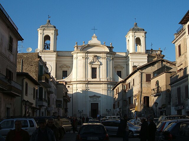
Tivoli
- Italian comune
Hiking in Tivoli
Tivoli, located in the Lazio region of Italy, is renowned for its stunning landscapes, historical sites, and beautiful villas. Here are some key points for hikers looking to explore this picturesque area:...
- Country:
- Postal Code: 00019; 00011; 00010
- Local Dialing Code: 0774
- Licence Plate Code: ROMA
- Coordinates: 41° 58' 0" N, 12° 48' 0" E
- GPS tracks (wikiloc): [Link]
- AboveSeaLevel: 235 м m
- Area: 68.65 sq km
- Population: 56603
- Web site: [Link]
Ciciliano
- Italian comune
Hiking in Ciciliano
Ciciliano is a charming town in the Lazio region of Italy, located about 50 kilometers east of Rome. It is situated in a picturesque area characterized by rolling hills, dense forests, and scenic views, making it an excellent location for hiking enthusiasts. Here are some key points to consider when hiking in the Ciciliano area:...
- Country:
- Postal Code: 00020
- Local Dialing Code: 0774
- Licence Plate Code: ROMA
- Coordinates: 41° 57' 36" N, 12° 56' 30" E
- GPS tracks (wikiloc): [Link]
- AboveSeaLevel: 619 м m
- Area: 18.85 sq km
- Population: 1331
- Web site: [Link]
Sambuci
- Italian comune
Hiking in Sambuci
Sambuci is a charming village located in the Lazio region of Italy, not far from Rome. Nestled in the foothills of the Monti Simbruini, it offers a variety of opportunities for hiking and exploring the natural beauty of the surrounding area....
- Country:
- Postal Code: 00020
- Local Dialing Code: 0774
- Licence Plate Code: RM
- Coordinates: 41° 59' 0" N, 12° 56' 0" E
- GPS tracks (wikiloc): [Link]
- AboveSeaLevel: 434 м m
- Area: 8.3 sq km
- Population: 901
- Web site: [Link]


San Gregorio da Sassola
- Italian comune
Hiking in San Gregorio da Sassola
San Gregorio da Sassola, a charming small town in the Lazio region of Italy, is surrounded by beautiful landscapes that offer a variety of hiking opportunities. Here are some key aspects of hiking in this area:...
- Country:
- Postal Code: 00010
- Local Dialing Code: 0774
- Licence Plate Code: RM
- Coordinates: 41° 55' 0" N, 12° 52' 0" E
- GPS tracks (wikiloc): [Link]
- AboveSeaLevel: 420 м m
- Area: 35.45 sq km
- Population: 1582
- Web site: [Link]


San Polo dei Cavalieri
- Italian comune
Hiking in San Polo dei Cavalieri
San Polo dei Cavalieri, located in the Lazio region of Italy, offers a delightful hiking experience amidst beautiful landscapes and rich history. The area is characterized by its picturesque countryside, rolling hills, and lush forests, making it a great destination for hiking enthusiasts of all levels....
- Country:
- Postal Code: 00010
- Local Dialing Code: 0774
- Licence Plate Code: RM
- Coordinates: 42° 1' 0" N, 12° 50' 0" E
- GPS tracks (wikiloc): [Link]
- AboveSeaLevel: 651 м m
- Area: 42.53 sq km
- Population: 2919
- Web site: [Link]

Vicovaro
- Italian comune
Hiking in Vicovaro
Vicovaro is a charming town located in the province of Rome, Italy, nestled in the beautiful countryside of the Lazio region. It's a great destination for hiking enthusiasts due to its picturesque landscapes, rich history, and numerous trails that cater to various skill levels. Here are some highlights to consider if you're planning to hike in and around Vicovaro:...
- Country:
- Postal Code: 00029
- Local Dialing Code: 0774
- Licence Plate Code: RM
- Coordinates: 42° 1' 4" N, 12° 53' 49" E
- GPS tracks (wikiloc): [Link]
- AboveSeaLevel: 300 м m
- Area: 35.94 sq km
- Population: 3968
- Web site: [Link]