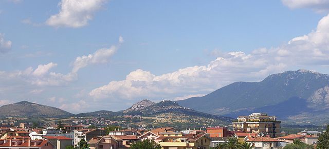
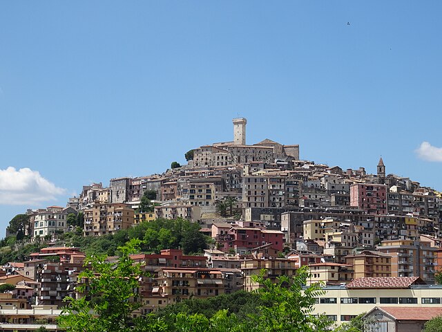
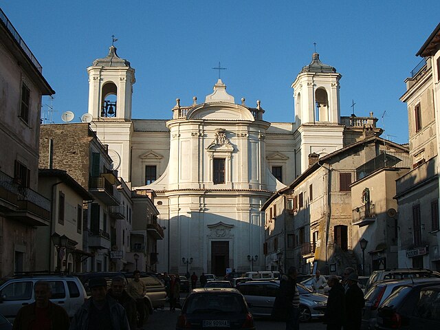
San Polo dei Cavalieri (San Polo dei Cavalieri)
.svg)
- Italian comune
 Hiking in San Polo dei Cavalieri
San Polo dei Cavalieri, located in the Lazio region of Italy, offers a delightful hiking experience amidst beautiful landscapes and rich history. The area is characterized by its picturesque countryside, rolling hills, and lush forests, making it a great destination for hiking enthusiasts of all levels.
Hiking Trails
-
Sentiero della Valle dell'Aniene: This trail takes you through the scenic Aniene Valley, allowing you to experience stunning views of the river and surrounding countryside. It's a relatively easy hike, suitable for families and beginners.
-
Monte Gennaro: For those looking for more of a challenge, hiking to Monte Gennaro offers spectacular panoramic views from its summit. The trail is moderate to difficult and can be rocky in some sections, so proper footwear is recommended.
-
The Historic Center Loop: If you're interested in combining history with hiking, consider a walk around the historic center of San Polo dei Cavalieri. The trail includes visits to old churches and historical buildings, showcasing the rich cultural heritage of the area.
Best Time to Hike
The best seasons for hiking in this region are spring (April to June) and fall (September to November) when the weather is mild, and the landscapes are particularly beautiful. Summer can be quite hot, while winter may bring snow to the higher elevations, making some trails more challenging.
What to Bring
- Appropriate Footwear: Sturdy hiking boots or shoes.
- Water: It’s essential to stay hydrated.
- Snacks: Energy bars or fruits for a quick boost.
- Map and Compass: Although trails are marked, it's good to have a map.
- Sun Protection: Sunscreen, sunglasses, and a hat are important, especially in summer.
Local Flora and Fauna
While hiking, you may encounter diverse wildlife, including various bird species and, if you're lucky, deer or foxes. The flora is equally rich, with many native plants and flowers adding to the scenery, especially in spring.
Cultural Insights
San Polo dei Cavalieri is not just about nature; it also offers insights into local traditions and culture. Be sure to explore the village and indulge in local cuisine at nearby restaurants or cafés.
Safety Tips
- Always inform someone about your hiking plans.
- Check the weather forecast before heading out.
- Follow trail markers and stay on designated paths.
- Respect nature; pack out what you pack in.
Whether you're looking for a leisurely stroll or an adventurous hike, San Polo dei Cavalieri provides a lovely setting for outdoor exploration.
- Country:

- Postal Code: 00010
- Local Dialing Code: 0774
- Licence Plate Code: RM
- Coordinates: 42° 1' 0" N, 12° 50' 0" E


- GPS tracks (wikiloc): [Link]
- AboveSeaLevel: 651 м m
- Area: 42.53 sq km
- Population: 2919
- Web site: http://www.comune.sanpolodenza.re.it
- Wikipedia en: wiki(en)
- Wikipedia: wiki(it)
- Wikidata storage: Wikidata: Q243371
- Wikipedia Commons Category: [Link]
- Freebase ID: [/m/0gm8cp]
- GeoNames ID: Alt: [6538689]
- VIAF ID: Alt: [171064904]
- OSM relation ID: [41712]
- ISTAT ID: 058096
- Italian cadastre code: I125
Shares border with regions:
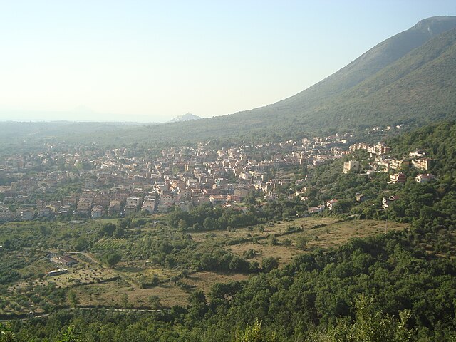
Monteflavio
- Italian comune
Hiking in Monteflavio
Monteflavio is a charming village located in the Province of Rome, Italy, nestled in the beautiful Sabine Hills. The area around Monteflavio offers several opportunities for hiking, characterized by its lush landscapes, historic sites, and panoramic views....
- Country:
- Postal Code: 00010
- Local Dialing Code: 0774
- Licence Plate Code: RM
- Coordinates: 42° 6' 30" N, 12° 49' 51" E
- GPS tracks (wikiloc): [Link]
- AboveSeaLevel: 800 м m
- Area: 16.84 sq km
- Population: 1285
- Web site: [Link]
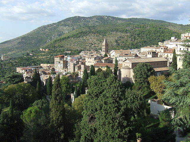

Tivoli
- Italian comune
Hiking in Tivoli
Tivoli, located in the Lazio region of Italy, is renowned for its stunning landscapes, historical sites, and beautiful villas. Here are some key points for hikers looking to explore this picturesque area:...
- Country:
- Postal Code: 00019; 00011; 00010
- Local Dialing Code: 0774
- Licence Plate Code: ROMA
- Coordinates: 41° 58' 0" N, 12° 48' 0" E
- GPS tracks (wikiloc): [Link]
- AboveSeaLevel: 235 м m
- Area: 68.65 sq km
- Population: 56603
- Web site: [Link]

Castel Madama
- Italian comune
Hiking in Castel Madama
Castel Madama is a charming medieval town located in the province of Rome, Italy, surrounded by beautiful natural landscapes, making it an excellent destination for hiking enthusiasts. Here are some key points you might find interesting:...
- Country:
- Postal Code: 00024
- Local Dialing Code: 0774
- Licence Plate Code: ROMA
- Coordinates: 41° 58' 29" N, 12° 52' 2" E
- GPS tracks (wikiloc): [Link]
- AboveSeaLevel: 428 м m
- Area: 28.8 sq km
- Population: 7328
- Web site: [Link]

Guidonia Montecelio
- Italian comune
Hiking in Guidonia Montecelio
Guidonia Montecelio, located in the Lazio region of Italy, is a great destination for hiking enthusiasts. The area is characterized by a mix of natural landscapes, historical sites, and striking views, making it appealing for outdoor activities. Here are some key points about hiking in Guidonia Montecelio:...
- Country:
- Postal Code: 00012
- Local Dialing Code: 0774
- Licence Plate Code: ROMA
- Coordinates: 41° 59' 49" N, 12° 43' 34" E
- GPS tracks (wikiloc): [Link]
- AboveSeaLevel: 105 м m
- Area: 79.06 sq km
- Population: 89288
- Web site: [Link]


Licenza
- Italian comune
Hiking in Licenza
Licenza is a charming town located in the province of Rome, Italy, known for its stunning landscapes, historical sites, and relatively mild climate. Hiking in and around Licenza can be an enjoyable experience, offering a mix of natural beauty and cultural exploration....
- Country:
- Postal Code: 00026
- Local Dialing Code: 0774
- Licence Plate Code: RM
- Coordinates: 42° 4' 27" N, 12° 54' 6" E
- GPS tracks (wikiloc): [Link]
- AboveSeaLevel: 475 м m
- Area: 17.99 sq km
- Population: 950
- Web site: [Link]

Marcellina
- Italian comune
Hiking in Marcellina
Marcellina is a picturesque municipality located in the province of Rome, Italy. While it may not be as famous as some of the larger national parks and hiking destinations in the region, it offers beautiful landscapes and a chance to experience nature away from the crowds. Here are some key points to consider when hiking in Marcellina:...
- Country:
- Postal Code: 00010
- Local Dialing Code: 0774
- Licence Plate Code: ROMA
- Coordinates: 42° 1' 28" N, 12° 48' 16" E
- GPS tracks (wikiloc): [Link]
- AboveSeaLevel: 285 м m
- Area: 15.36 sq km
- Population: 7325
- Web site: [Link]

Palombara Sabina
- Italian comune
Hiking in Palombara Sabina
Palombara Sabina, located in the Lazio region of Italy, is a charming town known for its picturesque landscapes and a variety of hiking opportunities. Nestled in the Sabine Hills, it offers a mix of natural beauty, historical sites, and beautiful trails that are perfect for both beginner and experienced hikers....
- Country:
- Postal Code: 00018
- Local Dialing Code: 0774
- Licence Plate Code: ROMA
- Coordinates: 42° 4' 0" N, 12° 46' 0" E
- GPS tracks (wikiloc): [Link]
- AboveSeaLevel: 372 м m
- Area: 75.8 sq km
- Population: 13200
- Web site: [Link]


Roccagiovine
- Italian comune
Hiking in Roccagiovine
Roccagiovine is a small village located in the Lazio region of Italy, nestled in the Sabine Hills. It is an excellent destination for hiking enthusiasts looking to explore picturesque landscapes, rich history, and serene natural surroundings. Here are some key points to consider when planning a hiking trip to Roccagiovine:...
- Country:
- Postal Code: 00020
- Local Dialing Code: 0774
- Licence Plate Code: RM
- Coordinates: 42° 3' 0" N, 12° 54' 0" E
- GPS tracks (wikiloc): [Link]
- AboveSeaLevel: 520 м m
- Area: 8.41 sq km
- Population: 260
- Web site: [Link]

Vicovaro
- Italian comune
Hiking in Vicovaro
Vicovaro is a charming town located in the province of Rome, Italy, nestled in the beautiful countryside of the Lazio region. It's a great destination for hiking enthusiasts due to its picturesque landscapes, rich history, and numerous trails that cater to various skill levels. Here are some highlights to consider if you're planning to hike in and around Vicovaro:...
- Country:
- Postal Code: 00029
- Local Dialing Code: 0774
- Licence Plate Code: RM
- Coordinates: 42° 1' 4" N, 12° 53' 49" E
- GPS tracks (wikiloc): [Link]
- AboveSeaLevel: 300 м m
- Area: 35.94 sq km
- Population: 3968
- Web site: [Link]