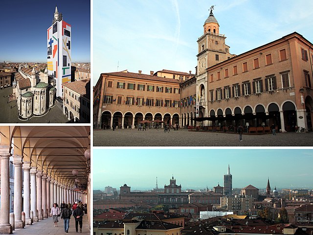
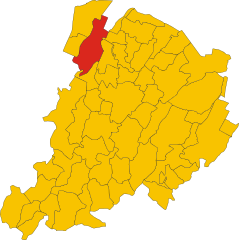
Castelfranco Emilia (Castelfranco Emilia)
- Italian comune
Castelfranco Emilia, located in the Emilia-Romagna region of northern Italy, is not only known for its beautiful architecture and history but also for its scenic landscapes and opportunities for hiking. Although it may not be as famous for hiking as some Italian regions, there are still several trails and natural spots nearby that can offer a charming experience for hikers.
Hiking Areas and Trails
-
Regional Park of Monteveglio: This park, located not too far from Castelfranco Emilia, offers several hiking trails that wind through lush forests, vineyards, and rolling hills. The area's rich biodiversity and panoramic views make it an excellent destination for nature enthusiasts.
-
Sassomolino and Monte San Pietro: A bit further afield, these areas provide a network of hiking trails that can vary in difficulty, catering to both beginners and experienced hikers. You’ll find paths leading through picturesque rural landscapes, making it perfect for a peaceful day out.
-
Modena Hills: The hills around Modena, which are not far from Castelfranco Emilia, feature trails that provide superb views of the surrounding countryside and vineyards. These trails often take you past historical sites and local farms, making for a culturally enriching hike.
What to Expect
-
Scenery: The hiking trails will often lead you through vineyards, olive groves, and woods, with opportunities to enjoy stunning views of the Emilia-Romagna countryside.
-
Wildlife: The area is home to various flora and fauna, so look out for birds, butterflies, and other wildlife along your hikes.
-
Local Culture: As you hike, you may encounter charming villages and local farms where you can taste local products such as wine and cheese.
Tips for Hiking in Castelfranco Emilia
-
Check Trail Maps: Some trails may not be well-marked, so having a map or a hiking app can be helpful.
-
Seasonal Considerations: Spring and autumn are ideal times for hiking, as the weather is usually mild. Summer can be hot, and winter may introduce some risks with icy trails.
-
Stay Hydrated and Prepared: Carry enough water and snacks, wear appropriate footwear, and dress in layers to adjust to changing weather conditions.
-
Respect Nature: Stay on marked trails, pack out what you pack in, and be considerate of wildlife and other hikers.
By experiencing the tranquility and beauty of the trails around Castelfranco Emilia, you’ll not only enjoy physical activity but also appreciate the region’s rich cultural and natural heritage. Happy hiking!
- Country:

- Postal Code: 41013
- Local Dialing Code: 059
- Licence Plate Code: MO
- Coordinates: 44° 35' 48" N, 11° 3' 10" E


- GPS tracks (wikiloc): [Link]
- AboveSeaLevel: 42 м m
- Area: 102.51 sq km
- Population: 32894
- Web site: http://www.comune.castelfranco-emilia.mo.it/servizi/notizie/notizie_homepage.aspx
- Wikipedia en: wiki(en)
- Wikipedia: wiki(it)
- Wikidata storage: Wikidata: Q100043
- Wikipedia Commons Category: [Link]
- Freebase ID: [/m/0bbdjg]
- GeoNames ID: Alt: [6541633]
- VIAF ID: Alt: [149109389]
- OSM relation ID: [43271]
- archINFORM location ID: [14766]
- Library of Congress authority ID: Alt: [n99024060]
- MusicBrainz area ID: [e4b84acb-9602-4d24-b69f-06f11d96179d]
- Quora topic ID: [Castelfranco-Emilia]
- UN/LOCODE: [ITCFE]
- ISTAT ID: 036006
- Italian cadastre code: C107
Shares border with regions:


Nonantola
- Italian comune
Nonantola, located in the Emilia-Romagna region of Italy, is a charming town that offers a variety of hiking opportunities in the surrounding areas. While Nonantola itself is not known for dramatic mountain trails, the region offers scenic walks through countryside landscapes, lush vineyards, and historical sites....
- Country:

- Postal Code: 41015
- Local Dialing Code: 059
- Licence Plate Code: MO
- Coordinates: 44° 40' 40" N, 11° 2' 35" E


- GPS tracks (wikiloc): [Link]
- AboveSeaLevel: 20 м m
- Area: 55.32 sq km
- Population: 15957
- Web site: [Link]


San Cesario sul Panaro
- Italian comune
 Hiking in San Cesario sul Panaro
San Cesario sul Panaro is a charming town located in the Emilia-Romagna region of Italy, not far from the city of Modena. While it's not as widely known for hiking as some other areas in Italy, it still offers beautiful landscapes and opportunities for outdoor activities, including hiking....
- Country:

- Postal Code: 41018
- Local Dialing Code: 059
- Licence Plate Code: MO
- Coordinates: 44° 34' 0" N, 11° 2' 0" E


- GPS tracks (wikiloc): [Link]
- AboveSeaLevel: 54 м m
- Area: 27.31 sq km
- Population: 6460
- Web site: [Link]


Modena
- Italian city and comune
Modena, located in the Emilia-Romagna region of Italy, is renowned for its rich cultural heritage, delicious cuisine, and beautiful landscapes, making it a great destination for hiking enthusiasts. While Modena itself is a city, its surrounding areas offer fantastic hiking opportunities, particularly in the Apennine Mountains, which are just a short drive away....
- Country:

- Postal Code: 41121–41126
- Local Dialing Code: 059
- Licence Plate Code: MO
- Coordinates: 44° 38' 45" N, 10° 55' 33" E


- GPS tracks (wikiloc): [Link]
- AboveSeaLevel: 34 м m
- Area: 183.19 sq km
- Population: 184727
- Web site: [Link]
Anzola dell'Emilia
- Italian comune
Anzola dell'Emilia is a charming town located in the Emilia-Romagna region of Italy, known for its rich cultural heritage and beautiful landscapes. While it may not be as famous for hiking as some of the more mountainous regions of Italy, there are certainly opportunities for outdoor activities in and around Anzola dell'Emilia....
- Country:

- Postal Code: 40011
- Local Dialing Code: 051
- Licence Plate Code: BO
- Coordinates: 44° 32' 50" N, 11° 11' 44" E


- GPS tracks (wikiloc): [Link]
- AboveSeaLevel: 38 м m
- Area: 36.6 sq km
- Population: 12310
- Web site: [Link]
Bazzano
- settlement in the italian municipality of Valsamoggia
Bazzano, a small town located in the Emilia-Romagna region of Italy, is often appreciated for its picturesque countryside and proximity to the Apennine Mountains. While it may not be as widely known as larger hiking destinations, it offers access to several trails that provide beautiful views and a chance to experience the rich natural environment of the area....
- Country:

- Postal Code: 40053
- Local Dialing Code: 051
- Licence Plate Code: BO
- Coordinates: 44° 30' 11" N, 11° 5' 11" E


- GPS tracks (wikiloc): [Link]
- AboveSeaLevel: 93 м m
- Area: 13.99 sq km
- Web site: [Link]
Crespellano
- Italian comune
Crespellano is a charming village located in the Emilia-Romagna region of Italy, not far from Bologna. It offers several opportunities for hiking enthusiasts who want to explore the natural beauty and scenic landscapes of the surrounding area....
- Country:

- Postal Code: 40056
- Local Dialing Code: 051
- Licence Plate Code: BO
- Coordinates: 44° 30' 41" N, 11° 7' 53" E


- GPS tracks (wikiloc): [Link]
- AboveSeaLevel: 64 м m
- Area: 37.5 sq km
- Web site: [Link]


San Giovanni in Persiceto
- Italian comune
 Hiking in San Giovanni in Persiceto
San Giovanni in Persiceto, located in the Emilia-Romagna region of Italy, offers beautiful landscapes and scenic routes that attract hikers looking to explore the rustic charm of the area. While the town itself is known for its historical architecture and cultural heritage, the surrounding countryside provides several opportunities for hiking and outdoor activities....
- Country:

- Postal Code: 40017
- Local Dialing Code: 051
- Licence Plate Code: BO
- Coordinates: 44° 38' 27" N, 11° 11' 6" E


- GPS tracks (wikiloc): [Link]
- AboveSeaLevel: 21 м m
- Area: 114.41 sq km
- Population: 28153
- Web site: [Link]
Sant'Agata Bolognese
- Italian comune
 Hiking in Sant'Agata Bolognese
Sant'Agata Bolognese is a charming village located in the Emilia-Romagna region of Italy, and while it may not be widely known as a hiking destination, it offers a few opportunities to enjoy the beautiful Italian countryside....
- Country:

- Postal Code: 40019
- Local Dialing Code: 051
- Licence Plate Code: BO
- Coordinates: 44° 40' 0" N, 11° 8' 0" E


- GPS tracks (wikiloc): [Link]
- AboveSeaLevel: 21 м m
- Area: 34.79 sq km
- Population: 7344
- Web site: [Link]
