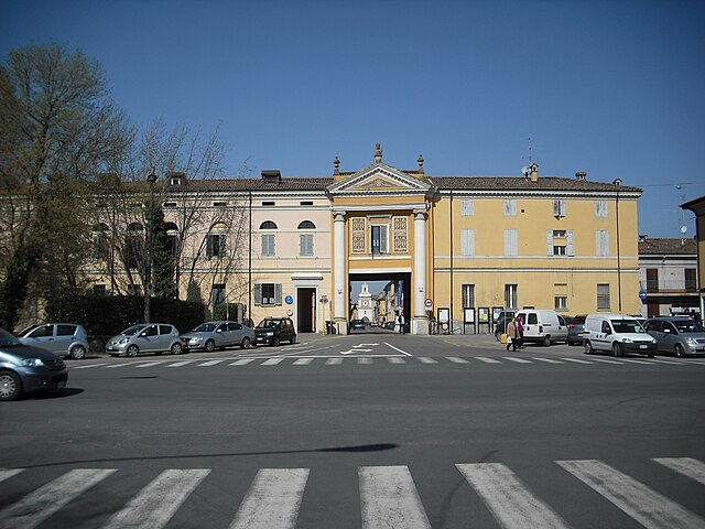
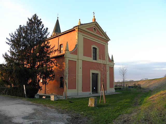
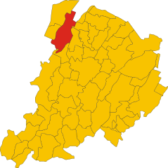
San Giovanni in Persiceto (San Giovanni in Persiceto)
- Italian comune
 Hiking in San Giovanni in Persiceto
San Giovanni in Persiceto, located in the Emilia-Romagna region of Italy, offers beautiful landscapes and scenic routes that attract hikers looking to explore the rustic charm of the area. While the town itself is known for its historical architecture and cultural heritage, the surrounding countryside provides several opportunities for hiking and outdoor activities.
Hiking Opportunities
-
Via Emilia: This historic Roman road runs nearby and features parts that are suitable for hiking. Following the Via Emilia allows you to explore both nature and historical landmarks.
-
Local Nature Reserves: There are several natural reserves and parks in the vicinity where you can enjoy walking trails. Look for spots like the Parco del Reno, which features trails along the river.
-
Countryside Trails: The area around San Giovanni in Persiceto is characterized by picturesque farmland, vineyards, and orchards. Many trails offer a leisurely way to enjoy the rural scenery, perfect for an easy day hike.
-
Segni Trail: Although it may require a short trip outside the town, the Segni Trail is a lovely option that takes you through lush landscapes and offers views of the surrounding hills.
Tips for Hiking in San Giovanni in Persiceto
-
Prepare for Varied Terrain: The trails can range from easy walks to more challenging paths, so be sure to choose a route that matches your fitness level.
-
Check the Weather: The weather in Emilia-Romagna can be quite variable, so it's essential to check forecasts and dress in layers.
-
Respect Nature: Follow the Leave No Trace principles. Enjoy the scenery, but be cautious about littering or disturbing wildlife.
-
Stay Hydrated: Always carry enough water, especially during the warmer months.
-
Local Guides: Consider hiring a local guide or joining a hiking group to enhance your experience with insights into the flora, fauna, and culture of the area.
Conclusion
Overall, hiking in and around San Giovanni in Persiceto provides an excellent opportunity to experience the natural beauty and rich cultural history of Emilia-Romagna. Whether you're looking for a peaceful stroll or a deeper exploration of the area's trails, you'll find plenty to enjoy just outside this charming town.
- Country:

- Postal Code: 40017
- Local Dialing Code: 051
- Licence Plate Code: BO
- Coordinates: 44° 38' 27" N, 11° 11' 6" E


- GPS tracks (wikiloc): [Link]
- AboveSeaLevel: 21 м m
- Area: 114.41 sq km
- Population: 28153
- Web site: http://www.comunepersiceto.it/
- Wikipedia en: wiki(en)
- Wikipedia: wiki(it)
- Wikidata storage: Wikidata: Q94990
- Wikipedia Commons Category: [Link]
- Freebase ID: [/m/08n_95]
- GeoNames ID: Alt: [6538475]
- BnF ID: [12330213g]
- VIAF ID: Alt: [155991000]
- OSM relation ID: [43387]
- archINFORM location ID: [46088]
- Library of Congress authority ID: Alt: [n84155475]
- MusicBrainz area ID: [be73788f-6f11-41e8-af3d-4a90f27b787c]
- WOEID: [722649]
- UN/LOCODE: [ITGIP]
- Gran Enciclopèdia Catalana ID: [0058702]
- ISNI: Alt: [0000 0001 1512 4928]
- ISTAT ID: 037053
- Italian cadastre code: G467
Shares border with regions:


Castelfranco Emilia
- Italian comune
Castelfranco Emilia, located in the Emilia-Romagna region of northern Italy, is not only known for its beautiful architecture and history but also for its scenic landscapes and opportunities for hiking. Although it may not be as famous for hiking as some Italian regions, there are still several trails and natural spots nearby that can offer a charming experience for hikers....
- Country:

- Postal Code: 41013
- Local Dialing Code: 059
- Licence Plate Code: MO
- Coordinates: 44° 35' 48" N, 11° 3' 10" E


- GPS tracks (wikiloc): [Link]
- AboveSeaLevel: 42 м m
- Area: 102.51 sq km
- Population: 32894
- Web site: [Link]
Anzola dell'Emilia
- Italian comune
Anzola dell'Emilia is a charming town located in the Emilia-Romagna region of Italy, known for its rich cultural heritage and beautiful landscapes. While it may not be as famous for hiking as some of the more mountainous regions of Italy, there are certainly opportunities for outdoor activities in and around Anzola dell'Emilia....
- Country:

- Postal Code: 40011
- Local Dialing Code: 051
- Licence Plate Code: BO
- Coordinates: 44° 32' 50" N, 11° 11' 44" E


- GPS tracks (wikiloc): [Link]
- AboveSeaLevel: 38 м m
- Area: 36.6 sq km
- Population: 12310
- Web site: [Link]


Castello d'Argile
- Italian comune
Castello d'Argile, located in the Emilia-Romagna region of Italy, offers a picturesque setting for those interested in hiking, albeit it is not as famous for hiking trails as some other regions in Italy. This small town, situated in the province of Bologna, provides a blend of rural charm and historical sights....
- Country:

- Postal Code: 40050
- Local Dialing Code: 051
- Licence Plate Code: BO
- Coordinates: 44° 40' 52" N, 11° 17' 48" E


- GPS tracks (wikiloc): [Link]
- AboveSeaLevel: 23 м m
- Area: 29.07 sq km
- Population: 6583
- Web site: [Link]


Crevalcore
- Italian comune
Crevalcore is a charming town located in the Emilia-Romagna region of Italy, known more for its agricultural landscape than for traditional hiking trails. However, there are opportunities for easy hiking and walking in the surrounding countryside....
- Country:

- Postal Code: 40014
- Local Dialing Code: 051
- Licence Plate Code: BO
- Coordinates: 44° 43' 0" N, 11° 9' 0" E


- GPS tracks (wikiloc): [Link]
- AboveSeaLevel: 20 м m
- Area: 102.75 sq km
- Population: 13501
- Web site: [Link]


Sala Bolognese
- Italian comune
Sala Bolognese, located in the Emilia-Romagna region of Italy, is not a widely recognized hiking destination compared to surrounding areas. However, the region's rich landscape and proximity to larger natural attractions provide opportunities for walkers and hikers to explore....
- Country:

- Postal Code: 40010
- Local Dialing Code: 051
- Licence Plate Code: BO
- Coordinates: 44° 37' 49" N, 11° 16' 34" E


- GPS tracks (wikiloc): [Link]
- AboveSeaLevel: 25 м m
- Area: 45.64 sq km
- Population: 8372
- Web site: [Link]
Sant'Agata Bolognese
- Italian comune
 Hiking in Sant'Agata Bolognese
Sant'Agata Bolognese is a charming village located in the Emilia-Romagna region of Italy, and while it may not be widely known as a hiking destination, it offers a few opportunities to enjoy the beautiful Italian countryside....
- Country:

- Postal Code: 40019
- Local Dialing Code: 051
- Licence Plate Code: BO
- Coordinates: 44° 40' 0" N, 11° 8' 0" E


- GPS tracks (wikiloc): [Link]
- AboveSeaLevel: 21 м m
- Area: 34.79 sq km
- Population: 7344
- Web site: [Link]


Cento
- Italian comune
Cento is a town located in the Emilia-Romagna region of northern Italy, known more for its historical significance and cultural sites than for extensive hiking trails. However, if you're looking to explore the natural beauty of the surrounding areas, there are a few options you might consider....
- Country:

- Postal Code: 44042
- Local Dialing Code: 051
- Licence Plate Code: FE
- Coordinates: 44° 44' 0" N, 11° 17' 0" E


- GPS tracks (wikiloc): [Link]
- AboveSeaLevel: 15 м m
- Area: 64.74 sq km
- Population: 35547
- Web site: [Link]
