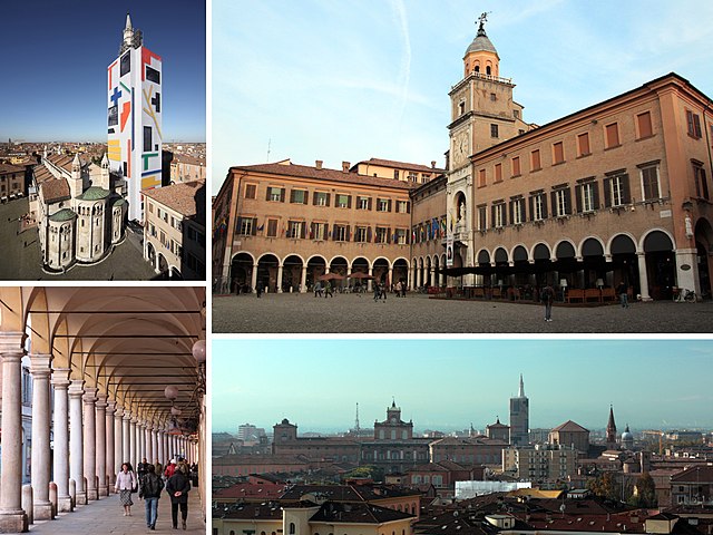
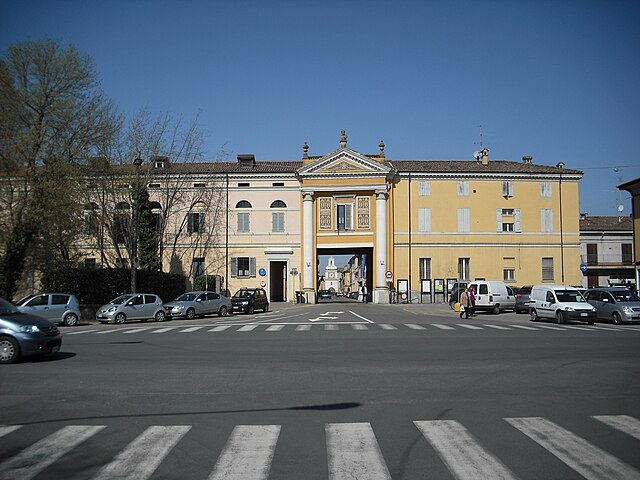
Nonantola (Nonantola)
- Italian comune
Nonantola, located in the Emilia-Romagna region of Italy, is a charming town that offers a variety of hiking opportunities in the surrounding areas. While Nonantola itself is not known for dramatic mountain trails, the region offers scenic walks through countryside landscapes, lush vineyards, and historical sites.
Key Hiking Areas and Trails
-
Parco Regionale dei Sassi di Roccamalatina:
- Located a short drive from Nonantola, this regional park features striking rock formations and stunning views. Trails vary in difficulty, making it suitable for both beginners and experienced hikers.
-
Ciclovia del Sole (Sun Cycle Route):
- This long-distance cycling and walking path runs through the Emilia-Romagna region, connecting various municipalities and offering a unique experience of the countryside. You can explore various parts of the route that run near Nonantola.
-
Maranello:
- Just a bit further afield, Maranello is known for its connection to Ferrari but also for beautiful trails through the nearby hills and vineyards. Hiking here can be complemented with visits to local farms and wineries.
-
Modena Province Vineyards:
- The landscapes around Nonantola include picturesque vineyards, especially around the Modena area. Several trails allow hikers to explore these vineyards and enjoy the local cuisine and wines.
Tips for Hiking in Nonantola:
- Weather Considerations: Check the weather forecast before heading out, especially in spring and autumn when conditions can change rapidly.
- Footwear: Wear sturdy, comfortable shoes suitable for walking on varied terrain.
- Hydration and Snacks: Carry enough water and light snacks to keep your energy up during hikes.
- Maps and Guides: It can be helpful to have local maps or guides, especially if you’re exploring less-marked paths.
Additional Activities
In addition to hiking, Nonantola is rich in history and culture, with notable sites like the Abbey of Nonantola, where you can learn about the area’s monastic heritage. You might also consider combining your hiking with culinary experiences, as the Emilia-Romagna region is famous for its cuisine, including Parmigiano-Reggiano cheese and balsamic vinegar.
Overall, Nonantola and its surroundings provide a relaxing and culturally enriching hiking experience, perfect for nature lovers and those looking to explore the Italian countryside.
- Country:

- Postal Code: 41015
- Local Dialing Code: 059
- Licence Plate Code: MO
- Coordinates: 44° 40' 40" N, 11° 2' 35" E


- GPS tracks (wikiloc): [Link]
- AboveSeaLevel: 20 м m
- Area: 55.32 sq km
- Population: 15957
- Web site: http://www.comune.nonantola.mo.it
- Wikipedia en: wiki(en)
- Wikipedia: wiki(it)
- Wikidata storage: Wikidata: Q100080
- Wikipedia Commons Category: [Link]
- Freebase ID: [/m/090224]
- GeoNames ID: Alt: [6536727]
- BnF ID: [122952232]
- VIAF ID: Alt: [140247636]
- OSM relation ID: [43444]
- GND ID: Alt: [4293548-9]
- Library of Congress authority ID: Alt: [n85208461]
- UN/LOCODE: [ITNON]
- ISTAT ID: 036027
- Italian cadastre code: F930
Shares border with regions:
Bomporto
- Italian comune
Bomporto, located in the Emilia-Romagna region of Italy, is a charming area with picturesque landscapes, making it a great destination for hiking enthusiasts. While Bomporto itself may not have extensive hiking trails, there are several options in the surrounding regions that offer beautiful scenery and outdoor experiences....
- Country:

- Postal Code: 41030
- Local Dialing Code: 059
- Licence Plate Code: MO
- Coordinates: 44° 44' 0" N, 11° 2' 0" E


- GPS tracks (wikiloc): [Link]
- AboveSeaLevel: 20 м m
- Area: 38.87 sq km
- Population: 10170
- Web site: [Link]


Castelfranco Emilia
- Italian comune
Castelfranco Emilia, located in the Emilia-Romagna region of northern Italy, is not only known for its beautiful architecture and history but also for its scenic landscapes and opportunities for hiking. Although it may not be as famous for hiking as some Italian regions, there are still several trails and natural spots nearby that can offer a charming experience for hikers....
- Country:

- Postal Code: 41013
- Local Dialing Code: 059
- Licence Plate Code: MO
- Coordinates: 44° 35' 48" N, 11° 3' 10" E


- GPS tracks (wikiloc): [Link]
- AboveSeaLevel: 42 м m
- Area: 102.51 sq km
- Population: 32894
- Web site: [Link]
Ravarino
- Italian comune
Ravarino is a small town located in the Emilia-Romagna region of Italy, known for its scenic countryside and proximity to larger cities like Modena and Bologna. While Ravarino itself might not be famous for high-profile hiking trails, the surrounding landscapes offer opportunities for nature lovers and hikers looking to explore the beautiful Italian countryside....
- Country:

- Postal Code: 41017
- Local Dialing Code: 059
- Licence Plate Code: MO
- Coordinates: 44° 43' 0" N, 11° 6' 0" E


- GPS tracks (wikiloc): [Link]
- AboveSeaLevel: 23 м m
- Area: 28.53 sq km
- Population: 6132
- Web site: [Link]


Modena
- Italian city and comune
Modena, located in the Emilia-Romagna region of Italy, is renowned for its rich cultural heritage, delicious cuisine, and beautiful landscapes, making it a great destination for hiking enthusiasts. While Modena itself is a city, its surrounding areas offer fantastic hiking opportunities, particularly in the Apennine Mountains, which are just a short drive away....
- Country:

- Postal Code: 41121–41126
- Local Dialing Code: 059
- Licence Plate Code: MO
- Coordinates: 44° 38' 45" N, 10° 55' 33" E


- GPS tracks (wikiloc): [Link]
- AboveSeaLevel: 34 м m
- Area: 183.19 sq km
- Population: 184727
- Web site: [Link]


Crevalcore
- Italian comune
Crevalcore is a charming town located in the Emilia-Romagna region of Italy, known more for its agricultural landscape than for traditional hiking trails. However, there are opportunities for easy hiking and walking in the surrounding countryside....
- Country:

- Postal Code: 40014
- Local Dialing Code: 051
- Licence Plate Code: BO
- Coordinates: 44° 43' 0" N, 11° 9' 0" E


- GPS tracks (wikiloc): [Link]
- AboveSeaLevel: 20 м m
- Area: 102.75 sq km
- Population: 13501
- Web site: [Link]
Sant'Agata Bolognese
- Italian comune
 Hiking in Sant'Agata Bolognese
Sant'Agata Bolognese is a charming village located in the Emilia-Romagna region of Italy, and while it may not be widely known as a hiking destination, it offers a few opportunities to enjoy the beautiful Italian countryside....
- Country:

- Postal Code: 40019
- Local Dialing Code: 051
- Licence Plate Code: BO
- Coordinates: 44° 40' 0" N, 11° 8' 0" E


- GPS tracks (wikiloc): [Link]
- AboveSeaLevel: 21 м m
- Area: 34.79 sq km
- Population: 7344
- Web site: [Link]
