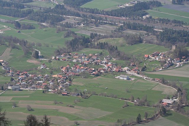
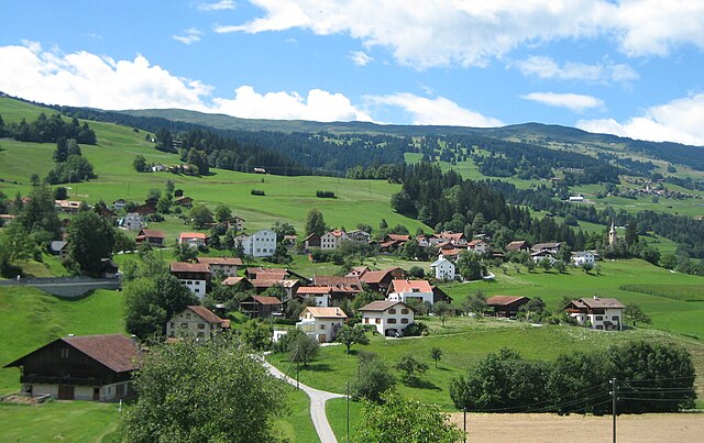
Cazis (Cazis)
- municipality in Switzerland
Cazis, located in the beautiful canton of Graubünden in Switzerland, is a fantastic destination for hiking enthusiasts. The region is known for its stunning Alpine scenery, charming villages, and well-maintained hiking trails. Here are some key highlights about hiking in Cazis:
Trails and Routes
- Diverse Trails: Cazis offers a variety of trails for different skill levels, from leisurely walks suitable for families to more challenging hiking paths for experienced hikers.
- Panoramic Views: Many trails provide breathtaking views of the surrounding mountains, valleys, and rivers. The section of the Graubünden Trail that passes near Cazis is particularly scenic.
- Well-Marked Paths: The hiking routes are usually well-marked and maintained, making it easy to navigate the area. Look for the white and red markers indicating Alpine paths.
Key Hikes
- Cazis to the Rhine Gorge: This hike takes you to the magnificent Rhine Gorge, often referred to as the "Grand Canyon of Switzerland." The breathtaking landscapes and geological formations are truly impressive.
- Cazis to Tomils: A moderate hike that rewards you with panoramic views over the region and the surrounding forests.
- Ridge Walks: There are several ridge walks around Cazis that offer stunning vistas of the Alps. These routes are especially popular for their dramatic landscapes.
Best Time to Hike
- Summer and Early Autumn: The best time for hiking in Cazis is typically from June to October when the weather is milder and the trails are usually dry.
Considerations
- Weather Conditions: Always check the weather forecast before heading out, as conditions can change quickly in the mountains.
- Equipment: Wear sturdy hiking boots and carry necessary gear, including appropriate clothing, water, snacks, and a first-aid kit.
- Local Tips: It might be worth checking with local visitor centers for maps, guided tours, and any specific trail information.
Nearby Attractions
- Julier Pass and the Albula Pass: These scenic mountain passes not only provide great hiking opportunities but also stunning drives.
- Municipalities: Explore nearby towns like Thusis and Sils im Domleschg for cultural experiences and local cuisine post-hike.
Overall, hiking in Cazis can be a memorable experience filled with natural beauty and adventure. Always prepare adequately and have fun on the trails!
- Country:

- Postal Code: 7408
- Local Dialing Code: 081
- Licence Plate Code: GR
- Coordinates: 46° 44' 14" N, 9° 25' 36" E


- GPS tracks (wikiloc): [Link]
- AboveSeaLevel: 633 м m
- Area: 31.18 sq km
- Population: 2174
- Web site: http://www.cazis.ch
- Wikipedia en: wiki(en)
- Wikipedia: wiki(de)
- Wikidata storage: Wikidata: Q64443
- Wikipedia Commons Category: [Link]
- Freebase ID: [/m/026ffjh]
- GeoNames ID: Alt: [7285449]
- VIAF ID: Alt: [145561738]
- OSM relation ID: [1684061]
- archINFORM location ID: [42289]
- Library of Congress authority ID: Alt: [n92069834]
- HDS ID: [1485]
- Swiss municipality code: [3661]
Shares border with regions:


Rodels
- former municipality of Switzerland
Rodels, a picturesque village located in the canton of Graubünden in Switzerland, offers stunning hiking opportunities amidst breathtaking Alpine scenery. Here are some highlights and tips for hiking in Rodels:...
- Country:

- Postal Code: 7415
- Local Dialing Code: 081
- Licence Plate Code: GR
- Coordinates: 46° 43' 59" N, 9° 26' 0" E


- GPS tracks (wikiloc): [Link]
- AboveSeaLevel: 684 м m
- Area: 1.68 sq km
- Web site: [Link]


Pratval
- former municipality of Switzerland
Pratval, located in the scenic valleys of the Himalayas, is an excellent destination for hiking enthusiasts. This area is celebrated for its stunning landscapes, diverse flora and fauna, and a variety of trails suitable for hikers of all experience levels....
- Country:

- Postal Code: 7415
- Local Dialing Code: 081
- Licence Plate Code: GR
- Coordinates: 46° 42' 59" N, 9° 26' 0" E


- GPS tracks (wikiloc): [Link]
- AboveSeaLevel: 687 м m
- Area: 0.77 sq km
- Web site: [Link]


Fürstenau
- town on the Rhine river, in Graubünden, Switzerland
Fürstenau, located in the Swiss canton of Graubünden, is a charming village that offers a range of beautiful hiking opportunities amidst the stunning landscapes of the Swiss Alps. Here’s what you need to know about hiking in this area:...
- Country:

- Postal Code: 7414
- Local Dialing Code: 081
- Licence Plate Code: GR
- Coordinates: 46° 42' 59" N, 9° 26' 0" E


- GPS tracks (wikiloc): [Link]
- AboveSeaLevel: 650 м m
- Area: 1.32 sq km
- Population: 349
- Web site: [Link]


Paspels
- former municipality of Switzerland
Paspels is a charming village located in the canton of Grisons (Graubünden) in Switzerland. Nestled in the picturesque landscape, it serves as a great base for various hiking adventures. Here’s what you can expect when hiking in and around Paspels:...
- Country:

- Postal Code: 7417
- Local Dialing Code: 081
- Licence Plate Code: GR
- Coordinates: 46° 43' 59" N, 9° 26' 0" E


- GPS tracks (wikiloc): [Link]
- AboveSeaLevel: 778 м m
- Area: 4.59 sq km
- Web site: [Link]


Masein
- municipality in Switzerland
Masein, which is part of the more expansive region in Myanmar (Burma), offers a blend of lush landscapes, cultural richness, and opportunities for adventurous hiking. Here are some key highlights:...
- Country:

- Postal Code: 7425
- Local Dialing Code: 081
- Licence Plate Code: GR
- Coordinates: 46° 41' 50" N, 9° 25' 23" E


- GPS tracks (wikiloc): [Link]
- AboveSeaLevel: 942 м m
- Area: 4.2 sq km
- Population: 481
- Web site: [Link]


Rothenbrunnen
- municipality of Switzerland
Rothenbrunnen is a picturesque village situated in the beautiful Surselva region of Switzerland, known for its stunning landscapes, dramatic cliffs, and diverse hiking trails. Here are some highlights and tips for hiking in and around Rothenbrunnen:...
- Country:

- Postal Code: 7405
- Local Dialing Code: 081
- Licence Plate Code: GR
- Coordinates: 46° 46' 40" N, 9° 25' 16" E


- GPS tracks (wikiloc): [Link]
- AboveSeaLevel: 736 м m
- Area: 3.11 sq km
- Population: 311
- Web site: [Link]


Rhäzüns
- municipality in Switzerland
Rhäzüns is a beautiful municipality located in the Graubünden region of Switzerland, surrounded by stunning landscapes and offering excellent hiking opportunities. The area is characterized by its picturesque mountains, dense forests, and lovely meadows, making it a fantastic destination for outdoor enthusiasts....
- Country:

- Postal Code: 7403
- Local Dialing Code: 081
- Licence Plate Code: GR
- Coordinates: 46° 47' 59" N, 9° 23' 59" E


- GPS tracks (wikiloc): [Link]
- AboveSeaLevel: 657 м m
- Area: 13.37 sq km
- Population: 1494
- Web site: [Link]


Thusis
- municipality in Switzerland
Thusis, located in the canton of Graubünden in Switzerland, is a great destination for hikers. It sits at the confluence of the Rhine and Hinterrhein rivers and offers stunning views of the surrounding mountains and valleys....
- Country:

- Postal Code: 7430
- Local Dialing Code: 081
- Licence Plate Code: GR
- Coordinates: 46° 41' 19" N, 9° 25' 58" E


- GPS tracks (wikiloc): [Link]
- AboveSeaLevel: 805 м m
- Area: 6.81 sq km
- Population: 3138
- Web site: [Link]

