Cene (Cene)
- Italian comune
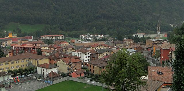
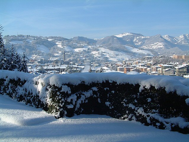
Cene is a small town located in the province of Bergamo, Lombardy, Italy. It is situated near the foothills of the Alps, which provides a beautiful setting for hiking enthusiasts. Here are some key points if you're considering hiking in and around Cene:
Hiking Trails
-
Scenic Views: Cene offers several trails that provide stunning views of the Seriana Valley and the surrounding mountains. The area is characterized by lush forests, rocky terrains, and picturesque landscapes.
-
Trail Difficulty: There are a variety of trails catering to different skill levels, from easy walks suitable for families to more challenging hikes for seasoned adventurers.
-
Popular Routes: Some popular nearby hiking routes include trails leading to the nearby towns of Nembro and Albino, as well as paths that lead deeper into the Orobie Mountain Range.
Preparation
-
Gear: Make sure you wear appropriate hiking boots and clothing. Waterproof jackets are also recommended, as the weather can change quickly in mountainous areas.
-
Maps and Guides: It might be beneficial to get a hiking map or use a hiking app for navigation, as some trails can be less marked.
-
Timing: Consider the time of year you plan to hike. Spring and early autumn are usually ideal for hiking in this region, as the weather is mild and the scenery is lush.
Safety
-
Wildlife: Be aware of local wildlife, including deer and possibly snakes. It's advisable to stick to the marked trails.
-
Hydration and Nutrition: Always carry enough water and snacks, as some trails can be long and remote.
-
Local Regulations: Familiarize yourself with local hiking regulations and guidelines to ensure a safe and respectful experience.
Accessibility
Cene is located about 10 kilometers from Bergamo, making it easily accessible for day trips. Public transport options may include buses, but having a car can provide greater flexibility to explore different trails.
Recommendations
- Consider visiting during weekdays to avoid crowds, especially during peak hiking seasons.
- After a day of hiking, enjoy the local cuisine at one of the town's trattorias to experience authentic Lombard flavors.
Hiking around Cene can be a wonderful way to enjoy nature, so be sure to take the time to appreciate the scenery and tranquility of the area!
- Country:

- Postal Code: 24020
- Local Dialing Code: 035
- Licence Plate Code: BG
- Coordinates: 45° 46' 46" N, 9° 49' 33" E


- GPS tracks (wikiloc): [Link]
- AboveSeaLevel: 368 м m
- Area: 8.6 sq km
- Population: 4267
- Web site: http://www.comunedicene.it
- Wikipedia en: wiki(en)
- Wikipedia: wiki(it)
- Wikidata storage: Wikidata: Q100354
- Wikipedia Commons Gallery: [Link]
- Wikipedia Commons Category: [Link]
- Freebase ID: [/m/0gj9n5]
- GeoNames ID: Alt: [6537148]
- OSM relation ID: [46078]
- UN/LOCODE: [ITENE]
- ISTAT ID: 016070
- Italian cadastre code: C459
Shares border with regions:


Casnigo
- Italian comune
Casnigo is a charming town located in the province of Bergamo, in the Lombardy region of northern Italy. Nestled within the Seriana Valley, it boasts stunning natural scenery, making it an excellent spot for hiking enthusiasts. Here are some key highlights for hiking in and around Casnigo:...
- Country:

- Postal Code: 24020
- Local Dialing Code: 035
- Licence Plate Code: BG
- Coordinates: 45° 48' 59" N, 9° 52' 0" E


- GPS tracks (wikiloc): [Link]
- AboveSeaLevel: 514 м m
- Area: 13.62 sq km
- Population: 3221
- Web site: [Link]


Cazzano Sant'Andrea
- Italian comune
Cazzano Sant'Andrea is a picturesque village located in the province of Bergamo, in the Lombardy region of Italy. This area is known for its natural beauty, rolling hills, and mountainous terrain, making it a wonderful destination for hiking enthusiasts....
- Country:

- Postal Code: 24026
- Local Dialing Code: 035
- Licence Plate Code: BG
- Coordinates: 45° 49' 0" N, 9° 53' 0" E


- GPS tracks (wikiloc): [Link]
- AboveSeaLevel: 504 м m
- Area: 2.02 sq km
- Population: 1670
- Web site: [Link]


Fiorano al Serio
- Italian comune
Fiorano al Serio is a charming town located in the province of Bergamo, in the Lombardy region of northern Italy. Surrounded by the stunning natural beauty of the Orobian Alps, it offers a variety of hiking opportunities for both beginners and experienced hikers....
- Country:

- Postal Code: 24020
- Local Dialing Code: 035
- Licence Plate Code: BG
- Coordinates: 45° 48' 7" N, 9° 50' 35" E


- GPS tracks (wikiloc): [Link]
- AboveSeaLevel: 396 м m
- Area: 1.06 sq km
- Population: 3016
- Web site: [Link]


Gaverina Terme
- Italian comune
Gaverina Terme, located in the province of Bergamo in Lombardy, Italy, is a charming destination known for its natural beauty, thermal springs, and outdoor activities, including hiking. Here are some key points about hiking in and around Gaverina Terme:...
- Country:

- Postal Code: 24060
- Local Dialing Code: 035
- Licence Plate Code: BG
- Coordinates: 45° 46' 0" N, 9° 53' 0" E


- GPS tracks (wikiloc): [Link]
- AboveSeaLevel: 509 м m
- Area: 5.2 sq km
- Population: 868
- Web site: [Link]


Gazzaniga
- Italian comune
Gazzaniga, a town located in the Lombardy region of Italy, is surrounded by beautiful natural landscapes that provide fantastic opportunities for hiking enthusiasts. While the town itself may not be a well-known hiking destination, its proximity to the Orobian Alps and the Seriana Valley offers a variety of trails suitable for all levels of hikers....
- Country:

- Postal Code: 24025
- Local Dialing Code: 035
- Licence Plate Code: BG
- Coordinates: 45° 48' 0" N, 9° 50' 0" E


- GPS tracks (wikiloc): [Link]
- AboveSeaLevel: 386 м m
- Area: 14.41 sq km
- Population: 5058
- Web site: [Link]


Leffe, Lombardy
- Italian comune
Leffe, located in the Lombardy region of northern Italy, is a charming village situated near Lake Iseo and is surrounded by beautiful natural landscapes, making it an excellent spot for hiking enthusiasts. Here are a few highlights and tips for hiking in and around Leffe:...
- Country:

- Postal Code: 24026
- Local Dialing Code: 035
- Licence Plate Code: BG
- Coordinates: 45° 48' 0" N, 9° 54' 0" E


- GPS tracks (wikiloc): [Link]
- AboveSeaLevel: 453 м m
- Area: 6.69 sq km
- Population: 4463
- Web site: [Link]


Albino, Lombardy
- Italian comune
Albino, located in the Lombardy region of Italy, is a charming town nestled in the foothills of the Bergamasque Alps. The area offers a variety of hiking opportunities, making it a great destination for outdoor enthusiasts....
- Country:

- Postal Code: 24021
- Local Dialing Code: 035
- Licence Plate Code: BG
- Coordinates: 45° 45' 38" N, 9° 47' 49" E


- GPS tracks (wikiloc): [Link]
- AboveSeaLevel: 342 м m
- Area: 31.81 sq km
- Population: 17903
- Web site: [Link]
Bianzano
- Italian comune
Bianzano is a charming village located in the province of Bergamo in northern Italy. It is surrounded by beautiful landscapes, making it a great destination for hiking enthusiasts. Here are some highlights and details about hiking in and around Bianzano:...
- Country:

- Postal Code: 24060
- Local Dialing Code: 035
- Licence Plate Code: BG
- Coordinates: 45° 46' 26" N, 9° 55' 10" E


- GPS tracks (wikiloc): [Link]
- AboveSeaLevel: 614 м m
- Area: 6.67 sq km
- Population: 610
- Web site: [Link]

