Cernay-en-Dormois (Cernay-en-Dormois)

- commune in Marne, France
- Country:

- Postal Code: 51800
- Coordinates: 49° 13' 34" N, 4° 45' 59" E


- GPS tracks (wikiloc): [Link]
- Area: 24.82 sq km
- Population: 155
- Wikipedia en: wiki(en)
- Wikipedia: wiki(fr)
- Wikidata storage: Wikidata: Q1115902
- Wikipedia Commons Category: [Link]
- Freebase ID: [/m/03qd4qd]
- GeoNames ID: Alt: [6435715]
- SIREN number: [215100975]
- BnF ID: [15262717k]
- INSEE municipality code: 51104
Shares border with regions:

Condé-lès-Autry
- commune in Ardennes, France
- Country:
- Postal Code: 08250
- Coordinates: 49° 15' 6" N, 4° 51' 16" E
- GPS tracks (wikiloc): [Link]
- Area: 7.97 sq km
- Population: 74
Rouvroy-Ripont
- commune in Marne, France
- Country:
- Postal Code: 51800
- Coordinates: 49° 13' 30" N, 4° 43' 53" E
- GPS tracks (wikiloc): [Link]
- AboveSeaLevel: 125 м m
- Area: 11.77 sq km
- Population: 9
Fontaine-en-Dormois
- commune in Marne, France
- Country:
- Postal Code: 51800
- Coordinates: 49° 14' 15" N, 4° 43' 3" E
- GPS tracks (wikiloc): [Link]
- Area: 5.29 sq km
- Population: 22

Minaucourt-le-Mesnil-lès-Hurlus
- commune in Marne, France
- Country:
- Postal Code: 51800
- Coordinates: 49° 10' 14" N, 4° 42' 55" E
- GPS tracks (wikiloc): [Link]
- AboveSeaLevel: 142 м m
- Area: 23.04 sq km
- Population: 51


Ville-sur-Tourbe
- commune in Marne, France
- Country:
- Postal Code: 51800
- Coordinates: 49° 11' 12" N, 4° 47' 2" E
- GPS tracks (wikiloc): [Link]
- Area: 11.13 sq km
- Population: 246
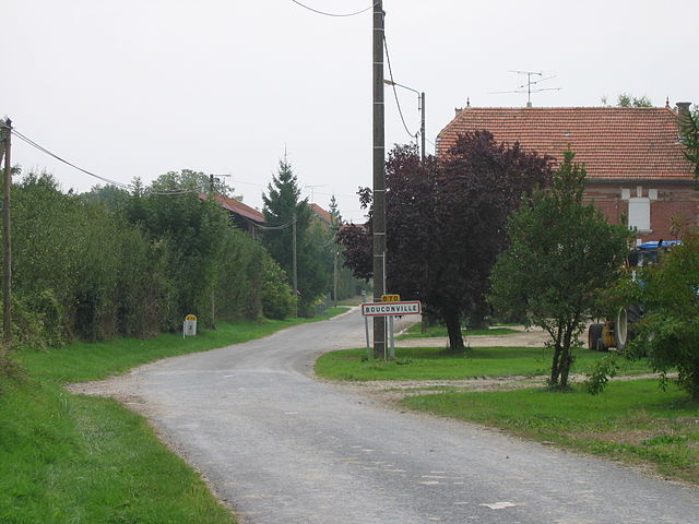
Bouconville
- commune in Ardennes, France
- Country:
- Postal Code: 08250
- Coordinates: 49° 15' 18" N, 4° 45' 45" E
- GPS tracks (wikiloc): [Link]
- Area: 15.21 sq km
- Population: 50

Servon-Melzicourt
- commune in Marne, France
- Country:
- Postal Code: 51800
- Coordinates: 49° 12' 54" N, 4° 50' 26" E
- GPS tracks (wikiloc): [Link]
- Area: 25.78 sq km
- Population: 111

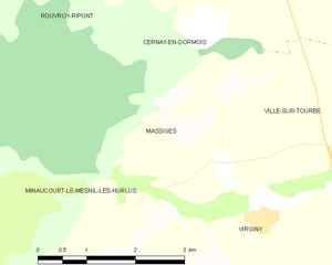
Massiges
- commune in Marne, France
- Country:
- Postal Code: 51800
- Coordinates: 49° 11' 13" N, 4° 45' 0" E
- GPS tracks (wikiloc): [Link]
- Area: 8.19 sq km
- Population: 49

Autry
- commune in Ardennes, France
- Country:
- Postal Code: 08250
- Coordinates: 49° 16' 6" N, 4° 50' 14" E
- GPS tracks (wikiloc): [Link]
- Area: 16.34 sq km
- Population: 124