Servon-Melzicourt (Servon-Melzicourt)

- commune in Marne, France
- Country:

- Postal Code: 51800
- Coordinates: 49° 12' 54" N, 4° 50' 26" E


- GPS tracks (wikiloc): [Link]
- Area: 25.78 sq km
- Population: 111
- Wikipedia en: wiki(en)
- Wikipedia: wiki(fr)
- Wikidata storage: Wikidata: Q631244
- Wikipedia Commons Category: [Link]
- Freebase ID: [/m/03qd9wf]
- GeoNames ID: Alt: [6436019]
- SIREN number: [215104969]
- BnF ID: [15263128t]
- VIAF ID: Alt: [248302174]
- INSEE municipality code: 51533
Shares border with regions:

Condé-lès-Autry
- commune in Ardennes, France
- Country:
- Postal Code: 08250
- Coordinates: 49° 15' 6" N, 4° 51' 16" E
- GPS tracks (wikiloc): [Link]
- Area: 7.97 sq km
- Population: 74

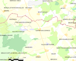
Cernay-en-Dormois
- commune in Marne, France
- Country:
- Postal Code: 51800
- Coordinates: 49° 13' 34" N, 4° 45' 59" E
- GPS tracks (wikiloc): [Link]
- Area: 24.82 sq km
- Population: 155
Malmy
- commune in Marne, France
- Country:
- Postal Code: 51800
- Coordinates: 49° 10' 33" N, 4° 48' 40" E
- GPS tracks (wikiloc): [Link]
- Area: 4.83 sq km
- Population: 34

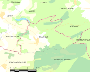
Binarville
- commune in Marne, France
- Country:
- Postal Code: 51800
- Coordinates: 49° 14' 23" N, 4° 53' 38" E
- GPS tracks (wikiloc): [Link]
- Area: 16.61 sq km
- Population: 106
Saint-Thomas-en-Argonne
- commune in Marne, France
- Country:
- Postal Code: 51800
- Coordinates: 49° 11' 8" N, 4° 51' 55" E
- GPS tracks (wikiloc): [Link]
- Area: 4.43 sq km
- Population: 37


Ville-sur-Tourbe
- commune in Marne, France
- Country:
- Postal Code: 51800
- Coordinates: 49° 11' 12" N, 4° 47' 2" E
- GPS tracks (wikiloc): [Link]
- Area: 11.13 sq km
- Population: 246


Vienne-le-Château
- commune in Marne, France
- Country:
- Postal Code: 51800
- Coordinates: 49° 11' 27" N, 4° 53' 16" E
- GPS tracks (wikiloc): [Link]
- Area: 51.36 sq km
- Population: 525
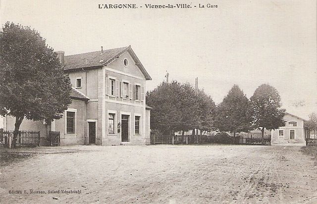

Vienne-la-Ville
- commune in Marne, France
- Country:
- Postal Code: 51800
- Coordinates: 49° 10' 3" N, 4° 51' 37" E
- GPS tracks (wikiloc): [Link]
- Area: 7.48 sq km
- Population: 172


Berzieux
- commune in Marne, France
- Country:
- Postal Code: 51800
- Coordinates: 49° 9' 53" N, 4° 47' 50" E
- GPS tracks (wikiloc): [Link]
- Area: 11.67 sq km
- Population: 72