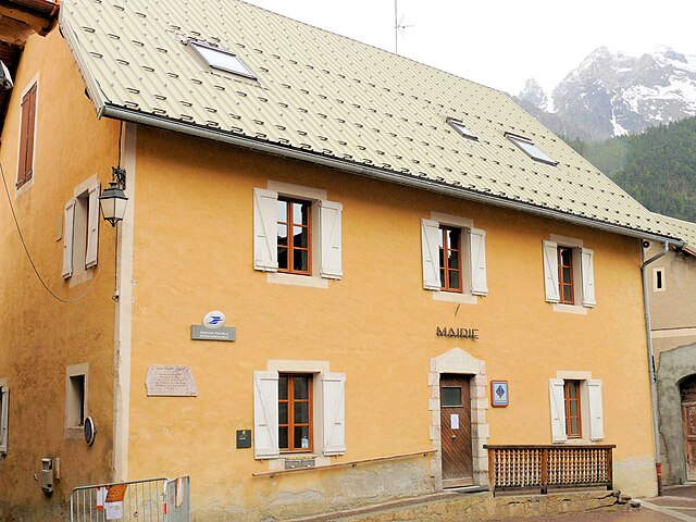
Château-Ville-Vieille (Château-Ville-Vieille)
- commune in Hautes-Alpes, France
 Hiking in Château-Ville-Vieille
Château-Ville-Vieille, located in the picturesque region of the Queyras in the French Alps, is an excellent destination for hiking enthusiasts. This charming village is situated at a high altitude and offers stunning views of the surrounding mountains, valleys, and the natural beauty of the Alps.
Hiking Trails
There are several hiking trails around Château-Ville-Vieille, suitable for various skill levels:
-
Col de la Croix: This trail takes you to the Col de la Croix, offering breathtaking views of the surrounding peaks. It's a moderate hike that rewards you with panoramic vistas.
-
Rond de l’Aigle: A more challenging hike, the Rond de l’Aigle trail navigates through alpine meadows and rocky terrains. It's ideal for experienced hikers looking to immerse themselves in nature.
-
Forêt de l’Ours: This easier trail leads through beautiful forests where you can enjoy the sights and sounds of nature. It is perfect for families or beginners looking for a leisurely hike.
-
Lac de l'Eychauda: This hike takes you to the stunning Lac de l’Eychauda, a glacial lake that reflects the surrounding peaks. It’s a fantastic spot for a picnic and photography.
Tips for Hiking in Château-Ville-Vieille
- Check the Weather: Conditions in the mountains can change rapidly. Always check the weather forecast before heading out.
- Wear Proper Gear: Good hiking boots, layered clothing, and weather-appropriate gear are essential.
- Stay Hydrated: Carry enough water, especially on longer hikes.
- Follow Trail Markings: Trails are often marked with color-coded signs, which help in navigating the paths safely.
- Wildlife and Flora: Be mindful of local wildlife. Take the time to appreciate the beautiful alpine flowers and fauna.
Best Time to Hike
The hiking season in Château-Ville-Vieille typically runs from late spring through early autumn, with the best months being June to September when the trails are usually clear of snow.
With its stunning landscapes and variety of trails, Château-Ville-Vieille offers an unforgettable hiking experience for all nature lovers. Whether you're seeking solitude in the alpine wilderness or looking to enjoy the company of friends and family amidst breathtaking scenery, this destination has something for everyone.
- Country:

- Postal Code: 05350
- Coordinates: 44° 45' 24" N, 6° 47' 28" E


- GPS tracks (wikiloc): [Link]
- Area: 66.9 sq km
- Population: 338
- Wikipedia en: wiki(en)
- Wikipedia: wiki(fr)
- Wikidata storage: Wikidata: Q1017846
- Wikipedia Commons Category: [Link]
- Freebase ID: [/m/03mfldy]
- Freebase ID: [/m/03mfldy]
- GeoNames ID: Alt: [6446634]
- GeoNames ID: Alt: [6446634]
- SIREN number: [210500385]
- SIREN number: [210500385]
- PACTOLS thesaurus ID: [pcrtKqoHAiWq7m]
- PACTOLS thesaurus ID: [pcrtKqoHAiWq7m]
- INSEE municipality code: 05038
- INSEE municipality code: 05038
Shares border with regions:

Arvieux
- commune in Hautes-Alpes, France
Arvieux is a stunning destination situated in the Queyras Regional Natural Park in the French Alps, known for its beautiful landscapes, charming villages, and numerous hiking trails. Here are some highlights and tips for hiking in Arvieux:...
- Country:

- Postal Code: 05350
- Coordinates: 44° 46' 0" N, 6° 44' 20" E


- GPS tracks (wikiloc): [Link]
- Area: 72.62 sq km
- Population: 363

Cervières
- commune in Hautes-Alpes, France
Cervières is a picturesque valley located in the Hautes-Alpes region of France, renowned for its stunning natural beauty, diverse landscapes, and rich cultural heritage. It offers a variety of hiking opportunities suited for all levels, from casual strolls to more challenging treks. Here are some highlights of hiking in this area:...
- Country:

- Postal Code: 05100
- Coordinates: 44° 52' 11" N, 6° 43' 19" E


- GPS tracks (wikiloc): [Link]
- Area: 109.68 sq km
- Population: 183

Molines-en-Queyras
- commune in Hautes-Alpes, France
Molines-en-Queyras is a picturesque village located in the Queyras Regional Natural Park in the French Alps. It's an ideal destination for hiking enthusiasts, offering a variety of trails that cater to different skill levels. Here’s what you can expect when hiking in this beautiful region:...
- Country:

- Postal Code: 05350
- Coordinates: 44° 43' 51" N, 6° 50' 36" E


- GPS tracks (wikiloc): [Link]
- Area: 53.62 sq km
- Population: 305

Guillestre
- commune in Hautes-Alpes, France
Guillestre is a charming village located in the southern Alps of France, within the Hautes-Alpes department. It serves as an excellent base for various hiking adventures, offering a range of trails catering to different skill levels and providing stunning alpine scenery....
- Country:

- Postal Code: 05600
- Coordinates: 44° 39' 37" N, 6° 38' 57" E


- GPS tracks (wikiloc): [Link]
- Area: 51.29 sq km
- Population: 2301
- Web site: [Link]

Aiguilles
- commune in Hautes-Alpes, France
Aiguilles, located in the French Alps, is a breathtaking area known for its dramatic peaks, stunning landscapes, and diverse hiking opportunities. Here’s a guide to hiking in this beautiful region:...
- Country:

- Postal Code: 05470
- Coordinates: 44° 46' 54" N, 6° 52' 8" E


- GPS tracks (wikiloc): [Link]
- Area: 40.16 sq km
- Population: 425

Ceillac
- commune in Hautes-Alpes, France
Ceillac is a charming village located in the Queyras Regional Natural Park in the French Alps, known for its stunning landscapes and excellent hiking opportunities. The area is characterized by its beautiful valleys, high peaks, and a variety of ecosystems, making it a perfect destination for both novice and experienced hikers....
- Country:

- Postal Code: 05600
- Coordinates: 44° 40' 1" N, 6° 46' 36" E


- GPS tracks (wikiloc): [Link]
- Area: 96.05 sq km
- Population: 294
- Web site: [Link]