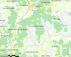
Arvieux (Arvieux)
- commune in Hautes-Alpes, France
 Hiking in Arvieux
Arvieux is a stunning destination situated in the Queyras Regional Natural Park in the French Alps, known for its beautiful landscapes, charming villages, and numerous hiking trails. Here are some highlights and tips for hiking in Arvieux:
Trails and Routes
-
Col de l'Izoard: A classic hike with breathtaking views, this trail takes you to the iconic Col de l'Izoard, famous for its stunning landscapes. There are several routes from Arvieux around the col that vary in difficulty and length.
-
Les Gorges de Briançon: This scenic trail winds through beautiful gorges and offers unique geological features. The trail is quite accessible and suitable for families.
-
Vallon de La Grosse Pierre: This trail leads to a picturesque valley and offers views of breathtaking alpine scenery. It’s a moderate hike that can typically be done in a few hours.
-
Sentier des Chapelles: This cultural hike takes you to several chapels of historical significance within the region, blending nature and history in one enjoyable outing.
Season and Weather
-
Best Time to Hike: The best time for hiking in Arvieux is typically from late spring (June) to early fall (September), when the weather is milder, and the snow has melted, revealing lush greenery and wildflowers.
-
Weather Considerations: Always check the weather forecast before heading out, as alpine weather can change rapidly. Dress in layers and prepare for different conditions.
Safety Tips
-
Proper Gear: Make sure to wear sturdy hiking boots with good grip, and bring along trekking poles if you're hiking on uneven terrain. A backpack with water, snacks, a first-aid kit, and a map or GPS device is essential.
-
Navigation: While many trails are well-marked, having a map and a good sense of direction can be helpful, especially in less trafficked areas.
-
Wildlife Awareness: Keep an eye out for local wildlife and be respectful of their habitat. Maintain a safe distance, and do not feed any animals you encounter.
Local Culture and Attractions
-
Charming Villages: Arvieux itself is a charming village with traditional alpine architecture. Take some time to explore the local culture and cuisine.
-
Queyras Regional Natural Park: This park is not just a hiking destination but also a great place for photography, bird-watching, and enjoying the pristine environment of the Alps.
Conclusion
Hiking in Arvieux offers a fantastic mix of natural beauty and cultural richness, making it a perfect destination for outdoor enthusiasts. Whether you’re looking for a challenging hike or a leisurely stroll, the diverse trails cater to various skill levels and interests. Always remember to practice Leave No Trace principles to preserve the beauty of this alpine paradise for future visitors. Enjoy your hike!
- Country:

- Postal Code: 05350
- Coordinates: 44° 46' 0" N, 6° 44' 20" E


- GPS tracks (wikiloc): [Link]
- Area: 72.62 sq km
- Population: 363
- Wikipedia en: wiki(en)
- Wikipedia: wiki(fr)
- Wikidata storage: Wikidata: Q1017904
- Wikipedia Commons Category: [Link]
- Freebase ID: [/m/03mfm7z]
- Freebase ID: [/m/03mfm7z]
- GeoNames ID: Alt: [3036621]
- GeoNames ID: Alt: [3036621]
- SIREN number: [210500070]
- SIREN number: [210500070]
- BnF ID: [11957974m]
- BnF ID: [11957974m]
- VIAF ID: Alt: [124459767]
- VIAF ID: Alt: [124459767]
- Library of Congress authority ID: Alt: [n89606803]
- Library of Congress authority ID: Alt: [n89606803]
- PACTOLS thesaurus ID: [pcrtDiUQvNk5nJ]
- PACTOLS thesaurus ID: [pcrtDiUQvNk5nJ]
- INSEE municipality code: 05007
- INSEE municipality code: 05007
Shares border with regions:

Château-Ville-Vieille
- commune in Hautes-Alpes, France
Hiking in Château-Ville-Vieille
Château-Ville-Vieille, located in the picturesque region of the Queyras in the French Alps, is an excellent destination for hiking enthusiasts. This charming village is situated at a high altitude and offers stunning views of the surrounding mountains, valleys, and the natural beauty of the Alps....
- Country:
- Postal Code: 05350
- Coordinates: 44° 45' 24" N, 6° 47' 28" E
- GPS tracks (wikiloc): [Link]
- Area: 66.9 sq km
- Population: 338

Cervières
- commune in Hautes-Alpes, France
Hiking in Cervières
Cervières is a picturesque valley located in the Hautes-Alpes region of France, renowned for its stunning natural beauty, diverse landscapes, and rich cultural heritage. It offers a variety of hiking opportunities suited for all levels, from casual strolls to more challenging treks. Here are some highlights of hiking in this area:...
- Country:
- Postal Code: 05100
- Coordinates: 44° 52' 11" N, 6° 43' 19" E
- GPS tracks (wikiloc): [Link]
- Area: 109.68 sq km
- Population: 183

Saint-Crépin
- commune in Hautes-Alpes, France
Hiking in Saint-Crépin
Saint-Crépin is a charming village located in the Hautes-Alpes region of southeastern France. Nestled in the beautiful Southern Alps, it offers a range of hiking opportunities that take advantage of its stunning natural surroundings....
- Country:
- Postal Code: 05600
- Coordinates: 44° 42' 24" N, 6° 36' 26" E
- GPS tracks (wikiloc): [Link]
- Area: 46.3 sq km
- Population: 703
- Web site: [Link]

La Roche-de-Rame
- commune in Hautes-Alpes, France
Hiking in La Roche-de-Rame
La Roche-de-Rame is a picturesque commune located in the Hautes-Alpes department in southeastern France. It is nestled in the stunning French Alps, providing a perfect backdrop for hiking enthusiasts. Here are some key points to consider if you're planning a hiking trip to La Roche-de-Rame:...
- Country:
- Postal Code: 05310
- Coordinates: 44° 45' 0" N, 6° 34' 50" E
- GPS tracks (wikiloc): [Link]
- Area: 40.53 sq km
- Population: 837

Guillestre
- commune in Hautes-Alpes, France
Hiking in Guillestre
Guillestre is a charming village located in the southern Alps of France, within the Hautes-Alpes department. It serves as an excellent base for various hiking adventures, offering a range of trails catering to different skill levels and providing stunning alpine scenery....
- Country:
- Postal Code: 05600
- Coordinates: 44° 39' 37" N, 6° 38' 57" E
- GPS tracks (wikiloc): [Link]
- Area: 51.29 sq km
- Population: 2301
- Web site: [Link]

Villar-Saint-Pancrace
- commune in Hautes-Alpes, France
Hiking in Villar-Saint-Pancrace
Villar-Saint-Pancrace is a charming alpine village located in the Provence-Alpes-Côte d'Azur region of France, near the town of Briançon. The area is known for its stunning landscapes, rich biodiversity, and a variety of hiking trails that cater to different skill levels. Here are some highlights for hiking in this region:...
- Country:
- Postal Code: 05100
- Coordinates: 44° 52' 23" N, 6° 37' 38" E
- GPS tracks (wikiloc): [Link]
- AboveSeaLevel: 1260 м m
- Area: 42.53 sq km
- Population: 1457

Eygliers
- commune in Hautes-Alpes, France
Hiking in Eygliers
Eygliers is a charming village located in the southern French Alps, near the Queyras Regional Natural Park. It’s a fantastic destination for hiking enthusiasts, offering stunning landscapes, diverse trails, and opportunities to explore both nature and local culture....
- Country:
- Postal Code: 05600
- Coordinates: 44° 40' 33" N, 6° 38' 2" E
- GPS tracks (wikiloc): [Link]
- AboveSeaLevel: 1029 м m
- Area: 30.04 sq km
- Population: 761