Châtillon-sur-Cher (Châtillon-sur-Cher)

- commune in Loir-et-Cher, France
- Country:

- Postal Code: 41130
- Coordinates: 47° 16' 37" N, 1° 29' 38" E


- GPS tracks (wikiloc): [Link]
- Area: 29.66 sq km
- Population: 1730
- Web site: http://chatillon-sur-cher.fr/
- Wikipedia en: wiki(en)
- Wikipedia: wiki(fr)
- Wikidata storage: Wikidata: Q1135644
- Wikipedia Commons Category: [Link]
- Freebase ID: [/m/03nv_cp]
- GeoNames ID: Alt: [3026056]
- SIREN number: [214100430]
- BnF ID: [15259319n]
- INSEE municipality code: 41043
Shares border with regions:


Noyers-sur-Cher
- commune in Loir-et-Cher, France
- Country:
- Postal Code: 41140
- Coordinates: 47° 16' 36" N, 1° 23' 59" E
- GPS tracks (wikiloc): [Link]
- Area: 22.74 sq km
- Population: 2772
Méhers
- commune in Loir-et-Cher, France
- Country:
- Postal Code: 41140
- Coordinates: 47° 19' 40" N, 1° 27' 25" E
- GPS tracks (wikiloc): [Link]
- Area: 18.27 sq km
- Population: 363
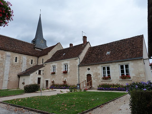
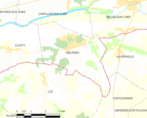
Meusnes
- commune in Loir-et-Cher, France
- Country:
- Postal Code: 41130
- Coordinates: 47° 15' 1" N, 1° 29' 48" E
- GPS tracks (wikiloc): [Link]
- Area: 13.35 sq km
- Population: 1092
- Web site: [Link]


Billy
- commune in Loir-et-Cher, France
- Country:
- Postal Code: 41130
- Coordinates: 47° 18' 44" N, 1° 32' 19" E
- GPS tracks (wikiloc): [Link]
- Area: 26.47 sq km
- Population: 1013


Chémery
- commune in Loir-et-Cher, France
- Country:
- Postal Code: 41700
- Coordinates: 47° 20' 42" N, 1° 28' 41" E
- GPS tracks (wikiloc): [Link]
- Area: 34.16 sq km
- Population: 985
Couffy
- commune in Loir-et-Cher, France
- Country:
- Postal Code: 41110
- Coordinates: 47° 14' 51" N, 1° 26' 22" E
- GPS tracks (wikiloc): [Link]
- Area: 14.92 sq km
- Population: 514


Selles-sur-Cher
- commune in Loir-et-Cher, France
- Country:
- Postal Code: 41130
- Coordinates: 47° 16' 32" N, 1° 33' 17" E
- GPS tracks (wikiloc): [Link]
- Area: 25.74 sq km
- Population: 4625
- Web site: [Link]