Selles-sur-Cher (Selles-sur-Cher)

- commune in Loir-et-Cher, France
- Country:

- Postal Code: 41130
- Coordinates: 47° 16' 32" N, 1° 33' 17" E


- GPS tracks (wikiloc): [Link]
- Area: 25.74 sq km
- Population: 4625
- Web site: http://www.mairie-sellessurcher.fr
- Wikipedia en: wiki(en)
- Wikipedia: wiki(fr)
- Wikidata storage: Wikidata: Q832386
- Wikipedia Commons Category: [Link]
- Freebase ID: [/m/03cwq9y]
- GeoNames ID: Alt: [2975215]
- SIREN number: [214102428]
- BnF ID: [152595165]
- VIAF ID: Alt: [150248277]
- GND ID: Alt: [4301056-8]
- Library of Congress authority ID: Alt: [n93119225]
- YouTube channel ID: [UC6ok4XXdcRaY8mTRwOieYUQ]
- INSEE municipality code: 41242
Shares border with regions:


Chabris
- commune in Indre, France
- Country:
- Postal Code: 36210
- Coordinates: 47° 15' 18" N, 1° 39' 12" E
- GPS tracks (wikiloc): [Link]
- Area: 41.22 sq km
- Population: 2737

La Vernelle
- commune in Indre, France
- Country:
- Postal Code: 36600
- Coordinates: 47° 14' 53" N, 1° 32' 35" E
- GPS tracks (wikiloc): [Link]
- Area: 17.08 sq km
- Population: 760


Châtillon-sur-Cher
- commune in Loir-et-Cher, France
- Country:
- Postal Code: 41130
- Coordinates: 47° 16' 37" N, 1° 29' 38" E
- GPS tracks (wikiloc): [Link]
- Area: 29.66 sq km
- Population: 1730
- Web site: [Link]
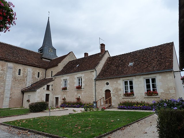
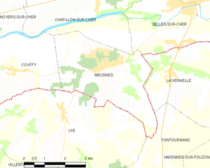
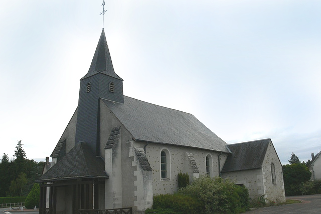
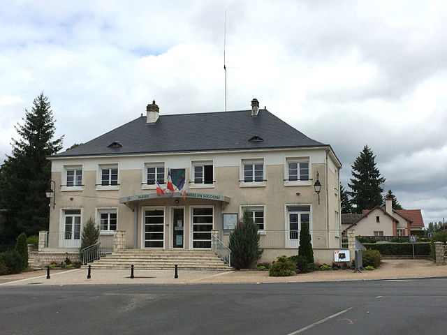
Meusnes
- commune in Loir-et-Cher, France
- Country:
- Postal Code: 41130
- Coordinates: 47° 15' 1" N, 1° 29' 48" E
- GPS tracks (wikiloc): [Link]
- Area: 13.35 sq km
- Population: 1092
- Web site: [Link]


Billy
- commune in Loir-et-Cher, France
- Country:
- Postal Code: 41130
- Coordinates: 47° 18' 44" N, 1° 32' 19" E
- GPS tracks (wikiloc): [Link]
- Area: 26.47 sq km
- Population: 1013


Gièvres
- commune in Loir-et-Cher, France
- Country:
- Postal Code: 41130
- Coordinates: 47° 16' 35" N, 1° 40' 8" E
- GPS tracks (wikiloc): [Link]
- Area: 38.05 sq km
- Population: 2556
- Web site: [Link]

Pruniers-en-Sologne
- commune in Loir-et-Cher, France
- Country:
- Postal Code: 41200
- Coordinates: 47° 19' 22" N, 1° 40' 16" E
- GPS tracks (wikiloc): [Link]
- Area: 43.84 sq km
- Population: 2424