Chambornay-lès-Bellevaux (Chambornay-lès-Bellevaux)

- commune in Haute-Saône, France
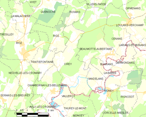
 Hiking in Chambornay-lès-Bellevaux
Chambornay-lès-Bellevaux is a charming village located in the Haute-Saône department of France, known for its beautiful natural landscapes and outdoor activities, including hiking. Here are some key points to consider if you're planning a hiking trip in the area:
Scenic Beauty
- Vibrant Nature: The region features a mix of lush forests, rolling hills, and picturesque countryside. The landscape is ideal for enjoying nature and taking in stunning views.
- Local Flora and Fauna: Keep an eye out for diverse wildlife and unique plant species native to the area.
Hiking Trails
- Variety of Trails: There are various hiking trails ranging from easy walks suitable for families to more challenging routes for experienced hikers. Trails may include loops around the village or longer hikes that explore the surrounding natural parks.
- Marked Routes: Many trails are well-marked, making it easier to navigate. Be sure to have a good map or a hiking app on your smartphone for additional guidance.
Points of Interest
- Cultural Heritage: Along the hiking routes, you might find historical sites, charming chapels, and traditional French architecture that provide insight into the local culture.
- Close Proximity to Natural Parks: The area is also a gateway to regional parks and nature reserves where you can enjoy extended hiking opportunities.
Seasonal Considerations
- Best Time to Hike: Spring and fall are typically the best times for hiking in Chambornay-lès-Bellevaux due to mild weather and beautiful foliage. Summer can be hot, while winter may require consideration of snow and trail conditions.
Safety Tips
- Stay Hydrated: Always carry enough water, especially on longer hikes.
- Weather Check: Before heading out, check the weather forecast to dress appropriately and ensure a safe hiking experience.
- Hiking Gear: Wear sturdy hiking boots and pack a first aid kit, snacks, and a map or GPS.
Local Amenities
- Accommodations: If you plan to stay overnight, search for nearby guesthouses, hotels, or camping sites that cater to hikers.
- Local Cuisine: Don’t miss the opportunity to enjoy local cuisine at nearby restaurants or cafés after your hike.
Hiking in Chambornay-lès-Bellevaux offers a delightful way to experience the natural beauty and cultural richness of the region. Whether you’re a novice or an experienced hiker, you can find a trail that suits your abilities and interests.
- Country:

- Postal Code: 70190
- Coordinates: 47° 23' 27" N, 6° 6' 23" E


- GPS tracks (wikiloc): [Link]
- Area: 5.89 sq km
- Population: 181
- Wikipedia en: wiki(en)
- Wikipedia: wiki(fr)
- Wikidata storage: Wikidata: Q845018
- Wikipedia Commons Category: [Link]
- Freebase ID: [/m/03ntkyp]
- GeoNames ID: Alt: [6614810]
- SIREN number: [217001189]
- BnF ID: [15272512h]
- INSEE municipality code: 70118
Shares border with regions:


Thurey-le-Mont
- commune in Doubs, France
Hiking in Thurey-le-Mont
Thurey-le-Mont, a small commune in the Bourgogne-Franche-Comté region of France, offers a beautiful backdrop for hikers looking to explore the rural landscapes of this area. While the commune itself may not be widely known as a major hiking destination, its surrounding regions provide a variety of trails that showcase the natural beauty of the Burgundy countryside....
- Country:
- Postal Code: 25870
- Coordinates: 47° 22' 23" N, 6° 7' 24" E
- GPS tracks (wikiloc): [Link]
- Area: 4.83 sq km
- Population: 128


Aulx-lès-Cromary
- commune in Haute-Saône, France
Hiking in Aulx-lès-Cromary
Aulx-lès-Cromary is a quaint commune located in the Haute-Saône department of the Bourgogne-Franche-Comté region in eastern France. While it may not be a mainstream hiking destination, it offers various opportunities for those looking to enjoy the natural beauty and tranquility of the French countryside....
- Country:
- Postal Code: 70190
- Coordinates: 47° 22' 26" N, 6° 6' 37" E
- GPS tracks (wikiloc): [Link]
- Area: 4.33 sq km
- Population: 160


Neuvelle-lès-Cromary
- commune in Haute-Saône, France
- Country:
- Postal Code: 70190
- Coordinates: 47° 23' 42" N, 6° 4' 30" E
- GPS tracks (wikiloc): [Link]
- Area: 6.29 sq km
- Population: 375

Cirey
- commune in Haute-Saône, France
Hiking in Cirey
Cirey is a small commune located in the Haute-Marne department in northeastern France. While it may not be as widely recognized as larger hiking destinations, it offers beautiful landscapes and opportunities for outdoor activities, especially for those who enjoy peaceful rural settings....
- Country:
- Postal Code: 70190
- Coordinates: 47° 23' 47" N, 6° 7' 57" E
- GPS tracks (wikiloc): [Link]
- Area: 13.09 sq km
- Population: 358
- Web site: [Link]


Traitiéfontaine
- commune in Haute-Saône, France
- Country:
- Postal Code: 70190
- Coordinates: 47° 24' 54" N, 6° 5' 25" E
- GPS tracks (wikiloc): [Link]
- Area: 5.92 sq km
- Population: 161


Valleroy
- commune in Doubs, France
Hiking in Valleroy
Valleroy, located in the Doubs department of France in the region of Bourgogne-Franche-Comté, is a charming area for hiking enthusiasts. Nestled within the picturesque Jura mountains, Valleroy offers a variety of trails suitable for different skill levels, from casual walkers to experienced hikers....
- Country:
- Postal Code: 25870
- Coordinates: 47° 23' 12" N, 6° 7' 5" E
- GPS tracks (wikiloc): [Link]
- Area: 3.05 sq km
- Population: 163