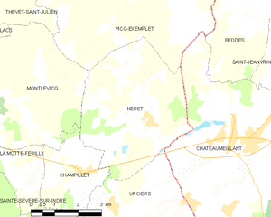
Champillet (Champillet)
- commune in Indre, France
- Country:

- Postal Code: 36160
- Coordinates: 46° 32' 52" N, 2° 6' 50" E


- GPS tracks (wikiloc): [Link]
- Area: 6.94 sq km
- Population: 160
- Wikipedia en: wiki(en)
- Wikipedia: wiki(fr)
- Wikidata storage: Wikidata: Q1069943
- Wikipedia Commons Category: [Link]
- Freebase ID: [/m/03nvb2y]
- GeoNames ID: Alt: [6448588]
- SIREN number: [213600380]
- BnF ID: [15257342p]
- Digital Atlas of the Roman Empire ID: [20621]
- INSEE municipality code: 36038
Shares border with regions:


La Motte-Feuilly
- commune in Indre, France
- Country:

- Postal Code: 36160
- Coordinates: 46° 32' 31" N, 2° 5' 23" E


- GPS tracks (wikiloc): [Link]
- Area: 5.68 sq km
- Population: 43


Urciers
- commune in Indre, France
- Country:

- Postal Code: 36160
- Coordinates: 46° 32' 7" N, 2° 7' 51" E


- GPS tracks (wikiloc): [Link]
- Area: 19.02 sq km
- Population: 242


Néret
- commune in Indre, France
- Country:

- Postal Code: 36400
- Coordinates: 46° 34' 8" N, 2° 8' 55" E


- GPS tracks (wikiloc): [Link]
- Area: 19.05 sq km
- Population: 202


Montlevicq
- commune in Indre, France
- Country:

- Postal Code: 36400
- Coordinates: 46° 34' 38" N, 2° 4' 12" E


- GPS tracks (wikiloc): [Link]
- Area: 18.79 sq km
- Population: 115


Feusines
- commune in Indre, France
- Country:

- Postal Code: 36160
- Coordinates: 46° 31' 21" N, 2° 6' 7" E


- GPS tracks (wikiloc): [Link]
- Area: 12.49 sq km
- Population: 205
