Montlevicq (Montlevicq)

- commune in Indre, France
- Country:

- Postal Code: 36400
- Coordinates: 46° 34' 38" N, 2° 4' 12" E


- GPS tracks (wikiloc): [Link]
- Area: 18.79 sq km
- Population: 115
- Wikipedia en: wiki(en)
- Wikipedia: wiki(fr)
- Wikidata storage: Wikidata: Q1137462
- Wikipedia Commons Category: [Link]
- Freebase ID: [/m/0c08hk]
- GeoNames ID: Alt: [6616628]
- SIREN number: [213601305]
- BnF ID: [15257434b]
- INSEE municipality code: 36130
Shares border with regions:

Champillet
- commune in Indre, France
- Country:
- Postal Code: 36160
- Coordinates: 46° 32' 52" N, 2° 6' 50" E
- GPS tracks (wikiloc): [Link]
- Area: 6.94 sq km
- Population: 160


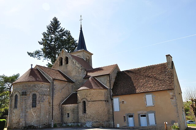
Vicq-Exemplet
- commune in Indre, France
- Country:
- Postal Code: 36400
- Coordinates: 46° 37' 44" N, 2° 8' 28" E
- GPS tracks (wikiloc): [Link]
- Area: 38.74 sq km
- Population: 318


La Motte-Feuilly
- commune in Indre, France
- Country:
- Postal Code: 36160
- Coordinates: 46° 32' 31" N, 2° 5' 23" E
- GPS tracks (wikiloc): [Link]
- Area: 5.68 sq km
- Population: 43

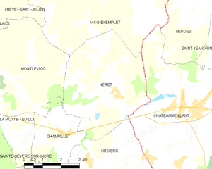
Néret
- commune in Indre, France
- Country:
- Postal Code: 36400
- Coordinates: 46° 34' 8" N, 2° 8' 55" E
- GPS tracks (wikiloc): [Link]
- Area: 19.05 sq km
- Population: 202


Lacs
- commune in Indre, France
- Country:
- Postal Code: 36400
- Coordinates: 46° 35' 7" N, 2° 1' 26" E
- GPS tracks (wikiloc): [Link]
- Area: 13.46 sq km
- Population: 661

Thevet-Saint-Julien
- commune in Indre, France
- Country:
- Postal Code: 36400
- Coordinates: 46° 38' 14" N, 2° 4' 8" E
- GPS tracks (wikiloc): [Link]
- Area: 30.94 sq km
- Population: 402


Briantes
- commune in Indre, France
- Country:
- Postal Code: 36400
- Coordinates: 46° 33' 28" N, 2° 1' 21" E
- GPS tracks (wikiloc): [Link]
- Area: 23.12 sq km
- Population: 608