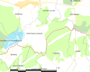
Chassey-lès-Montbozon (Chassey-lès-Montbozon)

- commune in Haute-Saône, France
- Country:

- Postal Code: 70230
- Coordinates: 47° 30' 38" N, 6° 20' 1" E


- GPS tracks (wikiloc): [Link]
- Area: 15.6 sq km
- Population: 216
- Wikipedia en: wiki(en)
- Wikipedia: wiki(fr)
- Wikidata storage: Wikidata: Q290556
- Wikipedia Commons Category: [Link]
- Freebase ID: [/m/03ntl6m]
- GeoNames ID: Alt: [3026380]
- SIREN number: [217001379]
- BnF ID: [13328078c]
- VIAF ID: Alt: [144569485]
- Library of Congress authority ID: Alt: [no98131384]
- Digital Atlas of the Roman Empire ID: [17640]
- Trismegistos Geo ID: [25376]
- INSEE municipality code: 70137
Shares border with regions:

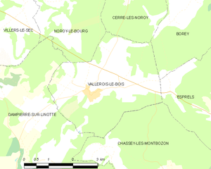
Vallerois-le-Bois
- commune in Haute-Saône, France
- Country:
- Postal Code: 70000
- Coordinates: 47° 32' 55" N, 6° 17' 21" E
- GPS tracks (wikiloc): [Link]
- Area: 12.59 sq km
- Population: 257

Thieffrans
- commune in Haute-Saône, France
- Country:
- Postal Code: 70230
- Coordinates: 47° 30' 3" N, 6° 18' 59" E
- GPS tracks (wikiloc): [Link]
- Area: 9.36 sq km
- Population: 175


Esprels
- commune in Haute-Saône, France
- Country:
- Postal Code: 70110
- Coordinates: 47° 32' 11" N, 6° 22' 21" E
- GPS tracks (wikiloc): [Link]
- Area: 14.81 sq km
- Population: 720


Bonnal
- commune in Doubs, France
- Country:
- Postal Code: 25680
- Coordinates: 47° 30' 25" N, 6° 21' 20" E
- GPS tracks (wikiloc): [Link]
- Area: 1.8 sq km
- Population: 32

Dampierre-sur-Linotte
- commune in Haute-Saône, France
- Country:
- Postal Code: 70230
- Coordinates: 47° 30' 42" N, 6° 13' 56" E
- GPS tracks (wikiloc): [Link]
- Area: 32.48 sq km
- Population: 804

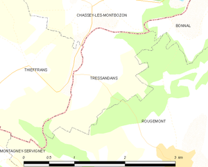
Tressandans
- commune in Doubs, France
- Country:
- Postal Code: 25680
- Coordinates: 47° 29' 53" N, 6° 20' 4" E
- GPS tracks (wikiloc): [Link]
- Area: 2.34 sq km
- Population: 25

Pont-sur-l'Ognon
- commune in Haute-Saône, France
- Country:
- Postal Code: 70110
- Coordinates: 47° 31' 16" N, 6° 23' 16" E
- GPS tracks (wikiloc): [Link]
- Area: 4.16 sq km
- Population: 67