Cheminon (Cheminon)

- commune in Marne, France
- Country:

- Postal Code: 51250
- Coordinates: 48° 44' 13" N, 4° 54' 11" E


- GPS tracks (wikiloc): [Link]
- Area: 27.6 sq km
- Population: 617
- Web site: http://cheminon.free-h.net
- Wikipedia en: wiki(en)
- Wikipedia: wiki(fr)
- Wikidata storage: Wikidata: Q1216692
- Wikipedia Commons Category: [Link]
- Freebase ID: [/m/03qd53t]
- GeoNames ID: Alt: [6435735]
- SIREN number: [215101346]
- BnF ID: [152627554]
- INSEE municipality code: 51144
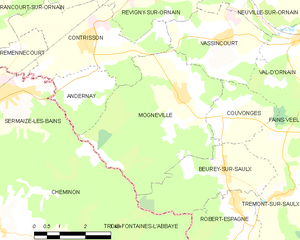
Shares border with regions:


Trois-Fontaines-l'Abbaye
- commune in Marne, France
- Country:
- Postal Code: 51340
- Coordinates: 48° 43' 4" N, 4° 56' 58" E
- GPS tracks (wikiloc): [Link]
- AboveSeaLevel: 169 м m
- Area: 43.71 sq km
- Population: 207


Sermaize-les-Bains
- commune in Marne, France
- Country:
- Postal Code: 51250
- Coordinates: 48° 47' 1" N, 4° 54' 41" E
- GPS tracks (wikiloc): [Link]
- Area: 17.69 sq km
- Population: 1968
- Web site: [Link]


Beurey-sur-Saulx
- commune in Meuse, France
- Country:
- Postal Code: 55000
- Coordinates: 48° 45' 28" N, 5° 1' 37" E
- GPS tracks (wikiloc): [Link]
- Area: 11.62 sq km
- Population: 408

Mognéville
- commune in Meuse, France
- Country:
- Postal Code: 55800
- Coordinates: 48° 46' 59" N, 5° 0' 17" E
- GPS tracks (wikiloc): [Link]
- Area: 18.57 sq km
- Population: 376
- Web site: [Link]


Pargny-sur-Saulx
- commune in Marne, France
- Country:
- Postal Code: 51340
- Coordinates: 48° 46' 9" N, 4° 50' 16" E
- GPS tracks (wikiloc): [Link]
- Area: 12.44 sq km
- Population: 1912
- Web site: [Link]


Maurupt-le-Montois
- commune in Marne, France
- Country:
- Postal Code: 51340
- Coordinates: 48° 44' 57" N, 4° 50' 56" E
- GPS tracks (wikiloc): [Link]
- Area: 18.12 sq km
- Population: 578