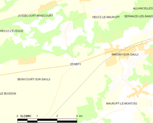
Pargny-sur-Saulx (Pargny-sur-Saulx)

- commune in Marne, France
- Country:

- Postal Code: 51340
- Coordinates: 48° 46' 9" N, 4° 50' 16" E


- GPS tracks (wikiloc): [Link]
- Area: 12.44 sq km
- Population: 1912
- Web site: http://www.pargnysursaulx.fr
- Wikipedia en: wiki(en)
- Wikipedia: wiki(fr)
- Wikidata storage: Wikidata: Q326118
- Wikipedia Commons Category: [Link]
- Freebase ID: [/m/02z1wgs]
- GeoNames ID: Alt: [2988523]
- SIREN number: [215103912]
- BnF ID: [15263023t]
- VIAF ID: Alt: [143469023]
- GND ID: Alt: [7658467-7]
- Library of Congress authority ID: Alt: [no2009043350]
- SUDOC authorities ID: [158755588]
- INSEE municipality code: 51423
Shares border with regions:

Étrepy
- commune in Marne, France
- Country:
- Postal Code: 51340
- Coordinates: 48° 45' 54" N, 4° 48' 22" E
- GPS tracks (wikiloc): [Link]
- Area: 7.63 sq km
- Population: 140


Cheminon
- commune in Marne, France
- Country:
- Postal Code: 51250
- Coordinates: 48° 44' 13" N, 4° 54' 11" E
- GPS tracks (wikiloc): [Link]
- Area: 27.6 sq km
- Population: 617
- Web site: [Link]


Heiltz-le-Maurupt
- commune in Marne, France
- Country:
- Postal Code: 51340
- Coordinates: 48° 47' 35" N, 4° 48' 54" E
- GPS tracks (wikiloc): [Link]
- Area: 16.27 sq km
- Population: 420


Sermaize-les-Bains
- commune in Marne, France
- Country:
- Postal Code: 51250
- Coordinates: 48° 47' 1" N, 4° 54' 41" E
- GPS tracks (wikiloc): [Link]
- Area: 17.69 sq km
- Population: 1968
- Web site: [Link]


Maurupt-le-Montois
- commune in Marne, France
- Country:
- Postal Code: 51340
- Coordinates: 48° 44' 57" N, 4° 50' 56" E
- GPS tracks (wikiloc): [Link]
- Area: 18.12 sq km
- Population: 578