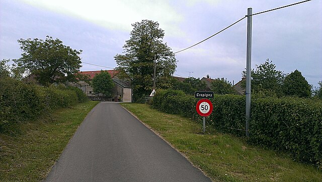
Chitry-les-Mines (Chitry-les-Mines)

- commune in Nièvre, France
- Country:

- Postal Code: 58800
- Coordinates: 47° 15' 38" N, 3° 39' 7" E


- GPS tracks (wikiloc): [Link]
- Area: 6.19 sq km
- Population: 207
- Wikipedia en: wiki(en)
- Wikipedia: wiki(fr)
- Wikidata storage: Wikidata: Q890705
- Wikipedia Commons Category: [Link]
- Freebase ID: [/m/03qfcbv]
- GeoNames ID: Alt: [6450001]
- SIREN number: [215800756]
- BnF ID: [15266340z]
- INSEE municipality code: 58075
Shares border with regions:
Chaumot
- commune in Nièvre, France
- Country:
- Postal Code: 58800
- Coordinates: 47° 15' 23" N, 3° 38' 49" E
- GPS tracks (wikiloc): [Link]
- Area: 7.69 sq km
- Population: 163

Ruages
- commune in Nièvre, France
- Country:
- Postal Code: 58190
- Coordinates: 47° 19' 0" N, 3° 40' 59" E
- GPS tracks (wikiloc): [Link]
- Area: 10.3 sq km
- Population: 100

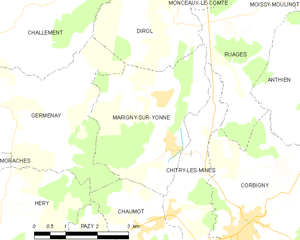
Marigny-sur-Yonne
- commune in Nièvre, France
- Country:
- Postal Code: 58800
- Coordinates: 47° 16' 51" N, 3° 39' 4" E
- GPS tracks (wikiloc): [Link]
- Area: 11.1 sq km
- Population: 200


Corbigny
- commune in Nièvre, France
- Country:
- Postal Code: 58800
- Coordinates: 47° 15' 24" N, 3° 41' 1" E
- GPS tracks (wikiloc): [Link]
- Area: 20.06 sq km
- Population: 1525