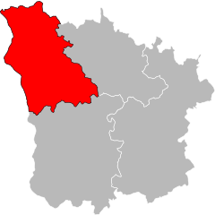
arrondissement of Clamecy (arrondissement de Clamecy)

- arrondissement of France
- Country:

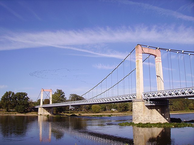
- Capital: Clamecy
- Coordinates: 47° 20' 0" N, 3° 40' 0" E


- GPS tracks (wikiloc): [Link]
- Population: 21597
- Wikipedia en: wiki(en)
- Wikipedia: wiki(fr)
- Wikidata storage: Wikidata: Q701005
- Freebase ID: [/m/0955qs]
- GeoNames ID: Alt: [3024780]
- VIAF ID: Alt: [241850461]
- INSEE arrondissement code: [582]
- GNS Unique Feature ID: -1420566
Includes regions:


canton of Corbigny
- canton of France
- Country:
- Capital: Corbigny
- Coordinates: 47° 14' 14" N, 3° 43' 26" E
- GPS tracks (wikiloc): [Link]
- Population: 10398


canton of Brinon-sur-Beuvron
- canton of France (until March 2015)
- Country:
- Capital: Brinon-sur-Beuvron
- Coordinates: 47° 16' 26" N, 3° 31' 0" E
- GPS tracks (wikiloc): [Link]

canton of Varzy
- canton of France (until March 2015)
- Country:
- Capital: Varzy
- Coordinates: 47° 22' 47" N, 3° 23' 1" E
- GPS tracks (wikiloc): [Link]
- Area: 261.6 sq km


canton of Clamecy
- canton of France
- Country:
- Capital: Clamecy
- Coordinates: 47° 27' 4" N, 3° 30' 37" E
- GPS tracks (wikiloc): [Link]
- Area: 665.05 sq km
- Population: 14369
Shares border with regions:


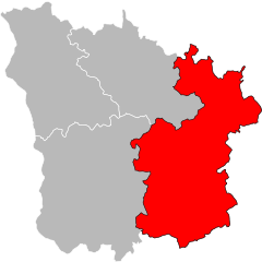
arrondissement of Nevers
- arrondissement of France
- Country:
- Capital: Nevers
- Coordinates: 46° 55' 0" N, 3° 20' 0" E
- GPS tracks (wikiloc): [Link]
- Area: 2020 sq km
- Population: 117173

arrondissement of Auxerre
- arrondissement of France
- Country:
- Capital: Auxerre
- Coordinates: 47° 45' 0" N, 3° 30' 0" E
- GPS tracks (wikiloc): [Link]
- Area: 3514.55 sq km
- Population: 166396

arrondissement of Avallon
- arrondissement of France
- Country:
- Capital: Avallon
- Coordinates: 47° 40' 0" N, 4° 0' 0" E
- GPS tracks (wikiloc): [Link]
- Area: 2209 sq km
- Population: 43650
arrondissement of Cosne-Cours-sur-Loire
- arrondissement of France
- Country:
- Capital: Cosne-Cours-sur-Loire
- Coordinates: 47° 20' 0" N, 3° 10' 0" E
- GPS tracks (wikiloc): [Link]
- Area: 1403.33 sq km
- Population: 44367

arrondissement of Château-Chinon
- arrondissement of France
- Country:
- Capital: Château-Chinon (Ville)
- Coordinates: 47° 0' 0" N, 3° 50' 0" E
- GPS tracks (wikiloc): [Link]
- Area: 1929 sq km
- Population: 28610