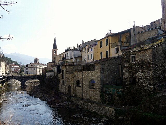
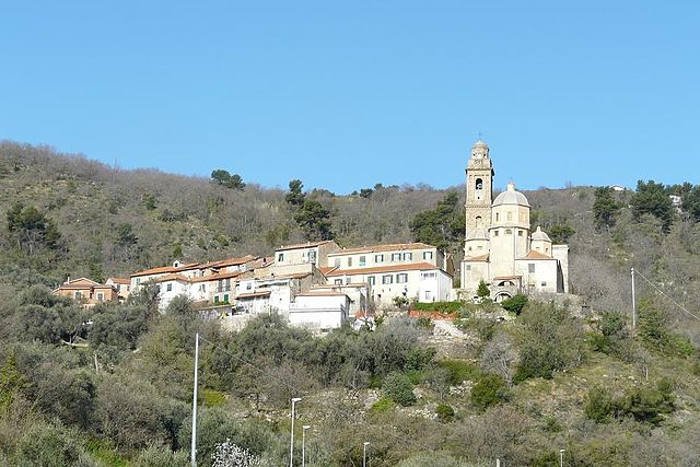
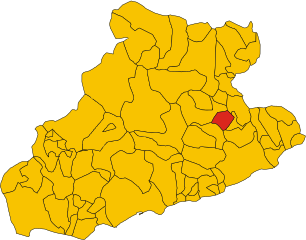
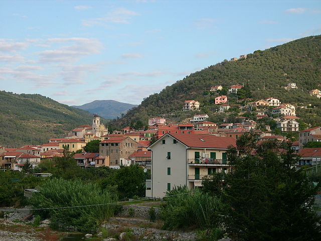
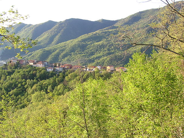
Chiusanico (Chiusanico)
.svg)
- Italian comune
 Hiking in Chiusanico
Chiusanico is a picturesque village located in the Liguria region of Italy, near the stunning coastline of the Italian Riviera. The area offers various hiking opportunities that cater to different skill levels, with trails that showcase the natural beauty of the region, including hills, vineyards, olive groves, and breathtaking views of the Ligurian Sea.
Here are some highlights for hiking in and around Chiusanico:
-
Trail Options: You can find various hiking trails ranging from easy walks suitable for families to more challenging routes for experienced hikers. Many trails lead through the beautiful countryside and connect to nearby hamlets and scenic viewpoints.
-
Views and Nature: Hiking in this region often includes sweeping views of the coastline and the surrounding hills. The trails may take you through areas rich in flora and fauna, providing opportunities for wildlife spotting.
-
Cultural Stops: Along the trails, you might discover small cultural and historical sites, such as ancient churches and old stone houses, adding a cultural dimension to your hike.
-
Nearby Trails: Chiusanico serves as a great starting point for longer hikes in the nearby Parco Nazionale de Cinque Terre or the Alta Via dei Monti Liguri, both offering more extensive trail networks.
-
Best Time to Hike: The best times for hiking in Chiusanico are typically in the spring (April to June) and fall (September to October), as the weather is mild, and the scenery is especially beautiful during these months.
-
Safety Considerations: Always make sure to carry enough water, wear appropriate footwear, and check the weather forecast before heading out. It's also recommended to have a map or a GPS device, as some trails may not be well-marked.
-
Local Tours: Consider joining a local hiking tour or hiring a guide if you're unfamiliar with the area. This can enhance your experience, as guides can share valuable insights about the local landscape and culture.
Before embarking on your hiking adventure, it's always a good idea to research specific trails for current conditions and any updates on accessibility. Enjoy exploring the beautiful region around Chiusanico!
- Country:

- Postal Code: 18027
- Local Dialing Code: 0183
- Licence Plate Code: IM
- Coordinates: 43° 58' 16" N, 7° 59' 36" E


- GPS tracks (wikiloc): [Link]
- AboveSeaLevel: 380 м m
- Area: 13.51 sq km
- Population: 578
- Web site: http://www.comune.chiusanico.im.it
- Wikipedia en: wiki(en)
- Wikipedia: wiki(it)
- Wikidata storage: Wikidata: Q268525
- Wikipedia Commons Category: [Link]
- Freebase ID: [/m/0gbyg0]
- GeoNames ID: Alt: [6536070]
- OSM relation ID: [42774]
- UN/LOCODE: [ITCHS]
- ISTAT ID: 008019
- Italian cadastre code: C657
Shares border with regions:

Borgomaro
- Italian comune
Hiking in Borgomaro
Borgomaro is a picturesque village located in the Liguria region of Italy, nestled in the foothills of the Maritime Alps. The area offers beautiful hiking opportunities, featuring lush landscapes, charming villages, and stunning views of the surrounding mountains and valleys....
- Country:
- Postal Code: 18021
- Local Dialing Code: 0183
- Licence Plate Code: IM
- Coordinates: 43° 58' 32" N, 7° 56' 41" E
- GPS tracks (wikiloc): [Link]
- AboveSeaLevel: 200 м m
- Area: 23.44 sq km
- Population: 881
- Web site: [Link]


Caravonica
- Italian comune
Hiking in Caravonica
Caravonica, located in Queensland, Australia, is a charming area near Cairns that offers various hiking opportunities, particularly in the surrounding natural landscapes. Here are some key points to consider for hiking in Caravonica:...
- Country:
- Postal Code: 18020
- Local Dialing Code: 0183
- Licence Plate Code: IM
- Coordinates: 43° 59' 32" N, 7° 57' 31" E
- GPS tracks (wikiloc): [Link]
- AboveSeaLevel: 360 м m
- Area: 4.47 sq km
- Population: 266
- Web site: [Link]


Cesio
- Italian comune
Hiking in Cesio
Cesio is a small town located in the Liguria region of Italy, nestled in the Val Nervia valley. It offers several hiking opportunities that showcase the stunning natural beauty of the surrounding area, characterized by lush landscapes, hills, and proximity to the Mediterranean coast....
- Country:
- Postal Code: 18022
- Local Dialing Code: 0183
- Licence Plate Code: IM
- Coordinates: 44° 0' 29" N, 7° 58' 32" E
- GPS tracks (wikiloc): [Link]
- AboveSeaLevel: 512 м m
- Area: 8.86 sq km
- Population: 283
- Web site: [Link]


Chiusavecchia
- Italian comune
Hiking in Chiusavecchia
Chiusavecchia, a picturesque village located in the province of Imperia in the Liguria region of Italy, offers a variety of hiking opportunities that showcase the stunning landscapes of the Italian Riviera. Here are some highlights and tips for hiking in and around Chiusavecchia:...
- Country:
- Postal Code: 18027
- Local Dialing Code: 0183
- Licence Plate Code: IM
- Coordinates: 43° 58' 4" N, 7° 59' 0" E
- GPS tracks (wikiloc): [Link]
- AboveSeaLevel: 140 м m
- Area: 4.09 sq km
- Population: 556
- Web site: [Link]

Diano Arentino
- Italian comune
Hiking in Diano Arentino
Diano Arentino is a lovely village located in the Italian region of Liguria, within the province of Imperia. It's nestled in the hills above the coastal town of Diano Marina, which offers a beautiful Mediterranean climate and stunning views. Hiking in this area can be an incredible experience due to the spectacular landscapes, rich flora and fauna, and the charming rural atmosphere....
- Country:
- Postal Code: 18013
- Local Dialing Code: 0183
- Licence Plate Code: IM
- Coordinates: 43° 56' 55" N, 8° 2' 32" E
- GPS tracks (wikiloc): [Link]
- AboveSeaLevel: 331 м m
- Area: 8.33 sq km
- Population: 719
- Web site: [Link]

Lucinasco
- Italian comune
Hiking in Lucinasco
Lucinasco is a charming village located in the province of Imperia in the Liguria region of Italy. Nestled in the hills above the coastline, it offers stunning views of the surrounding landscape, making it an excellent destination for hiking enthusiasts. Here are some key points about hiking in and around Lucinasco:...
- Country:
- Postal Code: 18020
- Local Dialing Code: 0183
- Licence Plate Code: IM
- Coordinates: 43° 58' 4" N, 7° 57' 46" E
- GPS tracks (wikiloc): [Link]
- AboveSeaLevel: 499 м m
- Area: 7.9 sq km
- Population: 283
- Web site: [Link]

Pontedassio
- Italian comune
Hiking in Pontedassio
Pontedassio, located in the beautiful Liguria region of Italy, offers a variety of hiking opportunities characterized by scenic landscapes, lush greenery, and breathtaking views of the surrounding hills and valleys. Here are some details to help you plan a hiking adventure in this picturesque area:...
- Country:
- Postal Code: 18027
- Local Dialing Code: 0183
- Licence Plate Code: IM
- Coordinates: 43° 56' 25" N, 8° 0' 44" E
- GPS tracks (wikiloc): [Link]
- AboveSeaLevel: 80 м m
- Area: 13.31 sq km
- Population: 2318
- Web site: [Link]


Stellanello
- Italian comune
Hiking in Stellanello
Stellanello is a charming village located in the Liguria region of Italy, known for its picturesque landscapes and outdoor recreational opportunities. Hiking in this area offers stunning views of the Mediterranean coast, lush greenery, and the surrounding hills....
- Country:
- Postal Code: 17020
- Local Dialing Code: 0182
- Licence Plate Code: SV
- Coordinates: 44° 0' 4" N, 8° 3' 18" E
- GPS tracks (wikiloc): [Link]
- AboveSeaLevel: 141 м m
- Area: 17.81 sq km
- Population: 809
- Web site: [Link]

Testico
- Italian comune
Hiking in Testico
Testico is a small village located in the Liguria region of Italy, near the coast and nestled in the hills. While it may not be as well-known as some other hiking destinations in Italy, it offers beautiful landscapes, traditional villages, and a chance to experience the natural beauty of the region....
- Country:
- Postal Code: 17020
- Local Dialing Code: 0182
- Licence Plate Code: SV
- Coordinates: 44° 0' 19" N, 8° 1' 49" E
- GPS tracks (wikiloc): [Link]
- AboveSeaLevel: 470 м m
- Area: 10.29 sq km
- Population: 198
- Web site: [Link]