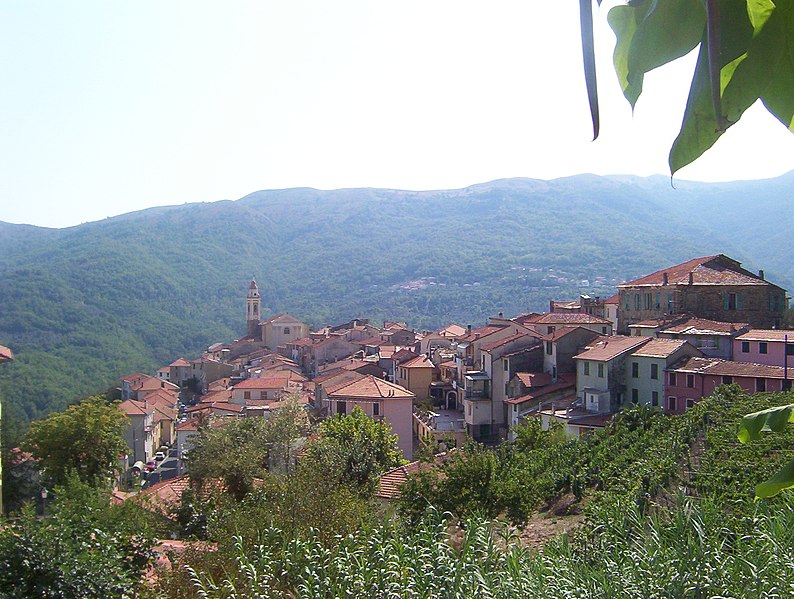
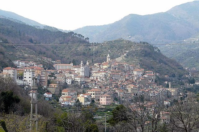
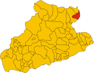
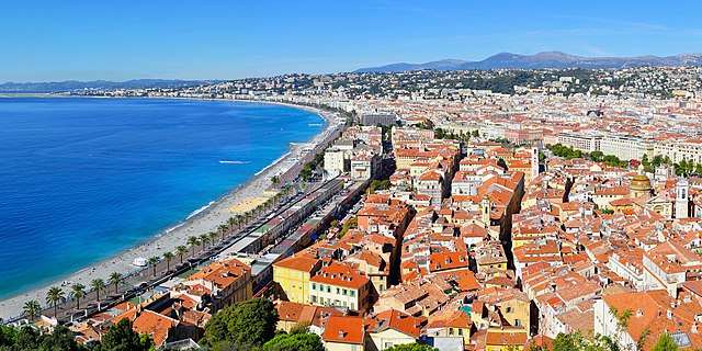
Province of Imperia (provincia di Imperia)

- province of Italy
 Hiking in Province of Imperia
The Province of Imperia, located in the Liguria region of Italy, is renowned for its stunning coastal scenery, charming villages, and mountainous landscapes, making it a fantastic destination for hiking enthusiasts. Here are some highlights and tips about hiking in this beautiful area:
Key Hiking Areas:
-
Parco Naturale Regionale di Portofino: This park offers a range of hiking trails with breathtaking views of the Ligurian Sea. Trails vary in difficulty and lead through Mediterranean forests and along coastal cliffs.
-
Colle di San Bartolomeo: A popular hiking area that provides panoramic views of the surrounding hills and coastline. There are well-marked trails that take you through olive groves and small villages.
-
Monte Bignone: This mountain near Imperia offers more challenging hikes and rewards hikers with breathtaking views from the summit. The trails here can be steep, so proper preparation is essential.
-
The Alta Via dei Monti Liguri: A long-distance trail that stretches through the Ligurian mountains, it offers a mixed experience of coastal views and inland scenery. It’s a challenging hike, but you can choose shorter sections if desired.
-
Sanremo and the Coastal Trails: The famous Italian Riviera town of Sanremo has lovely coastal paths where you can enjoy views of the Mediterranean as you hike along the coast.
Best Times to Hike:
- Spring (April to June) and Autumn (September to November) are the ideal seasons for hiking in the Province of Imperia due to mild temperatures and vibrant flora. Summer can be hot and crowded, while winter hikes can be enjoyed in lower altitudes or on clear days.
Safety Tips:
- Prepare for Varying Weather: Weather can change quickly, especially in the mountains. Always check the forecast before heading out and dress in layers.
- Hydration and Snacks: Bring plenty of water and some high-energy snacks. Some trails may not have sources of water along the way.
- Trail Maps and Navigation: Ensure you have a map or a GPS device, as some trails may not be well-marked. Familiarize yourself with the routes before you go.
Useful Resources:
- Local Hiking Groups: Joining a local hiking group or finding guided tours can enhance your experience and ensure safety, especially for more challenging hikes.
- Visitor Information Centers: These can provide maps, trail conditions, and advice tailored to your interests and skill levels.
Conclusion:
Hiking in the Province of Imperia offers a unique blend of natural beauty, cultural heritage, and outdoor adventure. Whether you prefer leisurely walks by the sea or challenging mountain hikes, there's something for every type of hiker in this picturesque part of Italy. Always respect nature, stay on marked trails, and enjoy your adventure!
- Country:

- Capital: Imperia
- Postal Code: 18100, 18010-18039
- Licence Plate Code: IM
- Coordinates: 43° 53' 11" N, 8° 1' 47" E


- GPS tracks (wikiloc): [Link]
- Area: 1156.13 sq km
- Web site: http://www.provincia.imperia.it
- Wikipedia en: wiki(en)
- Wikipedia: wiki(it)
- Wikidata storage: Wikidata: Q16186
- Wikipedia Commons Gallery: [Link]
- Wikipedia Commons Category: [Link]
- Freebase ID: [/m/052d_y]
- GeoNames ID: Alt: [3175531]
- VIAF ID: Alt: [159507607]
- GND ID: Alt: [4253391-0]
- archINFORM location ID: [2463]
- Library of Congress authority ID: Alt: [n85064162]
- Gran Enciclopèdia Catalana ID: [0033529]
- NUTS code: [ITC31]
- ISTAT ID: 008
- ISO 3166-2 code: IT-IM
Includes regions:


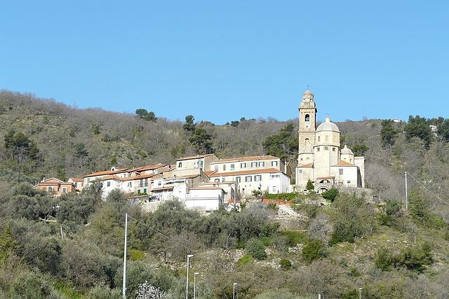
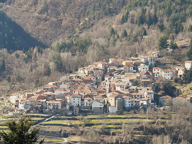
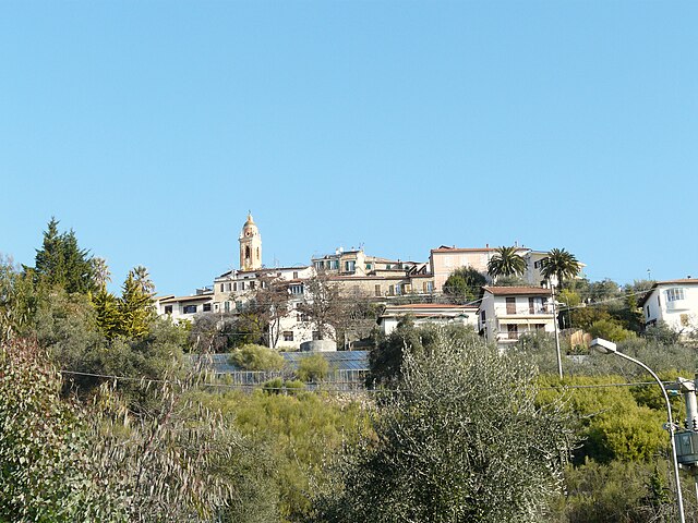
Diano San Pietro
- Italian comune
Hiking in Diano San Pietro
Diano San Pietro is a charming village located in the province of Imperia in the Liguria region of Italy. Nestled in the hills overlooking the Mediterranean Sea, it offers a picturesque setting ideal for hiking enthusiasts. Here are some highlights and tips about hiking in and around Diano San Pietro:...
- Country:
- Postal Code: 18013
- Local Dialing Code: 0183
- Licence Plate Code: IM
- Coordinates: 43° 55' 51" N, 8° 4' 7" E
- GPS tracks (wikiloc): [Link]
- AboveSeaLevel: 83 м m
- Area: 11.91 sq km
- Population: 1150
- Web site: [Link]
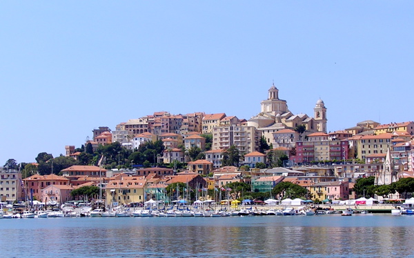

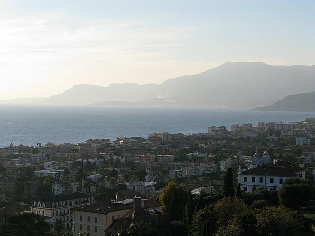
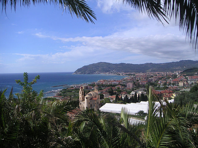
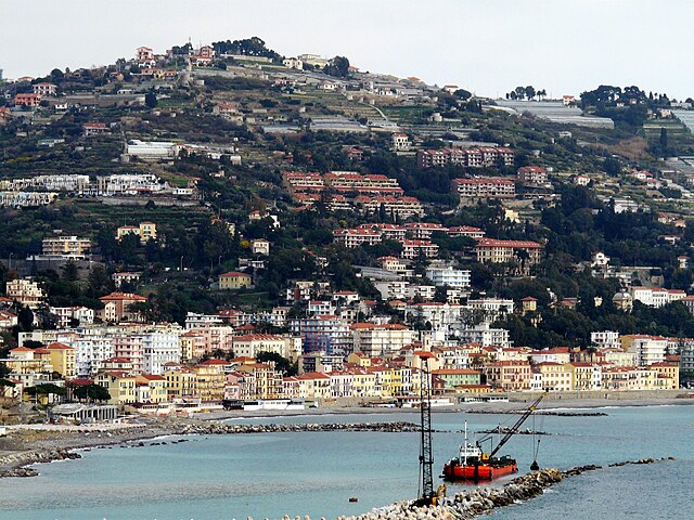
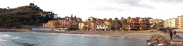
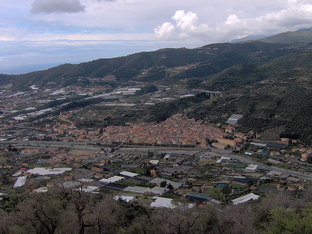
Imperia
- coastal city and comune in the region of Liguria, Italy
Hiking in Imperia
Imperia, located on the beautiful Italian Riviera in the Liguria region, offers a variety of hiking opportunities that showcase its stunning coastal landscapes, charming villages, and lush countryside. Here are some highlights and tips for hiking in Imperia:...
- Country:
- Postal Code: 18100
- Local Dialing Code: 0183
- Licence Plate Code: IM
- Coordinates: 43° 53' 11" N, 8° 1' 47" E
- GPS tracks (wikiloc): [Link]
- AboveSeaLevel: 10 м m
- Area: 45 sq km
- Population: 41999
- Web site: [Link]
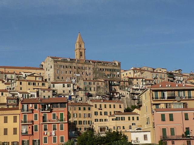

Ventimiglia
- city and comune in Liguria, northern Italy
Hiking in Ventimiglia
Ventimiglia, located in the Italian Riviera near the border with France, is a fantastic destination for hiking enthusiasts. The area is blessed with stunning coastal views, lush Mediterranean vegetation, and a variety of trails suitable for different skill levels. Here are some highlights and tips for hiking in Ventimiglia:...
- Country:
- Postal Code: 18039
- Local Dialing Code: 0184
- Licence Plate Code: IM
- Coordinates: 43° 47' 25" N, 7° 36' 30" E
- GPS tracks (wikiloc): [Link]
- AboveSeaLevel: 9 м m
- Area: 53.73 sq km
- Population: 24065
- Web site: [Link]


San Biagio della Cima
- Italian comune
Hiking in San Biagio della Cima
San Biagio della Cima is a charming village located in the region of Liguria, Italy, and is part of the municipality of Ventimiglia. Nestled in the hills above the coastal region, it offers a variety of hiking opportunities that showcase the stunning natural beauty of the area....
- Country:
- Postal Code: 18036
- Local Dialing Code: 0184
- Licence Plate Code: IM
- Coordinates: 43° 49' 7" N, 7° 38' 59" E
- GPS tracks (wikiloc): [Link]
- AboveSeaLevel: 100 м m
- Area: 4.31 sq km
- Population: 1305
- Web site: [Link]


Castellaro
- Italian comune
Hiking in Castellaro
Castellaro is a beautiful destination for hiking, located in the Italian region of Liguria, near the coast. The area offers diverse landscapes, from rolling hills to scenic coastal views, making it a great spot for both novice and experienced hikers. Here are some highlights and tips for hiking in Castellaro:...
- Country:
- Postal Code: 18011
- Local Dialing Code: 0184
- Licence Plate Code: IM
- Coordinates: 43° 51' 52" N, 7° 52' 8" E
- GPS tracks (wikiloc): [Link]
- AboveSeaLevel: 275 м m
- Area: 7.86 sq km
- Population: 1268
- Web site: [Link]


Airole
- Italian comune
Hiking in Airole
Airole is a charming village located in the Liguria region of Italy, near the border with France. It’s nestled in the picturesque valley of the Nervia River, surrounded by stunning landscapes that make it an attractive destination for hikers and nature enthusiasts. Here are some key points to consider when hiking in and around Airole:...
- Country:
- Postal Code: 18030
- Local Dialing Code: 0184
- Licence Plate Code: IM
- Coordinates: 43° 52' 19" N, 7° 33' 12" E
- GPS tracks (wikiloc): [Link]
- AboveSeaLevel: 149 м m
- Area: 14.63 sq km
- Population: 408
- Web site: [Link]


Apricale
- Italian comune
Hiking in Apricale
Apricale, a picturesque village in the Liguria region of Italy, offers some fantastic hiking opportunities. Nestled in the Sanremo valleys and surrounded by lush vegetation, it boasts beautiful landscapes, historical sites, and a rich cultural experience....
- Country:
- Postal Code: 18035
- Local Dialing Code: 0184
- Licence Plate Code: IM
- Coordinates: 43° 52' 50" N, 7° 39' 38" E
- GPS tracks (wikiloc): [Link]
- AboveSeaLevel: 291 м m
- Area: 19.94 sq km
- Population: 618
- Web site: [Link]

Aquila d'Arroscia
- Italian comune
Hiking in Aquila d'Arroscia
Aquila d'Arroscia is a charming village located in the Liguria region of Italy, nestled in the picturesque hills of the Italian Riviera. The area offers opportunities for delightful hiking, surrounded by stunning landscapes, rich vegetation, and historical sites....
- Country:
- Postal Code: 18020
- Local Dialing Code: 0183
- Licence Plate Code: IM
- Coordinates: 44° 5' 1" N, 8° 0' 20" E
- GPS tracks (wikiloc): [Link]
- AboveSeaLevel: 680 м m
- Area: 10.06 sq km
- Population: 158
- Web site: [Link]

Armo
- Italian comune
Hiking in Armo
Armo, located in the northern region of Italy, is known for its stunning landscapes and diverse hiking opportunities. The area is particularly popular among both local and international hikers due to its rich natural beauty, encompassing rolling hills, mountainous terrain, and picturesque valleys....
- Country:
- Postal Code: 18026
- Local Dialing Code: 0183
- Licence Plate Code: IM
- Coordinates: 44° 5' 16" N, 7° 54' 56" E
- GPS tracks (wikiloc): [Link]
- AboveSeaLevel: 578 м m
- Area: 10.09 sq km
- Population: 113
- Web site: [Link]

Aurigo
- Italian comune
Hiking in Aurigo
Aurigo is a charming village located in the Liguria region of Italy, specifically in the province of Imperia. Nestled in the hills of the Italian Riviera, Aurigo offers stunning landscapes, lush greenery, and picturesque views of the surrounding countryside and coastline....
- Country:
- Postal Code: 18020
- Local Dialing Code: 0183
- Licence Plate Code: IM
- Coordinates: 43° 58' 58" N, 7° 55' 22" E
- GPS tracks (wikiloc): [Link]
- AboveSeaLevel: 431 м m
- Area: 9.14 sq km
- Population: 337
- Web site: [Link]


Badalucco
- Italian comune
Hiking in Badalucco
Badalucco is a charming village located in the province of Imperia, in the Liguria region of Italy. Nestled in the foothills of the Alps, it offers a number of hiking opportunities that provide stunning views of the surrounding mountains and the nearby coastline....
- Country:
- Postal Code: 18010
- Local Dialing Code: 0184
- Licence Plate Code: IM
- Coordinates: 43° 54' 57" N, 7° 50' 49" E
- GPS tracks (wikiloc): [Link]
- AboveSeaLevel: 179 м m
- Area: 16.1 sq km
- Population: 1123
- Web site: [Link]

Bajardo
- Italian comune
Hiking in Bajardo
Bajardo, a charming village located in the Liguria region of Italy, offers some beautiful hiking opportunities, particularly for those who appreciate nature and stunning landscapes. Nestled in the hills of the Italian Riviera, it's surrounded by lush greenery, picturesque vistas, and a rich cultural heritage....
- Country:
- Postal Code: 18031
- Local Dialing Code: 0184
- Licence Plate Code: IM
- Coordinates: 43° 54' 13" N, 7° 43' 6" E
- GPS tracks (wikiloc): [Link]
- AboveSeaLevel: 900 м m
- Area: 24.32 sq km
- Population: 326
- Web site: [Link]

Bordighera
- Italian comune
Hiking in Bordighera
Bordighera, located on the Italian Riviera in the Liguria region, offers a variety of scenic hiking opportunities that can cater to different skill levels. Here are some highlights and tips for hiking in and around Bordighera:...
- Country:
- Postal Code: 18012
- Local Dialing Code: 0184
- Licence Plate Code: IM
- Coordinates: 43° 46' 44" N, 7° 40' 20" E
- GPS tracks (wikiloc): [Link]
- AboveSeaLevel: 5 м m
- Area: 10.65 sq km
- Population: 10412
- Web site: [Link]


Borghetto d'Arroscia
- Italian comune
Hiking in Borghetto d'Arroscia
Borghetto d'Arroscia is a picturesque village located in the Liguria region of Italy, nestled in the Arroscia Valley. This area is known for its stunning natural landscapes, rich history, and a variety of hiking trails that cater to different skill levels. Here are some highlights about hiking in and around Borghetto d'Arroscia:...
- Country:
- Postal Code: 18020
- Local Dialing Code: 0183
- Licence Plate Code: IM
- Coordinates: 44° 3' 27" N, 7° 58' 54" E
- GPS tracks (wikiloc): [Link]
- AboveSeaLevel: 155 м m
- Area: 25.94 sq km
- Population: 449
- Web site: [Link]

Borgomaro
- Italian comune
Hiking in Borgomaro
Borgomaro is a picturesque village located in the Liguria region of Italy, nestled in the foothills of the Maritime Alps. The area offers beautiful hiking opportunities, featuring lush landscapes, charming villages, and stunning views of the surrounding mountains and valleys....
- Country:
- Postal Code: 18021
- Local Dialing Code: 0183
- Licence Plate Code: IM
- Coordinates: 43° 58' 32" N, 7° 56' 41" E
- GPS tracks (wikiloc): [Link]
- AboveSeaLevel: 200 м m
- Area: 23.44 sq km
- Population: 881
- Web site: [Link]


Camporosso
- Italian comune
Hiking in Camporosso
Camporosso is a beautiful village located in the Italian region of Liguria, nestled in the heart of the Italian Riviera. This area is known for its stunning natural landscapes, offering a variety of hiking opportunities for outdoor enthusiasts. Here are some key points to consider if you're planning to hike in and around Camporosso:...
- Country:
- Postal Code: 18033
- Local Dialing Code: 0184
- Licence Plate Code: IM
- Coordinates: 43° 48' 54" N, 7° 37' 42" E
- GPS tracks (wikiloc): [Link]
- AboveSeaLevel: 25 м m
- Area: 17.94 sq km
- Population: 5559
- Web site: [Link]


Caravonica
- Italian comune
Hiking in Caravonica
Caravonica, located in Queensland, Australia, is a charming area near Cairns that offers various hiking opportunities, particularly in the surrounding natural landscapes. Here are some key points to consider for hiking in Caravonica:...
- Country:
- Postal Code: 18020
- Local Dialing Code: 0183
- Licence Plate Code: IM
- Coordinates: 43° 59' 32" N, 7° 57' 31" E
- GPS tracks (wikiloc): [Link]
- AboveSeaLevel: 360 м m
- Area: 4.47 sq km
- Population: 266
- Web site: [Link]


Castel Vittorio
- Italian comune
Hiking in Castel Vittorio
Castel Vittorio, a charming medieval village located in the Italian region of Liguria, is nestled in the scenic hills of the Nervia Valley. Hiking in this area offers a mix of natural beauty, cultural heritage, and various trails suitable for different skill levels....
- Country:
- Postal Code: 18030
- Local Dialing Code: 0184
- Licence Plate Code: IM
- Coordinates: 43° 55' 40" N, 7° 40' 27" E
- GPS tracks (wikiloc): [Link]
- AboveSeaLevel: 420 м m
- Area: 25.93 sq km
- Population: 288
- Web site: [Link]

Ceriana
- Italian comune
Hiking in Ceriana
Ceriana is a charming medieval village located in the Italian region of Liguria, not far from the beautiful Ligurian coast and the Riviera dei Fiori. The area boasts stunning landscapes, with rolling hills, olive groves, and panoramic views of the surrounding countryside and the sea. Here are some key highlights for hiking in and around Ceriana:...
- Country:
- Postal Code: 18034
- Local Dialing Code: 0184
- Licence Plate Code: IM
- Coordinates: 43° 52' 45" N, 7° 46' 29" E
- GPS tracks (wikiloc): [Link]
- AboveSeaLevel: 369 м m
- Area: 31.79 sq km
- Population: 1214
- Web site: [Link]


Cervo, Liguria
- Italian comune
Hiking in Cervo, Liguria
Cervo, located on the Italian Riviera in Liguria, is a picturesque village known for its charming architecture and stunning coastal views. Hiking in and around Cervo offers a variety of scenic trails that showcase the beauty of the Ligurian landscape, combining coastal paths and inland routes....
- Country:
- Postal Code: 18010
- Local Dialing Code: 0183
- Licence Plate Code: IM
- Coordinates: 43° 55' 31" N, 8° 6' 52" E
- GPS tracks (wikiloc): [Link]
- AboveSeaLevel: 66 м m
- Area: 3.59 sq km
- Population: 1139
- Web site: [Link]


Cesio
- Italian comune
Hiking in Cesio
Cesio is a small town located in the Liguria region of Italy, nestled in the Val Nervia valley. It offers several hiking opportunities that showcase the stunning natural beauty of the surrounding area, characterized by lush landscapes, hills, and proximity to the Mediterranean coast....
- Country:
- Postal Code: 18022
- Local Dialing Code: 0183
- Licence Plate Code: IM
- Coordinates: 44° 0' 29" N, 7° 58' 32" E
- GPS tracks (wikiloc): [Link]
- AboveSeaLevel: 512 м m
- Area: 8.86 sq km
- Population: 283
- Web site: [Link]


Chiusanico
- Italian comune
Hiking in Chiusanico
Chiusanico is a picturesque village located in the Liguria region of Italy, near the stunning coastline of the Italian Riviera. The area offers various hiking opportunities that cater to different skill levels, with trails that showcase the natural beauty of the region, including hills, vineyards, olive groves, and breathtaking views of the Ligurian Sea....
- Country:
- Postal Code: 18027
- Local Dialing Code: 0183
- Licence Plate Code: IM
- Coordinates: 43° 58' 16" N, 7° 59' 36" E
- GPS tracks (wikiloc): [Link]
- AboveSeaLevel: 380 м m
- Area: 13.51 sq km
- Population: 578
- Web site: [Link]


Chiusavecchia
- Italian comune
Hiking in Chiusavecchia
Chiusavecchia, a picturesque village located in the province of Imperia in the Liguria region of Italy, offers a variety of hiking opportunities that showcase the stunning landscapes of the Italian Riviera. Here are some highlights and tips for hiking in and around Chiusavecchia:...
- Country:
- Postal Code: 18027
- Local Dialing Code: 0183
- Licence Plate Code: IM
- Coordinates: 43° 58' 4" N, 7° 59' 0" E
- GPS tracks (wikiloc): [Link]
- AboveSeaLevel: 140 м m
- Area: 4.09 sq km
- Population: 556
- Web site: [Link]


Cipressa
- Italian comune
Hiking in Cipressa
Cipressa is a charming town located in the province of Imperia in the Liguria region of Italy. It’s situated along the beautiful Italian Riviera, which offers stunning coastal views and a pleasant Mediterranean climate. Hiking in the area around Cipressa provides a fantastic opportunity to explore scenic landscapes, traditional villages, and the breathtaking coastline. Here are some highlights and tips for hiking in and around Cipressa:...
- Country:
- Postal Code: 18017
- Local Dialing Code: 0183
- Licence Plate Code: IM
- Coordinates: 43° 51' 5" N, 7° 55' 50" E
- GPS tracks (wikiloc): [Link]
- AboveSeaLevel: 240 м m
- Area: 9.39 sq km
- Population: 1272
- Web site: [Link]


Civezza
- Italian comune
Hiking in Civezza
Civezza is a charming village located in the Italian region of Liguria, near the coast and not far from the well-known town of San Remo. The area around Civezza is characterized by its beautiful landscapes, olive groves, and scenic views of the Mediterranean Sea, making it a fantastic destination for hiking enthusiasts....
- Country:
- Postal Code: 18017
- Local Dialing Code: 0183
- Licence Plate Code: IM
- Coordinates: 43° 52' 46" N, 7° 57' 4" E
- GPS tracks (wikiloc): [Link]
- AboveSeaLevel: 222 м m
- Area: 3.88 sq km
- Population: 599
- Web site: [Link]


Cosio di Arroscia
- Italian comune
Hiking in Cosio di Arroscia
Cosio di Arroscia is a picturesque village located in the province of Imperia, in the Liguria region of Italy. It’s nestled in the Arroscia Valley and is surrounded by beautiful natural landscapes, making it a great spot for hiking enthusiasts seeking serene trails and stunning views....
- Country:
- Postal Code: 18023
- Local Dialing Code: 0183
- Licence Plate Code: IM
- Coordinates: 44° 4' 32" N, 7° 49' 52" E
- GPS tracks (wikiloc): [Link]
- AboveSeaLevel: 721 м m
- Area: 40.56 sq km
- Population: 204
- Web site: [Link]


Costarainera
- Italian comune
Hiking in Costarainera
Costa Rincón, also known as Costa Rainera, is an underrated gem for hiking enthusiasts. Nestled on the Pacific coast of Costa Rica, this region showcases a stunning blend of coastal scenery, lush jungles, and mountainous terrain. Here are some key points for hikers considering exploring this area:...
- Country:
- Postal Code: 18017
- Local Dialing Code: 0183
- Licence Plate Code: IM
- Coordinates: 43° 51' 16" N, 7° 56' 27" E
- GPS tracks (wikiloc): [Link]
- AboveSeaLevel: 220 м m
- Area: 2.52 sq km
- Population: 816
- Web site: [Link]

Diano Arentino
- Italian comune
Hiking in Diano Arentino
Diano Arentino is a lovely village located in the Italian region of Liguria, within the province of Imperia. It's nestled in the hills above the coastal town of Diano Marina, which offers a beautiful Mediterranean climate and stunning views. Hiking in this area can be an incredible experience due to the spectacular landscapes, rich flora and fauna, and the charming rural atmosphere....
- Country:
- Postal Code: 18013
- Local Dialing Code: 0183
- Licence Plate Code: IM
- Coordinates: 43° 56' 55" N, 8° 2' 32" E
- GPS tracks (wikiloc): [Link]
- AboveSeaLevel: 331 м m
- Area: 8.33 sq km
- Population: 719
- Web site: [Link]


Diano Castello
- Italian comune
Hiking in Diano Castello
Diano Castello is a charming village located in the Liguria region of Italy, known for its beautiful landscapes, olive groves, and panoramic views of the Mediterranean Sea. Hiking in and around Diano Castello offers a great opportunity to explore the natural beauty of the area, as well as its cultural and historical features....
- Country:
- Postal Code: 18013
- Local Dialing Code: 0183
- Licence Plate Code: IM
- Coordinates: 43° 55' 27" N, 8° 4' 1" E
- GPS tracks (wikiloc): [Link]
- AboveSeaLevel: 135 м m
- Area: 6.11 sq km
- Population: 2251
- Web site: [Link]

Diano Marina
- Italian comune
Hiking in Diano Marina
Diano Marina, located on the Italian Riviera in the Liguria region, is a beautiful coastline town known for its mild climate, stunning sea views, and delightful olive groves. While the town itself is more renowned for its beaches and leisure activities, it also offers some excellent hiking opportunities in the surrounding area....
- Country:
- Postal Code: 18013
- Local Dialing Code: 0183
- Licence Plate Code: IM
- Coordinates: 43° 54' 36" N, 8° 4' 55" E
- GPS tracks (wikiloc): [Link]
- AboveSeaLevel: 0 м m
- Area: 6.67 sq km
- Population: 5867
- Web site: [Link]


Dolceacqua
- Italian comune
Hiking in Dolceacqua
Dolceacqua is a charming village located in the Italian region of Liguria, near the border with France. It’s known for its picturesque medieval architecture, stunning landscapes, and the beautiful surrounding hills and valleys that offer a variety of hiking opportunities....
- Country:
- Postal Code: 18035
- Local Dialing Code: 0184
- Licence Plate Code: IM
- Coordinates: 43° 50' 53" N, 7° 37' 26" E
- GPS tracks (wikiloc): [Link]
- AboveSeaLevel: 51 м m
- Area: 20.28 sq km
- Population: 2093
- Web site: [Link]


Dolcedo
- Italian comune
Hiking in Dolcedo
Dolcedo, a charming village located in the Italian Riviera region of Liguria, offers a great backdrop for hiking enthusiasts. Nestled in a picturesque valley, surrounded by ancient olive groves and Mediterranean vegetation, Dolcedo provides an array of hiking trails that cater to various skill levels....
- Country:
- Postal Code: 18020
- Local Dialing Code: 0183
- Licence Plate Code: IM
- Coordinates: 43° 54' 25" N, 7° 57' 6" E
- GPS tracks (wikiloc): [Link]
- AboveSeaLevel: 75 м m
- Area: 19.8 sq km
- Population: 1385
- Web site: [Link]


Isolabona
- Italian comune
Hiking in Isolabona
Isolabona is a charming village located in the Province of Imperia in the Liguria region of northwestern Italy. It is nestled in the picturesque Nervia Valley, surrounded by lush hills and stunning landscapes, making it a hidden gem for hikers and outdoor enthusiasts....
- Country:
- Postal Code: 18035
- Local Dialing Code: 0184
- Licence Plate Code: IM
- Coordinates: 43° 52' 46" N, 7° 38' 20" E
- GPS tracks (wikiloc): [Link]
- AboveSeaLevel: 106 м m
- Area: 12.35 sq km
- Population: 695
- Web site: [Link]

Lucinasco
- Italian comune
Hiking in Lucinasco
Lucinasco is a charming village located in the province of Imperia in the Liguria region of Italy. Nestled in the hills above the coastline, it offers stunning views of the surrounding landscape, making it an excellent destination for hiking enthusiasts. Here are some key points about hiking in and around Lucinasco:...
- Country:
- Postal Code: 18020
- Local Dialing Code: 0183
- Licence Plate Code: IM
- Coordinates: 43° 58' 4" N, 7° 57' 46" E
- GPS tracks (wikiloc): [Link]
- AboveSeaLevel: 499 м m
- Area: 7.9 sq km
- Population: 283
- Web site: [Link]


Mendatica
- Italian comune
Hiking in Mendatica
Mendatica is a charming village in the Ligurian region of Italy, known for its picturesque landscapes and rich natural beauty, making it an excellent destination for hiking enthusiasts. The area is characterized by rugged mountains, dense forests, and scenic valleys, providing a variety of trails suitable for different skill levels....
- Country:
- Postal Code: 18025
- Local Dialing Code: 0183
- Licence Plate Code: IM
- Coordinates: 44° 4' 35" N, 7° 48' 20" E
- GPS tracks (wikiloc): [Link]
- AboveSeaLevel: 778 м m
- Area: 30.69 sq km
- Population: 187
- Web site: [Link]


Molini di Triora
- Italian comune
Hiking in Molini di Triora
Molini di Triora is a picturesque village located in the Liguria region of Italy, nestled in the mountains of the Impero Valley. This area is rich in natural beauty, historical significance, and offers plenty of hiking opportunities for enthusiasts....
- Country:
- Postal Code: 18010
- Local Dialing Code: 0184
- Licence Plate Code: IM
- Coordinates: 43° 59' 25" N, 7° 46' 29" E
- GPS tracks (wikiloc): [Link]
- AboveSeaLevel: 460 м m
- Area: 58.05 sq km
- Population: 604
- Web site: [Link]


Pornassio
- Italian comune
Hiking in Pornassio
Pornassio is a charming village located in the Liguria region of Italy, nestled in the beautiful mountains of the Apennines. It's an excellent base for hiking enthusiasts looking to explore the natural beauty of the area. Here are some highlights for hiking in and around Pornassio:...
- Country:
- Postal Code: 18024
- Local Dialing Code: 0183
- Licence Plate Code: IM
- Coordinates: 44° 4' 12" N, 7° 52' 10" E
- GPS tracks (wikiloc): [Link]
- AboveSeaLevel: 630 м m
- Area: 27.21 sq km
- Population: 681
- Web site: [Link]

Montegrosso Pian Latte
- Italian comune
Hiking in Montegrosso Pian Latte
Montegrosso Pian Latte is a charming village located in the province of Imperia, in the Italian Liguria region. Nestled in the foothills of the Alps, it offers an array of stunning landscapes, rich biodiversity, and various hiking trails suitable for different skill levels. Here are some key points to consider if you're planning to hike in Montegrosso Pian Latte:...
- Country:
- Postal Code: 18025
- Local Dialing Code: 0183
- Licence Plate Code: IM
- Coordinates: 44° 4' 0" N, 7° 49' 4" E
- GPS tracks (wikiloc): [Link]
- AboveSeaLevel: 721 м m
- Area: 10.03 sq km
- Population: 124
- Web site: [Link]


Olivetta San Michele
- Italian comune
Hiking in Olivetta San Michele
Olivetta San Michele is a charming village located in the province of Imperia, in the Liguria region of Italy. Nestled in the beautiful Alps of Liguria, it offers stunning landscapes, rich natural beauty, and several hiking opportunities for outdoor enthusiasts....
- Country:
- Postal Code: 18030
- Local Dialing Code: 0184
- Licence Plate Code: IM
- Coordinates: 43° 52' 47" N, 7° 30' 56" E
- GPS tracks (wikiloc): [Link]
- AboveSeaLevel: 292 м m
- Area: 13.84 sq km
- Population: 214
- Web site: [Link]

Ospedaletti
- Italian comune
Hiking in Ospedaletti
Ospedaletti, located along the Italian Riviera near the French border in the region of Liguria, offers beautiful coastal landscapes, charming towns, and access to a variety of hiking trails. Here are some highlights about hiking in and around Ospedaletti:...
- Country:
- Postal Code: 18014
- Local Dialing Code: 0184
- Licence Plate Code: IM
- Coordinates: 43° 48' 2" N, 7° 43' 4" E
- GPS tracks (wikiloc): [Link]
- AboveSeaLevel: 5 м m
- Area: 5.45 sq km
- Population: 3292
- Web site: [Link]


Perinaldo
- Italian comune
Hiking in Perinaldo
Perinaldo is a charming village located in the Italian region of Liguria, known for its stunning natural landscapes and historic architecture. It's situated in the hills above the Riviera dei Fiori, offering excellent opportunities for hiking and outdoor activities. Here are some key points about hiking in Perinaldo:...
- Country:
- Postal Code: 18032
- Local Dialing Code: 0184
- Licence Plate Code: IM
- Coordinates: 43° 52' 1" N, 7° 40' 28" E
- GPS tracks (wikiloc): [Link]
- AboveSeaLevel: 572 м m
- Area: 20.3 sq km
- Population: 871
- Web site: [Link]


Pietrabruna
- Italian comune
Hiking in Pietrabruna
Pietrabruna is a picturesque village located in the province of Imperia in the Italian region of Liguria. Nestled in the hills above the coastline, it offers stunning views and a variety of hiking opportunities that cater to different skill levels. Here are some key points about hiking in Pietrabruna:...
- Country:
- Postal Code: 18010
- Local Dialing Code: 0183
- Licence Plate Code: IM
- Coordinates: 43° 53' 23" N, 7° 54' 12" E
- GPS tracks (wikiloc): [Link]
- AboveSeaLevel: 400 м m
- Area: 10.22 sq km
- Population: 472
- Web site: [Link]

Pieve di Teco
- Italian comune
Hiking in Pieve di Teco
Pieve di Teco, located in the region of Liguria in northern Italy, offers a picturesque setting for hiking enthusiasts. This charming village, nestled in the Valle Arroscia, is surrounded by stunning landscapes, including rolling hills, terraced vineyards, and lush woodlands....
- Country:
- Postal Code: 18026
- Local Dialing Code: 0183
- Licence Plate Code: IM
- Coordinates: 44° 2' 53" N, 7° 54' 58" E
- GPS tracks (wikiloc): [Link]
- AboveSeaLevel: 240 м m
- Area: 40.51 sq km
- Population: 1339
- Web site: [Link]


Pigna, Liguria
- Italian comune
Hiking in Pigna, Liguria
Pigna, a picturesque village in the Italian region of Liguria, offers a wonderful hiking experience characterized by its enchanting landscapes, olive groves, and stunning views of the surrounding mountains and valleys. Here are some key points to consider when planning a hiking trip to Pigna:...
- Country:
- Postal Code: 18037
- Local Dialing Code: 0184
- Licence Plate Code: IM
- Coordinates: 43° 55' 57" N, 7° 39' 50" E
- GPS tracks (wikiloc): [Link]
- AboveSeaLevel: 280 м m
- Area: 53.23 sq km
- Population: 843
- Web site: [Link]


Pompeiana
- Italian comune
Hiking in Pompeiana
Pompeiana is a charming village located in the Liguria region of Italy, near the Italian Riviera. It offers a unique hiking experience with its stunning coastal views, picturesque landscapes, and rich history. Here are some highlights of hiking in and around Pompeiana:...
- Country:
- Postal Code: 18015
- Local Dialing Code: 0184
- Licence Plate Code: IM
- Coordinates: 43° 51' 12" N, 7° 53' 19" E
- GPS tracks (wikiloc): [Link]
- AboveSeaLevel: 200 м m
- Area: 5.38 sq km
- Population: 842
- Web site: [Link]

Pontedassio
- Italian comune
Hiking in Pontedassio
Pontedassio, located in the beautiful Liguria region of Italy, offers a variety of hiking opportunities characterized by scenic landscapes, lush greenery, and breathtaking views of the surrounding hills and valleys. Here are some details to help you plan a hiking adventure in this picturesque area:...
- Country:
- Postal Code: 18027
- Local Dialing Code: 0183
- Licence Plate Code: IM
- Coordinates: 43° 56' 25" N, 8° 0' 44" E
- GPS tracks (wikiloc): [Link]
- AboveSeaLevel: 80 м m
- Area: 13.31 sq km
- Population: 2318
- Web site: [Link]


Prelà
- Italian comune
Hiking in Prelà
Prelà is a charming village located in the Liguria region of Italy, known for its lush landscapes and proximity to the beautiful Italian Riviera. Hiking in and around Prelà offers a range of experiences, from gentle walks through olive groves to more challenging trails with stunning views of the surrounding mountains and coastline....
- Country:
- Postal Code: 18020
- Local Dialing Code: 0183
- Licence Plate Code: IM
- Coordinates: 43° 55' 26" N, 7° 54' 33" E
- GPS tracks (wikiloc): [Link]
- AboveSeaLevel: 151 м m
- Area: 14.8 sq km
- Population: 498
- Web site: [Link]

Ranzo
- Italian comune
Hiking in Ranzo
Ranzo is a charming village located in the province of Savona, in the Liguria region of Italy. It offers a range of hiking opportunities that highlight the natural beauty of the surrounding landscape, including picturesque views of the Italian Riviera and the nearby Apennine mountains....
- Country:
- Postal Code: 18020
- Local Dialing Code: 0183
- Licence Plate Code: IM
- Coordinates: 44° 3' 34" N, 8° 0' 53" E
- GPS tracks (wikiloc): [Link]
- AboveSeaLevel: 124 м m
- Area: 10.86 sq km
- Population: 555
- Web site: [Link]


Rezzo
- Italian comune
Hiking in Rezzo
Rezzo is a charming village located in the Italian region of Liguria, surrounded by the beautiful landscapes of the Maritime Alps. Hiking in and around Rezzo offers a fantastic way to explore the natural beauty of the area, with stunning views, diverse flora and fauna, and a rich cultural heritage....
- Country:
- Postal Code: 18026
- Local Dialing Code: 0183
- Licence Plate Code: IM
- Coordinates: 44° 1' 16" N, 7° 52' 19" E
- GPS tracks (wikiloc): [Link]
- AboveSeaLevel: 563 м m
- Area: 37.37 sq km
- Population: 339
- Web site: [Link]


Riva Ligure
- Italian comune
Hiking in Riva Ligure
Riva Ligure is a charming coastal village located in the province of Imperia in the Liguria region of Italy. It offers a beautiful setting for hiking, characterized by stunning views of the Mediterranean Sea, lush olive groves, and picturesque landscapes. Here are some key points about hiking in Riva Ligure:...
- Country:
- Postal Code: 18015
- Local Dialing Code: 0184
- Licence Plate Code: IM
- Coordinates: 43° 50' 15" N, 7° 52' 55" E
- GPS tracks (wikiloc): [Link]
- AboveSeaLevel: 2 м m
- Area: 2.07 sq km
- Population: 2878
- Web site: [Link]


Rocchetta Nervina
- Italian comune
Hiking in Rocchetta Nervina
Rocchetta Nervina is a charming village located in the Liguria region of Italy, specifically in the Province of Imperia. Nestled in the Nervia Valley and surrounded by stunning mountainous terrain, it serves as an excellent base for hiking enthusiasts looking to explore the natural beauty of the area....
- Country:
- Postal Code: 18030
- Local Dialing Code: 0184
- Licence Plate Code: IM
- Coordinates: 43° 53' 24" N, 7° 36' 1" E
- GPS tracks (wikiloc): [Link]
- AboveSeaLevel: 235 м m
- Area: 15.29 sq km
- Population: 299
- Web site: [Link]


San Bartolomeo al Mare
- Italian comune
Hiking in San Bartolomeo al Mare
San Bartolomeo al Mare, located in the beautiful Liguria region of Italy, is an excellent destination for hiking enthusiasts. The area is known for its stunning coastal views, charming villages, and a network of trails that cater to different skill levels....
- Country:
- Postal Code: 18016
- Local Dialing Code: 0183
- Licence Plate Code: IM
- Coordinates: 43° 55' 40" N, 8° 6' 8" E
- GPS tracks (wikiloc): [Link]
- AboveSeaLevel: 26 м m
- Area: 10.85 sq km
- Population: 3069
- Web site: [Link]

San Lorenzo al Mare
- Italian comune
Hiking in San Lorenzo al Mare
San Lorenzo al Mare is a picturesque coastal town in the Liguria region of Italy, situated along the Riviera dei Fiori. While it’s known for its beautiful beaches and charming village atmosphere, there are also several options for hiking enthusiasts....
- Country:
- Postal Code: 18017
- Local Dialing Code: 0183
- Licence Plate Code: IM
- Coordinates: 43° 51' 12" N, 7° 57' 50" E
- GPS tracks (wikiloc): [Link]
- AboveSeaLevel: 6 м m
- Area: 1.29 sq km
- Population: 1273
- Web site: [Link]


Santo Stefano al Mare
- Italian comune
Hiking in Santo Stefano al Mare
Santo Stefano al Mare is a charming village located on the Italian Riviera in the Liguria region. It's known for its stunning coastal views, lush landscapes, and Mediterranean climate, making it a fantastic destination for hiking enthusiasts....
- Country:
- Postal Code: 18010
- Local Dialing Code: 0184
- Licence Plate Code: IM
- Coordinates: 43° 50' 14" N, 7° 53' 58" E
- GPS tracks (wikiloc): [Link]
- AboveSeaLevel: 7 м m
- Area: 2.69 sq km
- Population: 2172
- Web site: [Link]

Seborga
- Italian comune
Hiking in Seborga
Seborga is a charming village located in the Italian Riviera, within the province of Imperia in the Liguria region. Known for its picturesque views, historic architecture, and a rich cultural history, Seborga also offers a variety of hiking opportunities for outdoor enthusiasts. Here’s what you need to know about hiking in and around Seborga:...
- Country:
- Postal Code: 18012
- Local Dialing Code: 0184
- Licence Plate Code: IM
- Coordinates: 43° 49' 34" N, 7° 41' 38" E
- GPS tracks (wikiloc): [Link]
- AboveSeaLevel: 500 м m
- Area: 4.87 sq km
- Population: 297
- Web site: [Link]


Soldano, Liguria
- Italian comune
Hiking in Soldano, Liguria
Soldano is a charming village located in the Liguria region of Italy, nestled in the hills of the Nervia Valley, not far from the Mediterranean coast. The area is ideal for hiking enthusiasts, offering a mix of coastal paths, hill trails, and scenic views. Here are some highlights and tips for hiking in Soldano:...
- Country:
- Postal Code: 18036
- Local Dialing Code: 0184
- Licence Plate Code: IM
- Coordinates: 43° 49' 42" N, 7° 39' 20" E
- GPS tracks (wikiloc): [Link]
- AboveSeaLevel: 80 м m
- Area: 3.47 sq km
- Population: 1029
- Web site: [Link]

Taggia
- Italian comune
Hiking in Taggia
Taggia is a charming town located in the Liguria region of Italy, known for its rich history, traditional olive production, and beautiful landscapes. Hiking around Taggia offers a variety of trails that cater to different skill levels, displaying the stunning scenery of the Italian Riviera, hills, and valleys....
- Country:
- Postal Code: 18018
- Local Dialing Code: 0184
- Licence Plate Code: IM
- Coordinates: 43° 50' 38" N, 7° 51' 3" E
- GPS tracks (wikiloc): [Link]
- AboveSeaLevel: 39 м m
- Area: 31.36 sq km
- Population: 14003
- Web site: [Link]


Terzorio
- Italian comune
Hiking in Terzorio
Terzorio is a charming village located in the province of Imperia, in the Italian region of Liguria. Nestled in the hills overlooking the beautiful Ligurian Sea, it offers breathtaking views and a tranquil atmosphere, making it an excellent spot for hiking enthusiasts....
- Country:
- Postal Code: 18010
- Local Dialing Code: 0184
- Licence Plate Code: IM
- Coordinates: 43° 51' 10" N, 7° 53' 53" E
- GPS tracks (wikiloc): [Link]
- AboveSeaLevel: 185 м m
- Area: 1.93 sq km
- Population: 233
- Web site: [Link]


Triora
- Italian comune
Hiking in Triora
Triora is a picturesque village located in the Italian region of Liguria, known for its stunning landscapes and rich history. Nestled in the mountains, it's an excellent destination for hiking enthusiasts....
- Country:
- Postal Code: 18010
- Local Dialing Code: 0184
- Licence Plate Code: IM
- Coordinates: 44° 0' 0" N, 7° 46' 0" E
- GPS tracks (wikiloc): [Link]
- AboveSeaLevel: 780 м m
- Area: 68 sq km
- Population: 361
- Web site: [Link]


Vallebona
- Italian comune
Hiking in Vallebona
Vallebona is a picturesque village located in the Italian region of Liguria, near the French border. Nestled in the hills above the coastline, it offers stunning views of the surrounding countryside and the Ligurian Sea. Hiking in the area around Vallebona can be a rewarding experience, as it encompasses a mix of natural beauty, cultural heritage, and diverse trails....
- Country:
- Postal Code: 18012
- Local Dialing Code: 0184
- Licence Plate Code: IM
- Coordinates: 43° 48' 44" N, 7° 39' 55" E
- GPS tracks (wikiloc): [Link]
- AboveSeaLevel: 149 м m
- Area: 5.88 sq km
- Population: 1319
- Web site: [Link]


Vallecrosia
- Italian comune
Hiking in Vallecrosia
Vallecrosia, located on the Italian Riviera in the Liguria region, is a charming town that offers a variety of hiking options, primarily around the scenic coastal areas and the nearby mountains. Here are some key points about hiking in and around Vallecrosia:...
- Country:
- Postal Code: 18019
- Local Dialing Code: 0184
- Licence Plate Code: IM
- Coordinates: 43° 47' 35" N, 7° 38' 38" E
- GPS tracks (wikiloc): [Link]
- AboveSeaLevel: 5 м m
- Area: 3.68 sq km
- Population: 6972
- Web site: [Link]


Vasia
- Italian comune
Hiking in Vasia
Vasia, located in the Liguria region of Italy, is a charming destination for hikers looking to explore picturesque landscapes and enjoy the serenity of nature. The area offers a variety of trails suitable for different skill levels, ranging from leisurely walks to more challenging hikes....
- Country:
- Postal Code: 18020
- Local Dialing Code: 0183
- Licence Plate Code: IM
- Coordinates: 43° 56' 0" N, 7° 57' 16" E
- GPS tracks (wikiloc): [Link]
- AboveSeaLevel: 385 м m
- Area: 11.15 sq km
- Population: 405
- Web site: [Link]


Vessalico
- Italian comune
Hiking in Vessalico
Vessalico is a charming village located in the region of Liguria, Italy, known for its beautiful landscapes and outdoor activities, including hiking. Set in the foothills of the Alps and near the Mediterranean coast, Vessalico offers a variety of trails that cater to different skill levels, making it a great destination for hikers....
- Country:
- Postal Code: 18026
- Local Dialing Code: 0183
- Licence Plate Code: IM
- Coordinates: 44° 2' 47" N, 7° 57' 43" E
- GPS tracks (wikiloc): [Link]
- AboveSeaLevel: 197 м m
- Area: 10.46 sq km
- Population: 286
- Web site: [Link]


Villa Faraldi
- Italian comune
Hiking in Villa Faraldi
Villa Faraldi is a charming small village located in the province of Imperia in the Italian region of Liguria. Nestled in the hills overlooking the Mediterranean Sea, it's an excellent spot for hiking enthusiasts looking for beautiful scenery, rich history, and a bit of local culture. Here are some highlights of hiking in and around Villa Faraldi:...
- Country:
- Postal Code: 18010
- Local Dialing Code: 0183
- Licence Plate Code: IM
- Coordinates: 43° 58' 2" N, 8° 5' 29" E
- GPS tracks (wikiloc): [Link]
- AboveSeaLevel: 336 м m
- Area: 9.52 sq km
- Population: 472
- Web site: [Link]


Sanremo
- Italian comune
Hiking in Sanremo
Sanremo, located on the Italian Riviera in the region of Liguria, is well-known for its beautiful landscapes, mild climate, and stunning coastal views. Hiking in and around Sanremo offers a wonderful opportunity to explore the natural beauty of the area, from the Mediterranean coast to the surrounding hills and mountains. Here are some highlights and tips for hiking in Sanremo:...
- Country:
- Postal Code: 18038
- Local Dialing Code: 0184
- Licence Plate Code: IM
- Coordinates: 43° 49' 17" N, 7° 47' 12" E
- GPS tracks (wikiloc): [Link]
- AboveSeaLevel: 15 м m
- Area: 55.96 sq km
- Population: 54824
- Web site: [Link]
Montalto Carpasio
- human settlement in Italy
Hiking in Montalto Carpasio
Montalto Carpasio is located in the Liguria region of Italy and is known for its stunning landscapes, picturesque views, and rich biodiversity. Here are some key points about hiking in the area:...
- Country:
- Licence Plate Code: IM
- Coordinates: 43° 55' 40" N, 7° 50' 40" E
- GPS tracks (wikiloc): [Link]
Shares border with regions:


Province of Cuneo
- province in Italy
Hiking in Province of Cuneo
The Province of Cuneo, located in the Piedmont region of northwestern Italy, is a fantastic destination for hiking enthusiasts. This area is known for its stunning alpine landscapes, diverse ecosystems, and charming villages, making it an ideal spot for outdoor activities. Here are some highlights and key information about hiking in the Province of Cuneo:...
- Country:
- Capital: Cuneo
- Postal Code: 12100
- Licence Plate Code: CN
- Coordinates: 44° 23' 0" N, 7° 33' 0" E
- GPS tracks (wikiloc): [Link]
- Area: 6902.65 sq km
- Web site: [Link]

Province of Savona
- province of Italy
Hiking in Province of Savona
The Province of Savona, located in the Liguria region of Italy, offers a diverse range of hiking opportunities that cater to various skill levels and preferences. With its stunning coastal views, rugged mountains, and charming villages, hiking in this area can be a memorable experience. Here are some highlights:...
- Country:
- Capital: Savona
- Postal Code: 12071; 17010–17047; 17100
- Local Dialing Code: 0182; 019
- Licence Plate Code: SV
- Coordinates: 44° 18' 26" N, 8° 29' 51" E
- GPS tracks (wikiloc): [Link]
- Area: 1544.77 sq km
- Web site: [Link]

Alpes-Maritimes
- French department
Hiking in Alpes-Maritimes
Hiking in Alpes-Maritimes, located in the Provence-Alpes-Côte d'Azur region of France, offers a diverse range of trails and stunning landscapes. From coastal paths along the Mediterranean Sea to rocky mountain trails in the Mercantour National Park, the area caters to hikers of all levels....
- Country:

- Capital: Nice
- Coordinates: 43° 50' 0" N, 7° 10' 0" E
- GPS tracks (wikiloc): [Link]
- Area: 4299 sq km
- Population: 1082440
- Web site: [Link]