Chuzelles (Chuzelles)

- commune in Isère, France
- Country:

- Postal Code: 38200
- Coordinates: 45° 35' 8" N, 4° 52' 39" E


- GPS tracks (wikiloc): [Link]
- Area: 13.03 sq km
- Population: 2008
- Web site: http://www.mairie-chuzelles.fr
- Wikipedia en: wiki(en)
- Wikipedia: wiki(fr)
- Wikidata storage: Wikidata: Q975602
- Wikipedia Commons Category: [Link]
- Freebase ID: [/m/03nvh55]
- GeoNames ID: Alt: [6612506]
- SIREN number: [213801103]
- BnF ID: [15257936d]
- VIAF ID: Alt: [235687206]
- INSEE municipality code: 38110
Shares border with regions:


Villette-de-Vienne
- commune in Isère, France
 Hiking in Villette-de-Vienne
Villette-de-Vienne is a small commune located in the Auvergne-Rhône-Alpes region of France. It offers a beautiful backdrop for hiking enthusiasts, thanks to its scenic landscapes and proximity to natural attractions....
- Country:
- Postal Code: 38200
- Coordinates: 45° 35' 19" N, 4° 54' 52" E
- GPS tracks (wikiloc): [Link]
- Area: 11.03 sq km
- Population: 1770
- Web site: [Link]

Seyssuel
- commune in Isère, France
- Country:
- Postal Code: 38200
- Coordinates: 45° 33' 36" N, 4° 50' 44" E
- GPS tracks (wikiloc): [Link]
- Area: 9.75 sq km
- Population: 1989
- Web site: [Link]


Communay
- commune in Rhône, France
- Country:
- Postal Code: 69360
- Coordinates: 45° 36' 16" N, 4° 50' 6" E
- GPS tracks (wikiloc): [Link]
- Area: 10.54 sq km
- Population: 4153
- Web site: [Link]
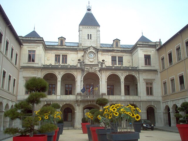
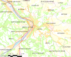
Vienne
- commune in Isère, France
- Country:
- Postal Code: 38200
- Coordinates: 45° 31' 32" N, 4° 52' 29" E
- GPS tracks (wikiloc): [Link]
- AboveSeaLevel: 169 м m
- Area: 22.65 sq km
- Population: 29162
- Web site: [Link]


Serpaize
- commune in Isère, France
Hiking in Serpaize
Serpaize is a charming commune located in the Auvergne-Rhône-Alpes region of eastern France. Although it may not be as widely known for hiking as some other areas in the region, it offers a variety of scenic trails that can be enjoyed by hikers of all levels....
- Country:
- Postal Code: 38200
- Coordinates: 45° 33' 32" N, 4° 55' 5" E
- GPS tracks (wikiloc): [Link]
- Area: 11.71 sq km
- Population: 1838
- Web site: [Link]


Simandres
- commune in Rhône, France
- Country:
- Postal Code: 69360
- Coordinates: 45° 37' 10" N, 4° 52' 23" E
- GPS tracks (wikiloc): [Link]
- Area: 10.45 sq km
- Population: 1726