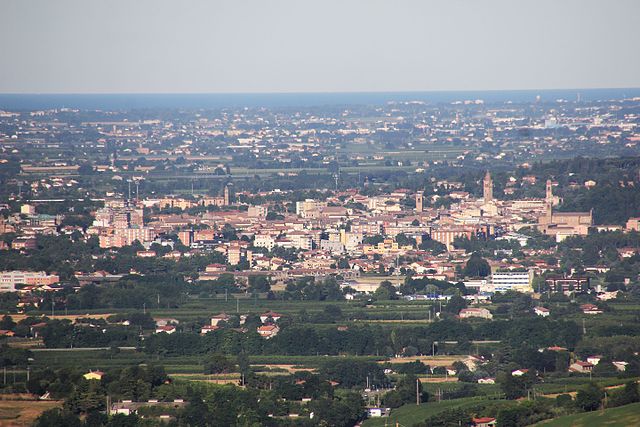
Civitella di Romagna (Civitella di Romagna)
.svg)
- Italian comune
 Hiking in Civitella di Romagna
Civitella di Romagna is a charming village located in the Emilia-Romagna region of Italy, nestled in the heart of the Apennine mountains. The area offers stunning landscapes, beautiful trails, and a rich history, making it an excellent destination for hiking enthusiasts.
Hiking Highlights in Civitella di Romagna:
-
Scenic Trails: The region is characterized by a network of trails that range from easy walks to challenging hikes. You can expect picturesque views of rolling hills, lush forests, and ancient villages.
-
Nature Reserves: The surrounding area includes the Casentino Forests, Monte Falterona, and Campigna National Park. These protected areas provide numerous hiking routes, with opportunities to see diverse wildlife and unique flora.
-
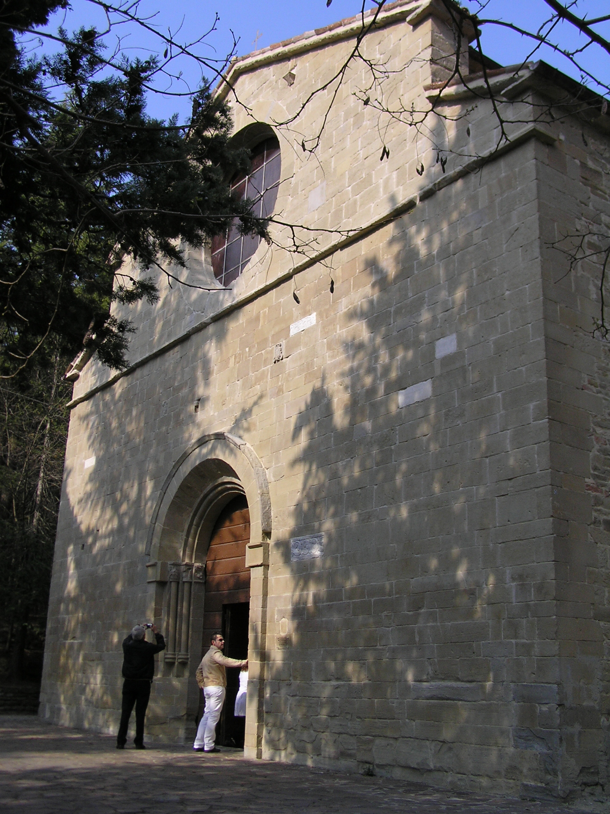
Historical Sites: Hiking in Civitella di Romagna often leads to historical sites, such as old castles, monasteries, and ruins. Exploring these sites adds a cultural dimension to your hike.
-
Local Flora and Fauna: The area is rich in biodiversity, making it an excellent spot for nature enthusiasts. Keep an eye out for various bird species, deer, and other wildlife.
-
Practical Considerations: While many trails are well-marked, it's always a good idea to have a map or GPS. Also, be prepared for changing weather conditions, especially if hiking in higher altitudes.
-
Community and Events: Civitella di Romagna often hosts local festivals and events that celebrate its culture and natural beauty. Participating in these can enhance your experience and connect you with the local community.
Recommendations:
-
Duration: Plan your hikes according to your skill level and available time. Shorter trails can take a couple of hours, while longer ones may require a full day.
-
Gear: Wear appropriate hiking gear, including sturdy footwear and layered clothing to adapt to changing temperatures.
-
Stay Hydrated: Bring plenty of water, especially if hiking during the warmer months, as some trails may have limited access to water sources.
-
Local Guides: Consider hiring a local guide for more in-depth insights into the area's natural history and cultural context.
Whether you’re a novice hiker or an experienced trekker, Civitella di Romagna offers a wonderful experience amidst nature and history. Enjoy your hike!
- Country:

- Postal Code: 47012
- Local Dialing Code: 0543
- Licence Plate Code: FC
- Coordinates: 44° 0' 0" N, 11° 56' 0" E


- GPS tracks (wikiloc): [Link]
- AboveSeaLevel: 219 м m
- Area: 117.93 sq km
- Population: 3758
- Web site: http://www.comune.civitella-di-romagna.fc.it
- Wikipedia en: wiki(en)
- Wikipedia: wiki(it)
- Wikidata storage: Wikidata: Q99938
- Wikipedia Commons Category: [Link]
- Freebase ID: [/m/0gklx2]
- GeoNames ID: Alt: [6541045]
- VIAF ID: Alt: [240570771]
- OSM relation ID: [42771]
- GND ID: Alt: [7530800-9]
- UN/LOCODE: [ITLLR]
- ISTAT ID: 040009
- Italian cadastre code: C777
Shares border with regions:

Cesena
- Italian comune
Hiking in Cesena
Cesena is a beautiful town located in the Emilia-Romagna region of northern Italy. While it may not be as famous for hiking as some of the more mountainous regions in the country, there are still some delightful trails and natural areas that make for enjoyable hikes....
- Country:
- Postal Code: 47023; 47522; 47521
- Local Dialing Code: 0547
- Licence Plate Code: FC
- Coordinates: 44° 8' 0" N, 12° 14' 0" E
- GPS tracks (wikiloc): [Link]
- AboveSeaLevel: 44 м m
- Area: 249.47 sq km
- Population: 96583
- Web site: [Link]

Galeata
- Italian comune
Hiking in Galeata
Galeata is a charming rural area located in the Emilia-Romagna region of Italy, known for its picturesque landscapes and rich natural heritage. Here are some insights into hiking in and around Galeata:...
- Country:
- Postal Code: 47010
- Local Dialing Code: 0543
- Licence Plate Code: FC
- Coordinates: 44° 0' 0" N, 11° 55' 0" E
- GPS tracks (wikiloc): [Link]
- AboveSeaLevel: 237 м m
- Area: 63.13 sq km
- Population: 2511
- Web site: [Link]


Meldola
- Italian comune
Hiking in Meldola
Meldola, located in the Emilia-Romagna region of Italy, is surrounded by beautiful landscapes and offers some great opportunities for hiking enthusiasts. The area features rolling hills, vineyards, and picturesque countryside, which make for scenic trails....
- Country:
- Postal Code: 47014
- Local Dialing Code: 0543
- Licence Plate Code: FC
- Coordinates: 44° 8' 0" N, 12° 4' 0" E
- GPS tracks (wikiloc): [Link]
- AboveSeaLevel: 58 м m
- Area: 79.08 sq km
- Population: 9978
- Web site: [Link]


Predappio
- Italian comune
Hiking in Predappio
Predappio, located in the Emilia-Romagna region of Italy, is surrounded by beautiful countryside and offers various hiking opportunities. The area is characterized by rolling hills, wooded areas, and stunning views, making it a great destination for outdoor activities....
- Country:
- Postal Code: 47016
- Local Dialing Code: 0543
- Licence Plate Code: FC
- Coordinates: 44° 6' 15" N, 11° 59' 6" E
- GPS tracks (wikiloc): [Link]
- AboveSeaLevel: 133 м m
- Area: 91.39 sq km
- Population: 6287
- Web site: [Link]


Santa Sofia
- Italian comune in Emilia–Romagna
Hiking in Santa Sofia
Santa Sofia, located in the province of Forlì-Cesenatico in the Emilia-Romagna region of Italy, offers beautiful hiking opportunities set in a picturesque natural landscape. Nestled in the foothills of the Apennines, the area is characterized by lush forests, rolling hills, and stunning views, making it an attractive destination for outdoor enthusiasts....
- Country:
- Postal Code: 47018
- Local Dialing Code: 0543
- Licence Plate Code: FC
- Coordinates: 43° 57' 0" N, 11° 54' 0" E
- GPS tracks (wikiloc): [Link]
- AboveSeaLevel: 257 м m
- Area: 148.56 sq km
- Population: 4120
- Web site: [Link]


Sarsina
- Italian comune
Hiking in Sarsina
Sarsina, located in the Emilia-Romagna region of Italy, is a charming town that offers various hiking opportunities amidst beautiful landscapes and rich historical and cultural heritage. The surrounding area includes the Appenine Mountains, which provide a variety of trails suitable for different skill levels....
- Country:
- Postal Code: 47027
- Local Dialing Code: 0547
- Licence Plate Code: FC
- Coordinates: 43° 55' 0" N, 12° 9' 0" E
- GPS tracks (wikiloc): [Link]
- AboveSeaLevel: 243 м m
- Area: 100 sq km
- Population: 3662
- Web site: [Link]