Clermont-Pouyguillès (Clermont-Pouyguillès)

- commune in Gers, France
- Country:

- Postal Code: 32300
- Coordinates: 43° 28' 16" N, 0° 31' 22" E


- GPS tracks (wikiloc): [Link]
- Area: 12.71 sq km
- Population: 157
- Wikipedia en: wiki(en)
- Wikipedia: wiki(fr)
- Wikidata storage: Wikidata: Q859481
- Wikipedia Commons Category: [Link]
- Freebase ID: [/m/03nrpgt]
- GeoNames ID: Alt: [6614592]
- SIREN number: [213201049]
- BnF ID: [152556917]
- INSEE municipality code: 32104
Shares border with regions:


Lourties-Monbrun
- commune in Gers, France
- Country:
- Postal Code: 32140
- Coordinates: 43° 27' 21" N, 0° 32' 23" E
- GPS tracks (wikiloc): [Link]
- Area: 9.5 sq km
- Population: 146


Seissan
- commune in Gers, France
- Country:
- Postal Code: 32260
- Coordinates: 43° 29' 32" N, 0° 35' 35" E
- GPS tracks (wikiloc): [Link]
- Area: 18.56 sq km
- Population: 1100
- Web site: [Link]
Moncassin
- commune in Gers, France
- Country:
- Postal Code: 32300
- Coordinates: 43° 27' 13" N, 0° 28' 46" E
- GPS tracks (wikiloc): [Link]
- Area: 13.93 sq km
- Population: 136
Saint-Médard
- commune in Gers, France
- Country:
- Postal Code: 32300
- Coordinates: 43° 29' 24" N, 0° 27' 35" E
- GPS tracks (wikiloc): [Link]
- Area: 17.07 sq km
- Population: 330
Loubersan
- commune in Gers, France
- Country:
- Postal Code: 32300
- Coordinates: 43° 29' 48" N, 0° 29' 56" E
- GPS tracks (wikiloc): [Link]
- Area: 10.77 sq km
- Population: 161

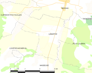
Labarthe
- commune in Gers, France
- Country:
- Postal Code: 32260
- Coordinates: 43° 28' 29" N, 0° 34' 48" E
- GPS tracks (wikiloc): [Link]
- AboveSeaLevel: 199 м m
- Area: 6.46 sq km
- Population: 159


Saint-Arroman
- commune in Gers, France
- Country:
- Postal Code: 32300
- Coordinates: 43° 26' 18" N, 0° 31' 17" E
- GPS tracks (wikiloc): [Link]
- Area: 11.97 sq km
- Population: 137