Loubersan (Loubersan)

- commune in Gers, France
- Country:

- Postal Code: 32300
- Coordinates: 43° 29' 48" N, 0° 29' 56" E


- GPS tracks (wikiloc): [Link]
- Area: 10.77 sq km
- Population: 161
- Wikipedia en: wiki(en)
- Wikipedia: wiki(fr)
- Wikidata storage: Wikidata: Q744218
- Wikipedia Commons Category: [Link]
- Freebase ID: [/m/03nrqp_]
- GeoNames ID: Alt: [6431977]
- SIREN number: [213202153]
- BnF ID: [152558010]
- INSEE municipality code: 32215
Shares border with regions:
Idrac-Respaillès
- commune in Gers, France
- Country:
- Postal Code: 32300
- Coordinates: 43° 31' 28" N, 0° 27' 27" E
- GPS tracks (wikiloc): [Link]
- Area: 13.03 sq km
- Population: 213


Seissan
- commune in Gers, France
- Country:
- Postal Code: 32260
- Coordinates: 43° 29' 32" N, 0° 35' 35" E
- GPS tracks (wikiloc): [Link]
- Area: 18.56 sq km
- Population: 1100
- Web site: [Link]
Saint-Médard
- commune in Gers, France
- Country:
- Postal Code: 32300
- Coordinates: 43° 29' 24" N, 0° 27' 35" E
- GPS tracks (wikiloc): [Link]
- Area: 17.07 sq km
- Population: 330

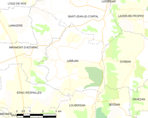
Labéjan
- commune in Gers, France
- Country:
- Postal Code: 32300
- Coordinates: 43° 32' 18" N, 0° 30' 0" E
- GPS tracks (wikiloc): [Link]
- AboveSeaLevel: 266 м m
- Area: 18.71 sq km
- Population: 331

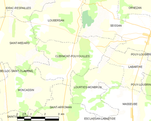
Clermont-Pouyguillès
- commune in Gers, France
- Country:
- Postal Code: 32300
- Coordinates: 43° 28' 16" N, 0° 31' 22" E
- GPS tracks (wikiloc): [Link]
- Area: 12.71 sq km
- Population: 157