Condillac (Condillac)
- commune in Drôme, France
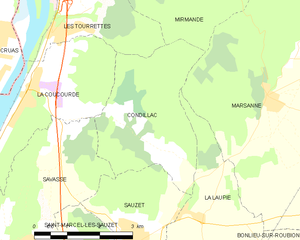
Condillac, located in the Drôme department in southeastern France, offers a variety of hiking opportunities thanks to its picturesque landscapes and varied terrain. The region is characterized by gentle hills, forests, and beautiful views of the Rhône Valley and surrounding mountains.
Hiking Opportunities
-
Scenic Trails: The area boasts several well-marked trails that cater to different skill levels. You can find easier paths suitable for families or more challenging routes for seasoned hikers.
-
Natural Beauty: Hiking in Condillac allows you to immerse yourself in nature, with beautiful flora and fauna. The trails often showcase the region's diverse ecosystems, including forests, vineyards, and open fields.
-
Nearby Attractions: In addition to hiking, consider exploring nearby sites, such as historical towns, local markets, and vineyards, where you can taste the famous wines of the area.
Recommendations
-
Maps and Guides: Always carry a detailed hiking map or GPS device. It’s advisable to get local guides or check out local tourist offices for trail suggestions and conditions.
-
Best Time to Visit: Spring (April to June) and early autumn (September to October) are ideal for hiking, as the weather is milder and the landscapes are often at their most beautiful.
-
Safety: Ensure you have appropriate footwear, sufficient water, and snacks. It’s also wise to inform someone of your hiking plans and expected return time.
Local Resources
- Tourist Information: Visit the local tourist office for maps, brochures, and rest area information.
- Hiking Clubs: Joining a local hiking club can provide you with guided hikes and the opportunity to meet other outdoor enthusiasts.
Hiking in Condillac can be a rewarding experience, combining physical activity with the chance to discover the natural beauty and charm of the Drôme region. Enjoy your adventure!
- Country:

- Postal Code: 26740
- Coordinates: 44° 38' 15" N, 4° 48' 45" E


- GPS tracks (wikiloc): [Link]
- Area: 9.57 sq km
- Population: 141
- Wikipedia en: wiki(en)
- Wikipedia: wiki(fr)
- Wikidata storage: Wikidata: Q762286
- Wikipedia Commons Category: [Link]
- Freebase ID: [/m/03mhf_t]
- Freebase ID: [/m/03mhf_t]
- GeoNames ID: Alt: [6430068]
- GeoNames ID: Alt: [6430068]
- SIREN number: [212601025]
- SIREN number: [212601025]
- BnF ID: [152529633]
- BnF ID: [152529633]
- INSEE municipality code: 26102
- INSEE municipality code: 26102
Shares border with regions:


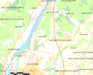
Savasse
- commune in Drôme, France
Savasse is a commune located in the Drôme department in southeastern France, near the city of Valence. While it might not be as well-known as other hiking destinations in the region, Savasse offers a delightful opportunity for hiking enthusiasts to explore the beautiful landscapes of the Rhône-Alpes region....
- Country:

- Postal Code: 26740
- Coordinates: 44° 36' 4" N, 4° 46' 31" E


- GPS tracks (wikiloc): [Link]
- Area: 22.01 sq km
- Population: 1424


Sauzet
- commune in Drôme, France
Sauzet, located in the Drôme department of the Auvergne-Rhône-Alpes region in southeastern France, is an excellent spot for hiking enthusiasts. The area is known for its beautiful landscapes, charming villages, and a variety of trails suitable for all levels of hikers....
- Country:

- Postal Code: 26740
- Coordinates: 44° 36' 9" N, 4° 49' 7" E


- GPS tracks (wikiloc): [Link]
- Area: 19.19 sq km
- Population: 1860


Les Tourrettes
- commune in Drôme, France
Les Tourrettes is a charming area in the Provence-Alpes-Côte d'Azur region of France, known for its picturesque landscapes and mild Mediterranean climate. While the area may not be as famous for hiking as some of its neighboring regions, it still offers opportunities for those looking to explore the natural beauty of southern France....
- Country:

- Postal Code: 26740
- Coordinates: 44° 39' 41" N, 4° 47' 22" E


- GPS tracks (wikiloc): [Link]
- Area: 7.34 sq km
- Population: 1042
- Web site: [Link]

Marsanne
- commune in Drôme, France
Marsanne, located in the Drôme department of the Auvergne-Rhône-Alpes region in southeastern France, is surrounded by beautiful landscapes that make it a great destination for hiking enthusiasts. The area is characterized by rolling hills, vineyards, and picturesque countryside, making it ideal for exploring nature....
- Country:

- Postal Code: 26740
- Coordinates: 44° 38' 37" N, 4° 52' 23" E


- GPS tracks (wikiloc): [Link]
- Area: 34.29 sq km
- Population: 1320


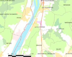
La Coucourde
- commune in Drôme, France
La Coucourde, nestled in the Drôme department of the Auvergne-Rhône-Alpes region in southeastern France, offers a picturesque setting for hiking enthusiasts. The area is characterized by its stunning landscapes, diverse terrain, and rich biodiversity, making it an excellent choice for both casual hikers and more experienced trekkers....
- Country:

- Postal Code: 26740
- Coordinates: 44° 39' 2" N, 4° 47' 1" E


- GPS tracks (wikiloc): [Link]
- Area: 11.15 sq km
- Population: 1039


La Laupie
- commune in Drôme, France
La Laupie is a picturesque region located in the Drôme department of France, known for its stunning landscapes and diverse hiking opportunities. It's a great destination for those looking to explore nature, enjoy peaceful surroundings, and experience the beauty of the French countryside....
- Country:

- Postal Code: 26740
- Coordinates: 44° 36' 37" N, 4° 50' 46" E


- GPS tracks (wikiloc): [Link]
- Area: 9.68 sq km
- Population: 793


Mirmande
- commune in Drôme, France
Mirmande is a charming village located in the Drôme region of southeastern France. Known for its picturesque views and medieval architecture, Mirmande is also surrounded by beautiful natural landscapes that offer excellent hiking opportunities....
- Country:

- Postal Code: 26270
- Coordinates: 44° 41' 54" N, 4° 50' 8" E


- GPS tracks (wikiloc): [Link]
- Area: 26.45 sq km
- Population: 553
- Web site: [Link]

