canton of Marsanne (canton de Marsanne)
- canton of France
Canton de Marsanne is a beautiful region located in the Auvergne-Rhône-Alpes area of France. It's known for its picturesque landscapes, charming villages, and natural beauty, making it a great destination for hiking enthusiasts. Here are some key points to consider when hiking in this region:
Trails and Terrain
- Varied Terrain: The Canton de Marsanne offers a mix of terrains, including rolling hills, forests, and rocky paths. Most trails are well-marked, catering to different skill levels from beginners to experienced hikers.
- Scenic Views: Many trails provide stunning views of the surrounding countryside, vineyards, and nearby Monts d’Ardèche. The landscape is particularly picturesque in the fall when the foliage changes colors.
Popular Hiking Routes
- GR Pédestre: Look for the Grande Randonnée (GR) paths, which are long-distance hiking routes linking various towns and landmarks.
- Local Trails: Many smaller trails connect villages within the canton, allowing for shorter hikes that can be enjoyed in a few hours.
- Cultural Routes: Some trails pass through historical towns and sites, so it's possible to combine hiking with cultural exploration.
Wildlife and Flora
- The region is rich in biodiversity, offering opportunities to observe a variety of wildlife. You might encounter deer, foxes, and many bird species. The flora is equally diverse, featuring lush forests and wildflowers in spring and summer.
Best Times to Hike
- Spring and Fall: These seasons provide mild weather and beautiful scenery. Spring features blooming flowers, while fall showcases vibrant foliage.
- Summer: Although you can hike in summer, be prepared for hotter temperatures and ensure you take precautions for hydration and sun protection.
Safety and Preparedness
- Equipment: Make sure to wear sturdy hiking boots and carry sufficient water, snacks, and a map or GPS device. Depending on the season, bring appropriate clothing layers.
- Local Regulations: Familiarize yourself with local hiking regulations and routes, especially if you are venturing into protected areas.
Accessibility
- The region is accessible by road, and many starting points for trails are located near villages, making transportation convenient.
When visiting Canton de Marsanne, take the time to enjoy not just the hikes but also the local culture, cuisine, and hospitality offered by the villages. Happy hiking!
- Country:

- Capital: Marsanne
- Coordinates: 44° 36' 43" N, 4° 51' 53" E


- GPS tracks (wikiloc): [Link]
- Wikidata storage: Wikidata: Q1726109
Includes regions:


Roynac
- commune in Drôme, France
Roynac is a charming commune in the Drôme department of southeastern France, located in the Auvergne-Rhône-Alpes region. It offers various hiking opportunities, set against the backdrop of picturesque landscapes, rolling hills, and lush forests. Here are some highlights about hiking in and around Roynac:...
- Country:

- Postal Code: 26450
- Coordinates: 44° 38' 34" N, 4° 56' 23" E


- GPS tracks (wikiloc): [Link]
- Area: 17.06 sq km
- Population: 482


Saint-Marcel-lès-Sauzet
- commune in Drôme, France
 Hiking in Saint-Marcel-lès-Sauzet
Saint-Marcel-lès-Sauzet is a charming commune located in the Drôme department in southeastern France. It’s an excellent location for hiking enthusiasts due to its picturesque landscapes, moderate climate, and proximity to the Vercors Regional Natural Park....
- Country:

- Postal Code: 26740
- Coordinates: 44° 35' 44" N, 4° 48' 18" E


- GPS tracks (wikiloc): [Link]
- Area: 3.98 sq km
- Population: 1226

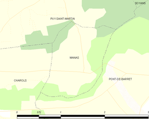
Manas
- commune in Drôme, France
Manas, located in the Drôme department of the Auvergne-Rhône-Alpes region of southeastern France, offers a charming backdrop for hiking enthusiasts. The area is characterized by its beautiful landscapes, rolling hills, vineyards, and proximity to the picturesque landscapes of the Vercors Regional Natural Park and the Drôme Provençale....
- Country:

- Postal Code: 26160
- Coordinates: 44° 35' 58" N, 4° 59' 3" E


- GPS tracks (wikiloc): [Link]
- Area: 1.91 sq km
- Population: 192

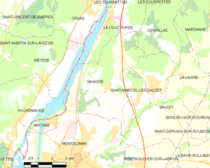
Savasse
- commune in Drôme, France
Savasse is a commune located in the Drôme department in southeastern France, near the city of Valence. While it might not be as well-known as other hiking destinations in the region, Savasse offers a delightful opportunity for hiking enthusiasts to explore the beautiful landscapes of the Rhône-Alpes region....
- Country:

- Postal Code: 26740
- Coordinates: 44° 36' 4" N, 4° 46' 31" E


- GPS tracks (wikiloc): [Link]
- Area: 22.01 sq km
- Population: 1424


Sauzet
- commune in Drôme, France
Sauzet, located in the Drôme department of the Auvergne-Rhône-Alpes region in southeastern France, is an excellent spot for hiking enthusiasts. The area is known for its beautiful landscapes, charming villages, and a variety of trails suitable for all levels of hikers....
- Country:

- Postal Code: 26740
- Coordinates: 44° 36' 9" N, 4° 49' 7" E


- GPS tracks (wikiloc): [Link]
- Area: 19.19 sq km
- Population: 1860


Les Tourrettes
- commune in Drôme, France
Les Tourrettes is a charming area in the Provence-Alpes-Côte d'Azur region of France, known for its picturesque landscapes and mild Mediterranean climate. While the area may not be as famous for hiking as some of its neighboring regions, it still offers opportunities for those looking to explore the natural beauty of southern France....
- Country:

- Postal Code: 26740
- Coordinates: 44° 39' 41" N, 4° 47' 22" E


- GPS tracks (wikiloc): [Link]
- Area: 7.34 sq km
- Population: 1042
- Web site: [Link]


Saint-Gervais-sur-Roubion
- commune in Drôme, France
 Hiking in Saint-Gervais-sur-Roubion
Saint-Gervais-sur-Roubion is a charming commune located in the Drôme department of southeastern France. It’s surrounded by beautiful countryside, making it a great destination for hiking enthusiasts. Here are some highlights and tips for hiking in the area:...
- Country:

- Postal Code: 26160
- Coordinates: 44° 34' 59" N, 4° 53' 27" E


- GPS tracks (wikiloc): [Link]
- Area: 14.57 sq km
- Population: 965

Marsanne
- commune in Drôme, France
Marsanne, located in the Drôme department of the Auvergne-Rhône-Alpes region in southeastern France, is surrounded by beautiful landscapes that make it a great destination for hiking enthusiasts. The area is characterized by rolling hills, vineyards, and picturesque countryside, making it ideal for exploring nature....
- Country:

- Postal Code: 26740
- Coordinates: 44° 38' 37" N, 4° 52' 23" E


- GPS tracks (wikiloc): [Link]
- Area: 34.29 sq km
- Population: 1320

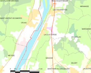
La Coucourde
- commune in Drôme, France
La Coucourde, nestled in the Drôme department of the Auvergne-Rhône-Alpes region in southeastern France, offers a picturesque setting for hiking enthusiasts. The area is characterized by its stunning landscapes, diverse terrain, and rich biodiversity, making it an excellent choice for both casual hikers and more experienced trekkers....
- Country:

- Postal Code: 26740
- Coordinates: 44° 39' 2" N, 4° 47' 1" E


- GPS tracks (wikiloc): [Link]
- Area: 11.15 sq km
- Population: 1039


Bonlieu-sur-Roubion
- commune in Drôme, France
Bonlieu-sur-Roubion is a picturesque village located in the Drôme department of southeastern France. Nestled in the beautiful Auvergne-Rhône-Alpes region, it offers a plethora of hiking opportunities amidst stunning landscapes....
- Country:

- Postal Code: 26160
- Coordinates: 44° 35' 40" N, 4° 52' 53" E


- GPS tracks (wikiloc): [Link]
- Area: 6.05 sq km
- Population: 448


La Laupie
- commune in Drôme, France
La Laupie is a picturesque region located in the Drôme department of France, known for its stunning landscapes and diverse hiking opportunities. It's a great destination for those looking to explore nature, enjoy peaceful surroundings, and experience the beauty of the French countryside....
- Country:

- Postal Code: 26740
- Coordinates: 44° 36' 37" N, 4° 50' 46" E


- GPS tracks (wikiloc): [Link]
- Area: 9.68 sq km
- Population: 793

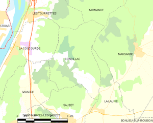
Condillac
- commune in Drôme, France
Condillac, located in the Drôme department in southeastern France, offers a variety of hiking opportunities thanks to its picturesque landscapes and varied terrain. The region is characterized by gentle hills, forests, and beautiful views of the Rhône Valley and surrounding mountains....
- Country:

- Postal Code: 26740
- Coordinates: 44° 38' 15" N, 4° 48' 45" E


- GPS tracks (wikiloc): [Link]
- Area: 9.57 sq km
- Population: 141


Cléon-d'Andran
- commune in Drôme, France
Cléon-d'Andran is a charming commune located in the Drôme department of southeastern France. The surrounding area is characterized by its beautiful landscapes, which are perfect for hiking enthusiasts. Here are some highlights and tips for hiking in and around Cléon-d'Andran:...
- Country:

- Postal Code: 26450
- Coordinates: 44° 36' 40" N, 4° 56' 9" E


- GPS tracks (wikiloc): [Link]
- Area: 10.25 sq km
- Population: 856

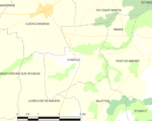
Charols
- commune in Drôme, France
Charols is a charming village located in the Drôme department of the Auvergne-Rhône-Alpes region in southeastern France. It's a great base for hiking enthusiasts due to its picturesque landscapes, diverse terrain, and several trails that cater to various skill levels....
- Country:

- Postal Code: 26450
- Coordinates: 44° 35' 34" N, 4° 57' 5" E


- GPS tracks (wikiloc): [Link]
- Area: 7.31 sq km
- Population: 887


La Bâtie-Rolland
- commune in Drôme, France
La Bâtie-Rolland is a charming commune located in the Drôme department of southeastern France. It's surrounded by beautiful landscapes, making it a great destination for hiking enthusiasts. Here are some important aspects to consider when planning a hiking trip in La Bâtie-Rolland:...
- Country:

- Postal Code: 26160
- Coordinates: 44° 33' 14" N, 4° 51' 54" E


- GPS tracks (wikiloc): [Link]
- Area: 8.33 sq km
- Population: 974