Cormaranche-en-Bugey (Cormaranche-en-Bugey)
- commune in Ain, France
 Hiking in Cormaranche-en-Bugey
Cormaranche-en-Bugey is a charming village located in the Bugey region of the Auvergne-Rhône-Alpes in France. It's known for its beautiful landscapes, lush greenery, and a variety of outdoor activities, making it a great destination for hiking enthusiasts.
Hiking Trails
The area surrounding Cormaranche-en-Bugey offers several hiking trails suitable for different skill levels. Some popular trails include:
-
Sentier des Écureuils: A family-friendly trail that offers a relatively easy hike through forests and alongside rivers. It’s perfect for a leisurely day out.
-
Mont Tournette Loop: This trail offers stunning panoramic views of the Bugey mountains. It’s a moderate hike, suitable for those with some hiking experience.
-
Les Crêtes de Bugey: For more experienced hikers, this trail features a more challenging ascent but rewards you with breathtaking views of the surrounding valleys and mountains.
Natural Attractions
While hiking, you can enjoy the diverse flora and fauna as well as the beautiful landscapes of the region. Look out for the unique geological formations, rivers, and possibly some wildlife.
Best Time to Hike
The best times for hiking in Cormaranche-en-Bugey are typically in spring (April to June) and fall (September to October) when the weather is mild and the scenery is particularly lovely. Summer can also be a great time, but be prepared for warmer conditions.
Recommendations
- Gear Up: Ensure you have appropriate hiking gear, including sturdy footwear, weather-appropriate clothing, and a comfortable backpack.
- Stay Hydrated: Always carry enough water, especially on longer hikes.
- Respect Nature: Follow Leave No Trace principles to help preserve the natural beauty of the area.
- Check Local Conditions: Before heading out, check local trail conditions, as some paths may be affected by seasonal weather changes.
Accessibility
Cormaranche-en-Bugey is accessible by car, and there are parking areas near the trailheads. Public transport options may be limited, so it’s good to plan accordingly.
In summary, hiking in Cormaranche-en-Bugey offers a delightful experience for all levels of hikers, with breathtaking views and a deep connection to nature. Always remember to prepare accordingly for the best experience!
- Country:

- Postal Code: 01110
- Coordinates: 45° 57' 11" N, 5° 36' 40" E


- GPS tracks (wikiloc): [Link]
- Area: 18.92 sq km
- Population: 803
- Web site: http://www.cormaranche-en-bugey.com
- Wikipedia en: wiki(en)
- Wikipedia: wiki(fr)
- Wikidata storage: Wikidata: Q213412
- Wikipedia Commons Category: [Link]
- Wikipedia Commons Maps Category: [Link]
- Freebase ID: [/m/0814_6]
- Freebase ID: [/m/0814_6]
- GeoNames ID: Alt: [3023655]
- GeoNames ID: Alt: [3023655]
- SIREN number: [210101226]
- SIREN number: [210101226]
- BnF ID: [131942720]
- BnF ID: [131942720]
- VIAF ID: Alt: [240538825]
- VIAF ID: Alt: [240538825]
- GND ID: Alt: [4579685-3]
- GND ID: Alt: [4579685-3]
- INSEE municipality code: 01122
- INSEE municipality code: 01122
Shares border with regions:

Hauteville-Lompnes
- commune in Ain, France
Hiking in Hauteville-Lompnes
Hauteville-Lompnes, located in the Ain department of the Auvergne-Rhône-Alpes region in France, is a stunning destination for hiking enthusiasts. Nestled in the foothills of the Alps, it offers a variety of trails ranging from easy walks to more challenging hikes, making it suitable for hikers of all experience levels....
- Country:
- Postal Code: 01110
- Coordinates: 45° 58' 44" N, 5° 35' 58" E
- GPS tracks (wikiloc): [Link]
- Area: 50.34 sq km
- Population: 3739
- Web site: [Link]
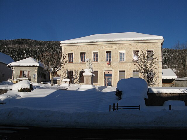
Lompnieu
- commune in Ain, France
Hiking in Lompnieu
Lompnieu is a charming village located in the Auvergne-Rhône-Alpes region of France, nestled in the beautiful Jura mountains. This area offers stunning landscapes, lush forests, and a variety of trails that cater to hikers of all levels. Here are some key points about hiking in Lompnieu:...
- Country:
- Postal Code: 01260
- Coordinates: 45° 57' 42" N, 5° 39' 39" E
- GPS tracks (wikiloc): [Link]
- Area: 11.35 sq km
- Population: 113
- Web site: [Link]

Sutrieu
- commune in Ain, France
Hiking in Sutrieu
Sutrieu, located in the Ain department of the Auvergne-Rhône-Alpes region in France, is known for its beautiful natural landscapes and hiking opportunities. The area is characterized by rolling hills, forests, and panoramic views, making it a great destination for outdoor enthusiasts....
- Country:
- Postal Code: 01260
- Coordinates: 45° 57' 5" N, 5° 39' 32" E
- GPS tracks (wikiloc): [Link]
- Area: 19.05 sq km
- Population: 211

Thézillieu
- commune in Ain, France
Hiking in Thézillieu
Thézillieu is a picturesque village located in the Ain department of France, nestled in the beautiful landscapes of the Rhône-Alpes region. Hiking in and around Thézillieu offers a wonderful opportunity to explore the natural beauty of the French countryside, with trails that cater to various skill levels. Here are some highlights and tips for hiking in this area:...
- Country:
- Postal Code: 01110
- Coordinates: 45° 53' 34" N, 5° 36' 3" E
- GPS tracks (wikiloc): [Link]
- Area: 26.25 sq km
- Population: 300
- Web site: [Link]