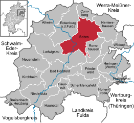
Cornberg (Cornberg)
- municipality in Landkreis Hersfeld-Rotenburg in Hesse, Germany
Cornberg is a charming area located in the northern part of Hesse, Germany, known for its beautiful landscapes and extensive hiking opportunities. Nestled in the countryside, Cornberg provides access to a variety of trails that cater to hikers of all levels, from leisurely walks to more challenging treks.
Hiking Highlights in Cornberg:
-
Scenic Trails: The region is surrounded by picturesque countryside, forests, and hills. Popular trails often feature a mix of natural beauty, including meadows, streams, and panoramic views of the nearby mountains.
-
Nature Reserves: Cornberg is close to some nature reserves that offer unique biodiversity and protected landscapes. Hiking in these areas allows you to experience local flora and fauna up close.
-
Historical Sites: While hiking, you may encounter historical landmarks and sites, including old churches, castles, and remnants of traditional architecture that offer insight into the region’s past.
-
Corenberg Castle Ruins: The ruins of the Cornberg Castle, perched atop a hill, are a popular hiking destination. The trail to the castle affords wonderful views and opportunities for exploration.
-
Local Trails: The area around Cornberg features various marked trails, often part of larger hiking networks in Hesse. Look for signs indicating different routes and distances to find an appropriate hike for your skill level.
-
Bird Watching: The natural landscapes in and around Cornberg make it a great spot for bird watching. Bring binoculars and take time to observe the local birdlife as you hike.
-
Hiking Tips:
- Weather: Check the weather beforehand, as conditions can change quickly in the mountains.
- Gear: Wear sturdy hiking boots and dress in layers to accommodate varying temperatures and exertion levels.
- Hydration: Always carry enough water and some snacks, especially on longer hikes.
- Trail Maps: Carry a local map or download a hiking app to navigate the trails effectively.
Getting There:
Cornberg is accessible by car and public transportation. If you're traveling from larger cities, check local transportation options to ensure a smooth journey.
Conclusion:
Whether you're a seasoned hiker or just looking to enjoy a nature stroll, Cornberg has something to offer. With its gorgeous surroundings, rich history, and well-maintained trails, it's a fantastic destination for outdoor enthusiasts. Be sure to respect nature and local regulations while enjoying your adventures!
- Country:

- Postal Code: 36219
- Local Dialing Code: 05650
- Licence Plate Code: HEF
- Coordinates: 51° 3' 0" N, 9° 52' 0" E


- GPS tracks (wikiloc): [Link]
- AboveSeaLevel: 275 м m
- Area: 23.36 sq km
- Population: 1347
- Web site: http://www.cornberg.de/
- Wikipedia en: wiki(en)
- Wikipedia: wiki(de)
- Wikidata storage: Wikidata: Q622576
- Wikipedia Commons Category: [Link]
- Freebase ID: [/m/02vrcb3]
- GeoNames ID: Alt: [2939847]
- VIAF ID: Alt: [236370752]
- OSM relation ID: [238956]
- GND ID: Alt: [4085332-9]
- German municipality key: 06632005
Shares border with regions:


Bebra
- town in Landkreis Hersfeld-Rotenburg in Hesse, Germany
Bebra, located in the state of Hesse, Germany, is surrounded by beautiful landscapes that offer various hiking opportunities. The area is characterized by scenic trails, diverse flora and fauna, and historical sites. Here are some details about hiking in and around Bebra:...
- Country:

- Postal Code: 36179
- Local Dialing Code: 06622
- Licence Plate Code: HEF
- Coordinates: 50° 58' 16" N, 9° 47' 25" E


- GPS tracks (wikiloc): [Link]
- AboveSeaLevel: 195 м m
- Area: 93.63 sq km
- Population: 14078
- Web site: [Link]


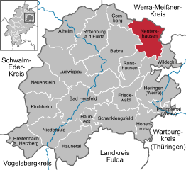
Nentershausen
- municipality in Landkreis Hersfeld-Rotenburg in Hesse, Germany
Nentershausen is a charming municipality located in the district of Hersfeld-Rotenburg in Hesse, Germany. It’s an excellent area for hiking, offering a mix of scenic landscapes, woodlands, and rural charm. Here are some key points to consider if you’re planning to hike in and around Nentershausen:...
- Country:

- Postal Code: 36214
- Local Dialing Code: 06627
- Licence Plate Code: HEF
- Coordinates: 51° 0' 45" N, 9° 56' 6" E


- GPS tracks (wikiloc): [Link]
- AboveSeaLevel: 299 м m
- Area: 57.06 sq km
- Population: 2617
- Web site: [Link]

