Nentershausen (Nentershausen)
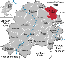
- municipality in Landkreis Hersfeld-Rotenburg in Hesse, Germany
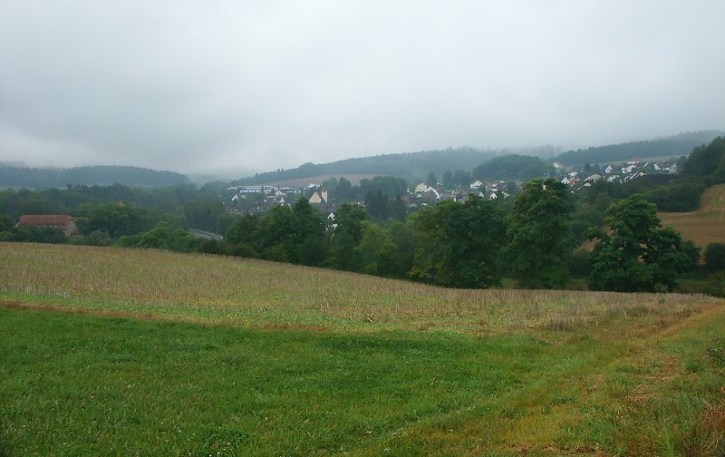
Nentershausen is a charming municipality located in the district of Hersfeld-Rotenburg in Hesse, Germany. It’s an excellent area for hiking, offering a mix of scenic landscapes, woodlands, and rural charm. Here are some key points to consider if you’re planning to hike in and around Nentershausen:
Trails
-
Local Hiking Trails: Nentershausen is surrounded by beautiful countryside with local trails that primarily cater to various skill levels. You can find well-marked paths that often lead through forested areas, farmland, and past picturesque villages.
-
Hessenweg Routes: The Hessenweg, a long-distance hiking trail, passes through the surrounding areas. These trails often provide stunning views and the chance to experience the traditional landscapes of Hesse.
-
Nature Reserves and Parks: Explore nearby nature reserves and parks, which provide ample opportunities for hiking and observing local wildlife. The varied terrain includes hills, valleys, and rivers, making for enjoyable and diverse hikes.
Scenic Highlights
- Forests: The area is rich in forests, particularly beech and coniferous woods, which provide shaded paths perfect for warmer months.
- Views: As you hike, you can expect to see beautiful views of the surrounding landscapes, especially from higher elevations.
- Cultural Sites: Along some trails, you might come across historical landmarks, such as ancient churches, traditional farms, and local monuments which add cultural richness to your hiking experience.
Accessibility
- Starting Points: You can start your hikes directly from the village or other nearby towns. Local maps and hiking resources can guide you to the best paths.
- Public Transport: Nentershausen is connected by public transport to larger towns, making it accessible if you're traveling from other parts of Hesse.
Tips for Hiking in Nentershausen
- Weather Preparedness: Always check the weather forecast before heading out and dress in layers, as temperatures can vary.
- Footwear: Wear comfortable and reliable hiking boots to handle both paved and unpaved paths.
- Sustenance: Carry enough water and snacks, especially if you plan on longer hikes, as amenities may be sparse along certain trails.
- Navigation: Consider using a hiking app or GPS device, or carry a physical map, as some trails may not be well signposted.
- Respect Nature: Stay on the marked trails to preserve the local flora and fauna.
Hiking in Nentershausen can be a rewarding experience, allowing you to immerse yourself in nature while exploring the serene beauty of Hesse. Enjoy your adventure!
- Country:

- Postal Code: 36214
- Local Dialing Code: 06627
- Licence Plate Code: HEF
- Coordinates: 51° 0' 45" N, 9° 56' 6" E


- GPS tracks (wikiloc): [Link]
- AboveSeaLevel: 299 м m
- Area: 57.06 sq km
- Population: 2617
- Web site: http://www.nentershausen.de
- Wikipedia en: wiki(en)
- Wikipedia: wiki(de)
- Wikidata storage: Wikidata: Q625897
- Wikipedia Commons Gallery: [Link]
- Wikipedia Commons Category: [Link]
- Freebase ID: [/m/02vrcd5]
- GeoNames ID: Alt: [6553257]
- OSM relation ID: [238954]
- GND ID: Alt: [4304345-8]
- Historical Gazetteer (GOV) ID: [NENSENJO41XA]
- German municipality key: 06632013
Shares border with regions:


Bebra
- town in Landkreis Hersfeld-Rotenburg in Hesse, Germany
Bebra, located in the state of Hesse, Germany, is surrounded by beautiful landscapes that offer various hiking opportunities. The area is characterized by scenic trails, diverse flora and fauna, and historical sites. Here are some details about hiking in and around Bebra:...
- Country:

- Postal Code: 36179
- Local Dialing Code: 06622
- Licence Plate Code: HEF
- Coordinates: 50° 58' 16" N, 9° 47' 25" E


- GPS tracks (wikiloc): [Link]
- AboveSeaLevel: 195 м m
- Area: 93.63 sq km
- Population: 14078
- Web site: [Link]


Cornberg
- municipality in Landkreis Hersfeld-Rotenburg in Hesse, Germany
Cornberg is a charming area located in the northern part of Hesse, Germany, known for its beautiful landscapes and extensive hiking opportunities. Nestled in the countryside, Cornberg provides access to a variety of trails that cater to hikers of all levels, from leisurely walks to more challenging treks....
- Country:

- Postal Code: 36219
- Local Dialing Code: 05650
- Licence Plate Code: HEF
- Coordinates: 51° 3' 0" N, 9° 52' 0" E


- GPS tracks (wikiloc): [Link]
- AboveSeaLevel: 275 м m
- Area: 23.36 sq km
- Population: 1347
- Web site: [Link]

