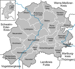
Hersfeld-Rotenburg (Landkreis Hersfeld-Rotenburg)
- district in Hesse, Germany
Hersfeld-Rotenburg is a beautiful district in the state of Hesse, Germany, known for its diverse landscapes, historical sites, and excellent hiking opportunities. The region is characterized by rolling hills, deep forests, and picturesque valleys, making it an ideal destination for outdoor enthusiasts and hikers.
Key Attractions and Trails for Hiking:
-
Hiking Trails:
- Bergwanderweg (Mountain Hiking Trail): This trail offers stunning views and takes you through the scenic forests and hills of the region. Various routes cater to different skill levels, allowing both beginners and experienced hikers to find a suitable path.
- Vogelsberg Mountains: Although slightly outside the direct area, this range is accessible and offers extensive hiking trails with impressive geological features and rich flora and fauna.
- Kaliberg Hiking Trail: This unique trail takes hikers through areas that were historically significant for salt mining, providing both natural beauty and cultural insights.
-
Natural Parks:
- The district includes parts of various nature parks, such as the Kellerwald-Edersee National Park. This park features beautiful forests, lakes, and scenic viewpoints – perfect for longer hiking excursions or shorter day hikes.
-
Historical Sites:
- While hiking, you can encounter various historical landmarks, such as ruins of old castles, churches, and traditional villages. The Monastery of Fulda and the Basilica of St. Liberatus are noteworthy places to visit nearby.
-
Wildlife and Flora:
- The region is home to diverse wildlife and a rich variety of plants. Be sure to be respectful of nature and follow the "Leave No Trace" principles while hiking.
-
Seasonal Variations:
- Each season offers different hiking experiences, from the vibrant autumn foliage to winter hiking on snow-covered trails. The spring brings blooming flowers, making it an especially lovely time to explore.
Tips for Hiking in Hersfeld-Rotenburg:
- Preparation: Always check trail conditions and weather forecasts. Bring a map or GPS device, plenty of water, and appropriate clothing.
- Local Guides: If you’re unfamiliar with the area, consider hiring a local guide or joining a hiking group to enrich your experience.
- Equipment: Wear good hiking boots and carry trekking poles if you're planning to tackle more challenging trails.
- Respect Nature: Stay on marked trails, take your litter with you, and respect the local wildlife.
Whether you're seeking a peaceful stroll through nature or an invigorating climb, Hersfeld-Rotenburg has something to offer every hiker. Enjoy your adventure!
- Country:

- Capital: Bad Hersfeld
- Licence Plate Code: ROF; HEF
- Coordinates: 50° 52' 18" N, 9° 42' 58" E


- GPS tracks (wikiloc): [Link]
- AboveSeaLevel: 197 м m
- Area: 1097.15 sq km
- Population: 120165
- Web site: http://www.hef-rof.de/
- Wikipedia en: wiki(en)
- Wikipedia: wiki(de)
- Wikidata storage: Wikidata: Q7898
- Wikipedia Commons Category: [Link]
- Freebase ID: [/m/01fnpx]
- GeoNames ID: Alt: [3220994]
- VIAF ID: Alt: [235933860]
- OSM relation ID: [62637]
- GND ID: Alt: [4095129-7]
- archINFORM location ID: [2455]
- NUTS code: [DE733]
- German district key: 06632
Includes regions:
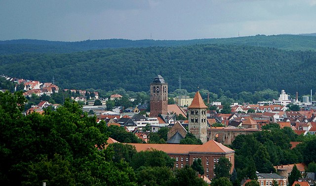
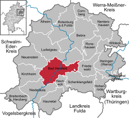
Bad Hersfeld
- seat of Landkreis Hersfeld-Rotenburg and town in Hesse, Germany
Bad Hersfeld, located in the state of Hesse, Germany, offers a fantastic location for hiking enthusiasts. Nestled in the picturesque hills of the region, it features a variety of trails that cater to different skill levels, from leisurely walks to more challenging hikes....
- Country:

- Postal Code: 36251
- Local Dialing Code: 06621
- Licence Plate Code: HEF
- Coordinates: 50° 52' 6" N, 9° 42' 24" E


- GPS tracks (wikiloc): [Link]
- AboveSeaLevel: 212 м m
- Area: 73.83 sq km
- Population: 29767
- Web site: [Link]


Philippsthal
- municipality in Landkreis Hersfeld-Rotenburg in Hesse, Germany
Philippsthal, located in the Werra region of Germany, is surrounded by stunning natural landscapes, making it an excellent destination for hiking enthusiasts. The area offers a variety of trails that cater to different skill levels, showcasing the beautiful scenery of the Werra Valley and surrounding hills....
- Country:

- Postal Code: 36269
- Local Dialing Code: 06620
- Licence Plate Code: HEF
- Coordinates: 50° 51' 0" N, 10° 0' 0" E


- GPS tracks (wikiloc): [Link]
- AboveSeaLevel: 315 м m
- Area: 21.31 sq km
- Population: 4183
- Web site: [Link]

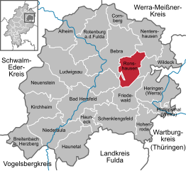
Ronshausen
- municipality in Landkreis Hersfeld-Rotenburg in Hesse, Germany
Ronshausen is a charming village located in the picturesque region of Hesse, Germany. It’s surrounded by beautiful landscapes, making it a great destination for hiking enthusiasts. The area is part of the Eichsfeld region, which offers a variety of trails ranging from easy walks to more challenging hikes....
- Country:

- Postal Code: 36217
- Local Dialing Code: 06622
- Licence Plate Code: HEF
- Coordinates: 50° 57' 0" N, 9° 51' 0" E


- GPS tracks (wikiloc): [Link]
- AboveSeaLevel: 219 м m
- Area: 37.65 sq km
- Population: 2307
- Web site: [Link]

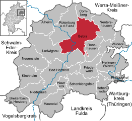
Bebra
- town in Landkreis Hersfeld-Rotenburg in Hesse, Germany
Bebra, located in the state of Hesse, Germany, is surrounded by beautiful landscapes that offer various hiking opportunities. The area is characterized by scenic trails, diverse flora and fauna, and historical sites. Here are some details about hiking in and around Bebra:...
- Country:

- Postal Code: 36179
- Local Dialing Code: 06622
- Licence Plate Code: HEF
- Coordinates: 50° 58' 16" N, 9° 47' 25" E


- GPS tracks (wikiloc): [Link]
- AboveSeaLevel: 195 м m
- Area: 93.63 sq km
- Population: 14078
- Web site: [Link]
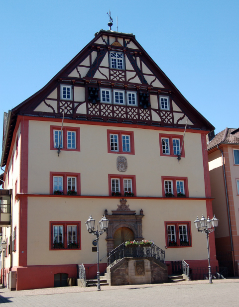

Rotenburg an der Fulda
- town in Landkreis Hersfeld-Rotenburg in Hesse, Germany
 Hiking in Rotenburg an der Fulda
Rotenburg an der Fulda, located in the beautiful state of Hesse in Germany, offers a fantastic setting for hiking enthusiasts. The region is characterized by its stunning landscapes, rich history, and well-maintained hiking trails. Here are some highlights of hiking in and around Rotenburg an der Fulda:...
- Country:

- Postal Code: 36199
- Local Dialing Code: 06623
- Coordinates: 50° 59' 42" N, 9° 43' 38" E


- GPS tracks (wikiloc): [Link]
- AboveSeaLevel: 183 м m
- Area: 79.84 sq km
- Population: 14487
- Web site: [Link]
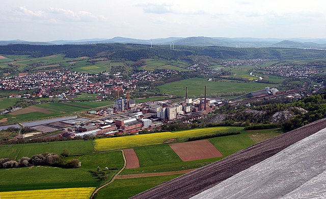

Heringen
- town in Landkreis Hersfeld-Rotenburg in Hesse, Germany
Heringen is a charming town located in the state of Hesse, Germany, offering a variety of hiking opportunities that showcase the natural beauty of the region. Here are some highlights to consider when hiking in and around Heringen:...
- Country:

- Postal Code: 36266
- Local Dialing Code: 06624
- Licence Plate Code: HEF
- Coordinates: 50° 53' 14" N, 10° 0' 20" E


- GPS tracks (wikiloc): [Link]
- AboveSeaLevel: 221 м m
- Area: 61.18 sq km
- Population: 7223
- Web site: [Link]
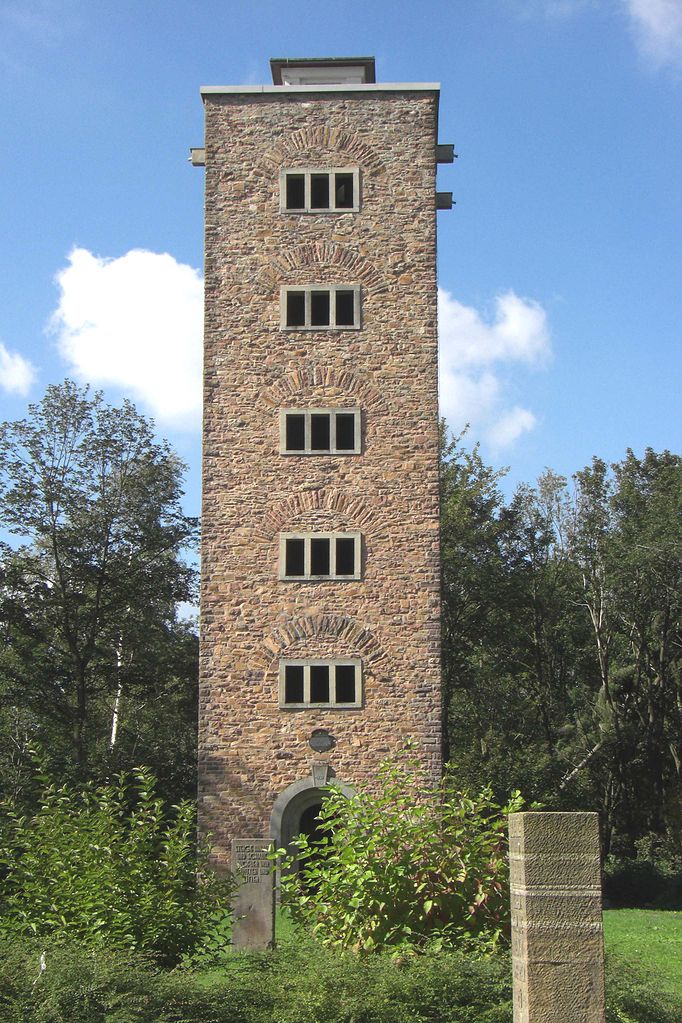

Alheim
- municipality in Landkreis Hersfeld-Rotenburg in Hesse, Germany
Alheim is a lesser-known destination for hiking, and detailed information about this area can be limited. However, if you’re looking to explore Alheim for hiking, here are some general tips and considerations:...
- Country:

- Postal Code: 36211
- Local Dialing Code: 06623; 05664
- Licence Plate Code: HEF
- Coordinates: 51° 2' 0" N, 9° 40' 0" E


- GPS tracks (wikiloc): [Link]
- AboveSeaLevel: 179 м m
- Area: 63.83 sq km
- Population: 4951
- Web site: [Link]


Hauneck
- municipality in Landkreis Hersfeld-Rotenburg in Hesse, Germany
Hauneck is a picturesque municipality located in the state of Hesse, Germany, known for its beautiful landscapes and charming villages. While it may not be as widely recognized as some major hiking destinations, it offers a number of trails that cater to outdoor enthusiasts of varying skill levels....
- Country:

- Postal Code: 36282
- Local Dialing Code: 06621
- Licence Plate Code: HEF
- Coordinates: 50° 49' 0" N, 9° 44' 0" E


- GPS tracks (wikiloc): [Link]
- AboveSeaLevel: 232 м m
- Area: 17.75 sq km
- Population: 3222
- Web site: [Link]
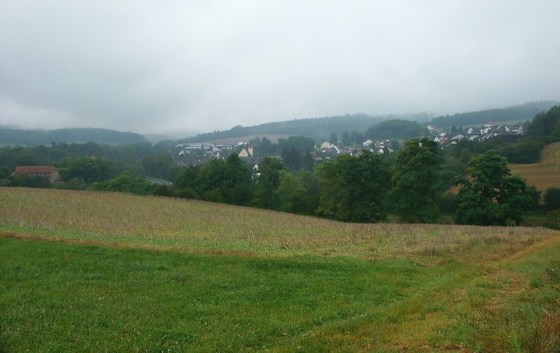

Cornberg
- municipality in Landkreis Hersfeld-Rotenburg in Hesse, Germany
Cornberg is a charming area located in the northern part of Hesse, Germany, known for its beautiful landscapes and extensive hiking opportunities. Nestled in the countryside, Cornberg provides access to a variety of trails that cater to hikers of all levels, from leisurely walks to more challenging treks....
- Country:

- Postal Code: 36219
- Local Dialing Code: 05650
- Licence Plate Code: HEF
- Coordinates: 51° 3' 0" N, 9° 52' 0" E


- GPS tracks (wikiloc): [Link]
- AboveSeaLevel: 275 м m
- Area: 23.36 sq km
- Population: 1347
- Web site: [Link]


Friedewald
- municipality in Landkreis Hersfeld-Rotenburg in Hesse, Germany
Friedewald is a picturesque village located in the state of Hesse, Germany, surrounded by beautiful natural landscapes that lend themselves well to hiking. The area is characterized by its rolling hills, forests, and scenic views, making it a great destination for outdoor enthusiasts....
- Country:

- Postal Code: 36289
- Local Dialing Code: 06674
- Licence Plate Code: HEF
- Coordinates: 50° 53' 0" N, 9° 52' 0" E


- GPS tracks (wikiloc): [Link]
- AboveSeaLevel: 392 м m
- Area: 39.65 sq km
- Population: 2420
- Web site: [Link]

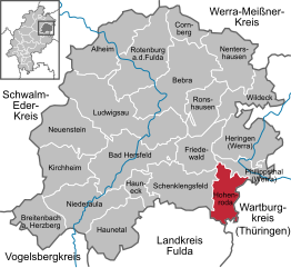
Hohenroda
- municipality in Landkreis Hersfeld-Rotenburg in Hesse, Germany
Hohenroda, located in the charming region of Hesse, Germany, offers a variety of hiking opportunities set amidst beautiful landscapes. The area is characterized by rolling hills, dense forests, and picturesque villages, making it an appealing destination for nature lovers and hikers alike....
- Country:

- Postal Code: 36284
- Local Dialing Code: 06676
- Licence Plate Code: HEF
- Coordinates: 50° 48' 28" N, 9° 55' 22" E


- GPS tracks (wikiloc): [Link]
- AboveSeaLevel: 340 м m
- Area: 35.74 sq km
- Population: 3089
- Web site: [Link]


Wildeck
- municipality in Landkreis Hersfeld-Rotenburg in Hesse, Germany
Wildeck is a beautiful area located in the state of Hesse, Germany, surrounded by scenic landscapes and diverse hiking trails. The region offers a mix of forest paths, hills, and valleys, making it perfect for hikers of all skill levels....
- Country:

- Postal Code: 36208
- Local Dialing Code: 06626
- Licence Plate Code: HEF
- Coordinates: 50° 57' 0" N, 9° 59' 0" E


- GPS tracks (wikiloc): [Link]
- AboveSeaLevel: 216 м m
- Area: 39.86 sq km
- Population: 5046
- Web site: [Link]


Niederaula
- municipality in Landkreis Hersfeld-Rotenburg in Hesse, Germany
Niederaula, located in the state of Hesse, Germany, offers a variety of hiking opportunities for outdoor enthusiasts. Nestled in a stunning natural landscape, the region is characterized by rolling hills, woodlands, and charming small villages....
- Country:

- Postal Code: 36272
- Local Dialing Code: 06625
- Licence Plate Code: HEF
- Coordinates: 50° 48' 0" N, 9° 36' 0" E


- GPS tracks (wikiloc): [Link]
- AboveSeaLevel: 213 м m
- Area: 64.17 sq km
- Population: 5351
- Web site: [Link]

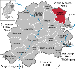
Nentershausen
- municipality in Landkreis Hersfeld-Rotenburg in Hesse, Germany
Nentershausen is a charming municipality located in the district of Hersfeld-Rotenburg in Hesse, Germany. It’s an excellent area for hiking, offering a mix of scenic landscapes, woodlands, and rural charm. Here are some key points to consider if you’re planning to hike in and around Nentershausen:...
- Country:

- Postal Code: 36214
- Local Dialing Code: 06627
- Licence Plate Code: HEF
- Coordinates: 51° 0' 45" N, 9° 56' 6" E


- GPS tracks (wikiloc): [Link]
- AboveSeaLevel: 299 м m
- Area: 57.06 sq km
- Population: 2617
- Web site: [Link]


Schenklengsfeld
- municipality in Landkreis Hersfeld-Rotenburg in Hesse, Germany
Schenklengsfeld is a small village in the state of Hesse, Germany, located in the scenic area of the Knüll mountains. This region is known for its beautiful landscapes, well-marked trails, and a variety of hiking options suitable for different skill levels. Here are some highlights of hiking in and around Schenklengsfeld:...
- Country:

- Postal Code: 36277
- Local Dialing Code: 06629
- Licence Plate Code: HEF
- Coordinates: 50° 49' 0" N, 9° 51' 0" E


- GPS tracks (wikiloc): [Link]
- AboveSeaLevel: 323 м m
- Area: 63.75 sq km
- Population: 4413
- Web site: [Link]


Ludwigsau
- municipality in Landkreis Hersfeld-Rotenburg in Hesse, Germany
Ludwigsau is a picturesque municipality located in the state of Hesse, Germany, and it offers a variety of hiking opportunities for outdoor enthusiasts. Here are some key points about hiking in the area:...
- Country:

- Postal Code: 36251
- Local Dialing Code: 06670; 06621
- Licence Plate Code: HEF
- Coordinates: 50° 54' 0" N, 9° 46' 0" E


- GPS tracks (wikiloc): [Link]
- AboveSeaLevel: 251 м m
- Area: 111.92 sq km
- Population: 5508
- Web site: [Link]

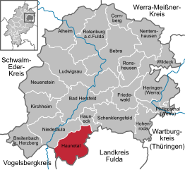
Haunetal
- municipality in Landkreis Hersfeld-Rotenburg in Hesse, Germany
Haunetal is a picturesque region located in Hesse, Germany, known for its natural beauty and diverse hiking trails. Here are some key points about hiking in Haunetal:...
- Country:

- Postal Code: 36166
- Local Dialing Code: 06673
- Licence Plate Code: HEF
- Coordinates: 50° 46' 0" N, 9° 40' 0" E


- GPS tracks (wikiloc): [Link]
- AboveSeaLevel: 307 м m
- Area: 54.91 sq km
- Population: 2907
- Web site: [Link]


Breitenbach am Herzberg
- municipality in Landkreis Hersfeld-Rotenburg in Hesse, Germany
 Hiking in Breitenbach am Herzberg
Breitenbach am Herzberg is a charming village located in the state of Hesse, Germany, and is surrounded by beautiful landscapes, making it an excellent location for hiking enthusiasts. The area offers a variety of trails suitable for different skill levels, from beginners to seasoned hikers....
- Country:

- Postal Code: 36287
- Local Dialing Code: 06675
- Licence Plate Code: HEF
- Coordinates: 50° 46' 0" N, 9° 31' 0" E


- GPS tracks (wikiloc): [Link]
- AboveSeaLevel: 247 м m
- Area: 42.14 sq km
- Population: 1699
- Web site: [Link]

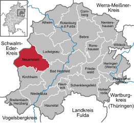
Neuenstein
- municipality in Landkreis Hersfeld-Rotenburg in Hesse, Germany
Neuenstein in Hesse, Germany, is a charming destination for hiking enthusiasts. Nestled in a picturesque landscape featuring rolling hills, dense forests, and scenic paths, it offers a variety of trails suited for different skill levels....
- Country:

- Postal Code: 36286
- Local Dialing Code: 06677; 06621
- Licence Plate Code: HEF
- Coordinates: 50° 56' 0" N, 9° 33' 0" E


- GPS tracks (wikiloc): [Link]
- AboveSeaLevel: 307 м m
- Area: 64.84 sq km
- Population: 2947
- Web site: [Link]


Kirchheim
- municipality in Landkreis Hersfeld-Rotenburg in Hesse, Germany
Kirchheim, located in Hesse, Germany, is a charming town surrounded by beautiful landscapes, making it a great destination for hiking enthusiasts. The region offers a variety of trails that cater to different skill levels, allowing both beginners and experienced hikers to enjoy the outdoors....
- Country:

- Postal Code: 36275
- Local Dialing Code: 06628; 06625
- Licence Plate Code: HEF
- Coordinates: 50° 50' 27" N, 9° 34' 28" E


- GPS tracks (wikiloc): [Link]
- AboveSeaLevel: 244 м m
- Area: 50.66 sq km
- Population: 3539
- Web site: [Link]
Shares border with regions:


Fulda
- district in Hesse, Germany
Fulda is a beautiful district located in Hesse, Germany, known for its scenic landscapes, historical sites, and outdoor activities, including hiking. Here are some key aspects of hiking in Fulda:...
- Country:

- Capital: Fulda
- Licence Plate Code: FD
- Coordinates: 50° 33' 37" N, 9° 41' 10" E


- GPS tracks (wikiloc): [Link]
- AboveSeaLevel: 297 м m
- Area: 1380.40 sq km
- Population: 216093
- Web site: [Link]
