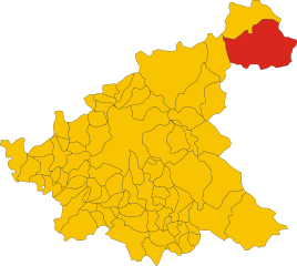
Cortino (Cortino)
.svg)
- Italian comune
 Hiking in Cortino
Cortino, located in the province of Teramo in the Abruzzo region of Italy, is surrounded by beautiful natural landscapes, making it a great destination for hiking enthusiasts. The area is characterized by its stunning mountainous terrain, lush forests, and picturesque views of the Gran Sasso d'Italia and the Monti della Laga.
Recommended Hiking Trails
-
Sentiero del Parco Nazionale del Gran Sasso e Monti della Laga:
- This National Park offers numerous trails. A popular route is the path leading to the summit of Monte della Laga, where hikers can enjoy breathtaking panoramas of the surrounding valleys and peaks.
-
Cascate del Rio Arno:
- This trail takes you to beautiful waterfalls in the region. The trail is relatively easy, making it a suitable choice for families or those looking for a less strenuous hike.
-
Cortino to Piano di Catania:
- This longer hike traverses through dense forests and offers a connection to local wildlife. The route provides a mix of terrain and elevation changes, suitable for seasoned hikers.
Tips for Hiking in Cortino
- Season: The best time for hiking in the Cortino area is during the spring (April to June) and early autumn (September to October) when the weather is mild and the landscapes are vibrant.
- Gear: Make sure to wear sturdy hiking boots and bring layered clothing, as temperatures can vary throughout the day. A good backpack with water, snacks, and a first aid kit is also essential.
- Navigation: While marked trails are available, it's always wise to have a map or GPS device. Local trails can sometimes be less well-known.
- Wildlife: As you hike, keep an eye out for local wildlife, including various bird species and possibly deer. Remember to respect their habitat.
- Local Regulations: Be aware of local regulations regarding camping and fires; always adhere to Leave No Trace principles.
Overall, hiking around Cortino offers a wonderful opportunity to explore the natural beauty of Abruzzo, along with its unique flora and fauna. Whether you’re a novice or an experienced hiker, there are trails suited to various skill levels to enjoy this beautiful part of Italy.
- Country:

- Postal Code: 64040
- Local Dialing Code: 0861
- Licence Plate Code: TE
- Coordinates: 42° 37' 19" N, 13° 30' 28" E


- GPS tracks (wikiloc): [Link]
- AboveSeaLevel: 892 м m
- Area: 62.95 sq km
- Population: 631
- Web site: http://www.comunedicortino.gov.it
- Wikipedia en: wiki(en)
- Wikipedia: wiki(it)
- Wikidata storage: Wikidata: Q51446
- Wikipedia Commons Category: [Link]
- Freebase ID: [/m/0dbp9c]
- GeoNames ID: Alt: [6542719]
- OSM relation ID: [42104]
- ISTAT ID: 067022
- Italian cadastre code: D076
Shares border with regions:

Teramo
- Italian comune
Hiking in Teramo
Teramo, located in the Abruzzo region of Italy, is an excellent destination for hiking enthusiasts. The area is characterized by its diverse landscapes, which include rugged mountains, rolling hills, and beautiful coastlines. Here are some highlights and considerations for hiking in and around Teramo:...
- Country:
- Postal Code: 64100
- Local Dialing Code: 0861
- Licence Plate Code: TE
- Coordinates: 42° 39' 32" N, 13° 42' 14" E
- GPS tracks (wikiloc): [Link]
- AboveSeaLevel: 265 м m
- Area: 153 sq km
- Population: 54857
- Web site: [Link]

Amatrice
- Italian comune
Hiking in Amatrice
Amatrice, located in the Apennine Mountains of Italy, is a beautiful destination for hiking enthusiasts. The region is known for its stunning landscapes, rich history, and picturesque villages. Here are some key points about hiking in Amatrice:...
- Country:
- Postal Code: 02012
- Local Dialing Code: 0746
- Licence Plate Code: RI
- Coordinates: 42° 37' 46" N, 13° 17' 18" E
- GPS tracks (wikiloc): [Link]
- AboveSeaLevel: 955 м m
- Area: 174.4 sq km
- Population: 2500
- Web site: [Link]

Crognaleto
- Italian comune
Hiking in Crognaleto
Crognaleto is a picturesque area located in the Abruzzo region of Italy, known for its stunning natural landscapes, beautiful mountains, and a variety of hiking trails that cater to different skill levels. The region is part of the Gran Sasso e Monti della Laga National Park, which provides a rich environment of biodiversity, including picturesque valleys, rugged peaks, and diverse flora and fauna....
- Country:
- Postal Code: 64043
- Local Dialing Code: 0861
- Licence Plate Code: TE
- Coordinates: 42° 35' 0" N, 13° 29' 0" E
- GPS tracks (wikiloc): [Link]
- AboveSeaLevel: 835 м m
- Area: 124.3 sq km
- Population: 1245
- Web site: [Link]
Montorio al Vomano
- Italian comune
Hiking in Montorio al Vomano
Montorio al Vomano is a charming town located in the Abruzzo region of Italy, surrounded by beautiful landscapes that make it an excellent destination for hiking enthusiasts. The area features a mix of mountainous terrain, lush forests, and scenic views, making it ideal for both casual hikers and more experienced trekkers....
- Country:
- Postal Code: 64046
- Local Dialing Code: 0861
- Licence Plate Code: TE
- Coordinates: 42° 35' 0" N, 13° 38' 0" E
- GPS tracks (wikiloc): [Link]
- AboveSeaLevel: 262 м m
- Area: 53.57 sq km
- Population: 8013
- Web site: [Link]

Rocca Santa Maria
- Italian comune
Hiking in Rocca Santa Maria
Rocca Santa Maria is a charming destination for hiking enthusiasts, located in the beautiful region of Abruzzo, Italy. Surrounded by the stunning landscapes of the Gran Sasso e Monti della Laga National Park, this area offers a variety of trails suitable for all levels of hikers....
- Country:
- Postal Code: 64010
- Local Dialing Code: 0861
- Licence Plate Code: TE
- Coordinates: 42° 41' 0" N, 13° 32' 0" E
- GPS tracks (wikiloc): [Link]
- AboveSeaLevel: 1073 м m
- Area: 61.8 sq km
- Population: 502
- Web site: [Link]

Torricella Sicura
- Italian comune
Hiking in Torricella Sicura
Torricella Sicura, located in the Abruzzo region of Italy, offers a beautiful landscape for hiking enthusiasts. Surrounded by the stunning views of the Gran Sasso and Monti della Laga National Park, which is not far from the village, the area features rugged mountains, rolling hills, and picturesque valleys....
- Country:
- Postal Code: 64010
- Local Dialing Code: 0861
- Licence Plate Code: TE
- Coordinates: 42° 39' 33" N, 13° 39' 26" E
- GPS tracks (wikiloc): [Link]
- AboveSeaLevel: 437 м m
- Area: 54.38 sq km
- Population: 2621
- Web site: [Link]